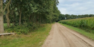
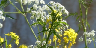
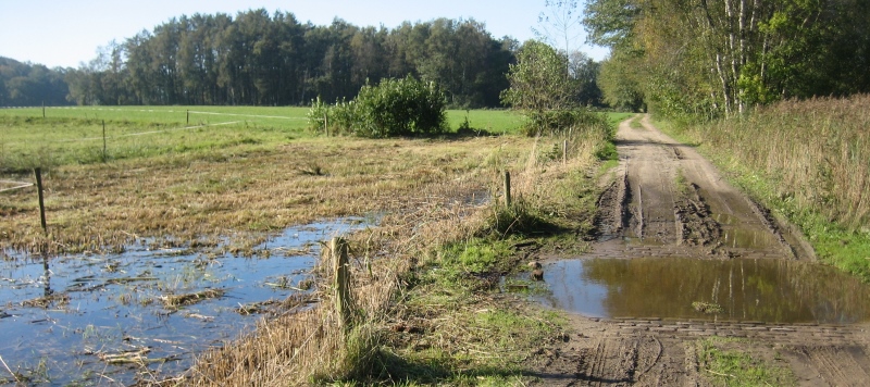
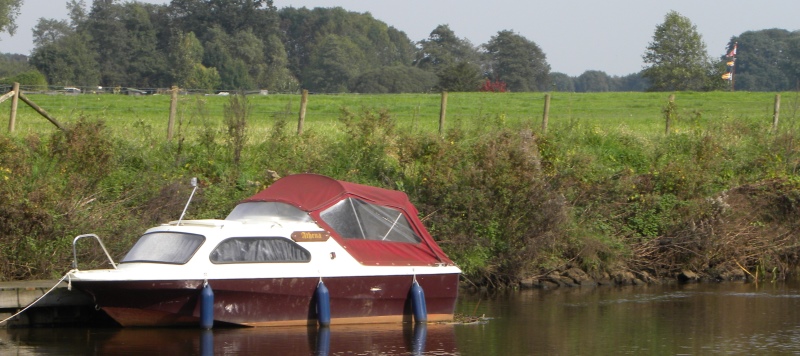
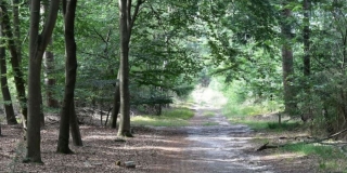
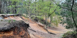
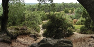
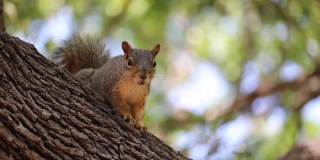
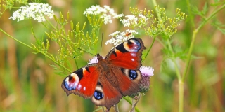
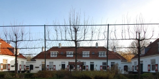
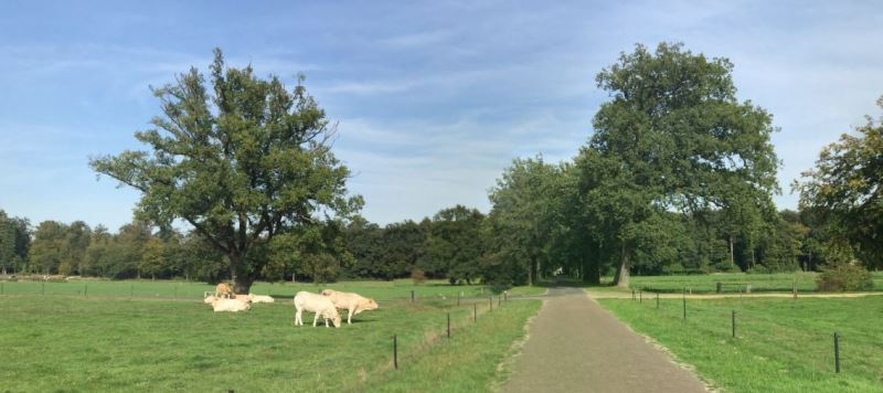
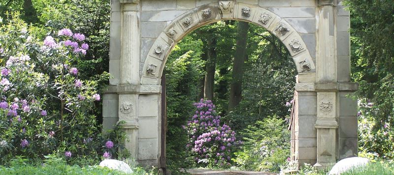
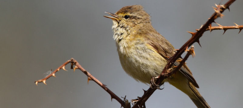
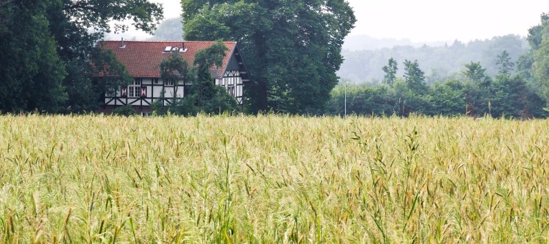
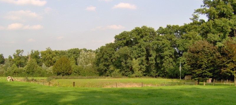
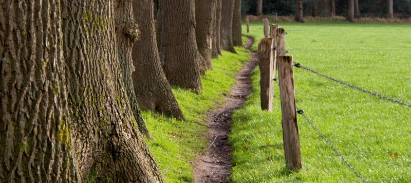
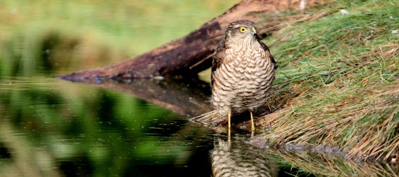
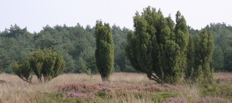
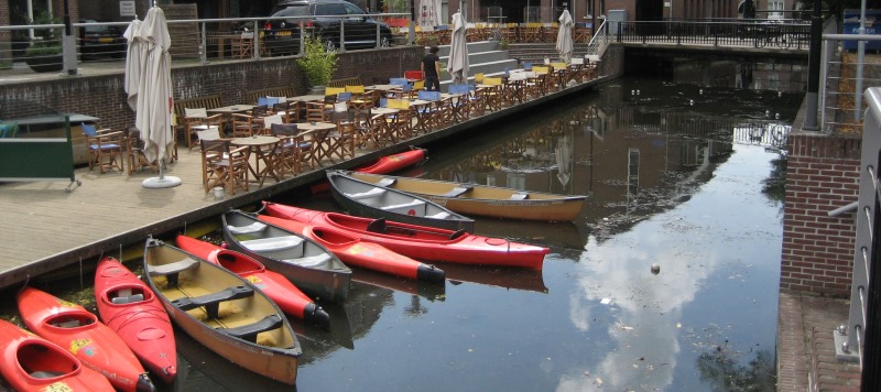
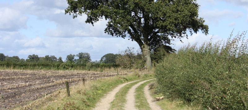
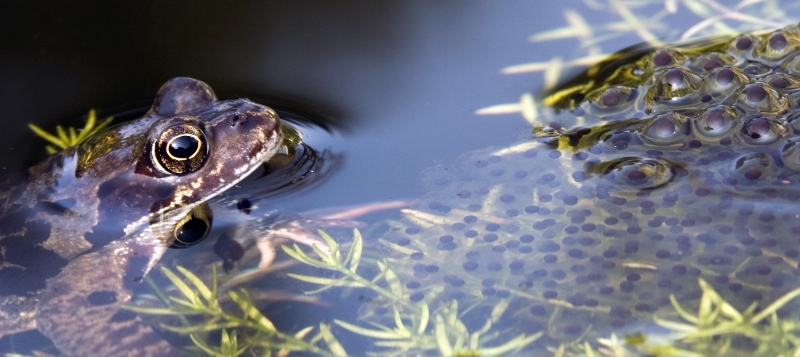
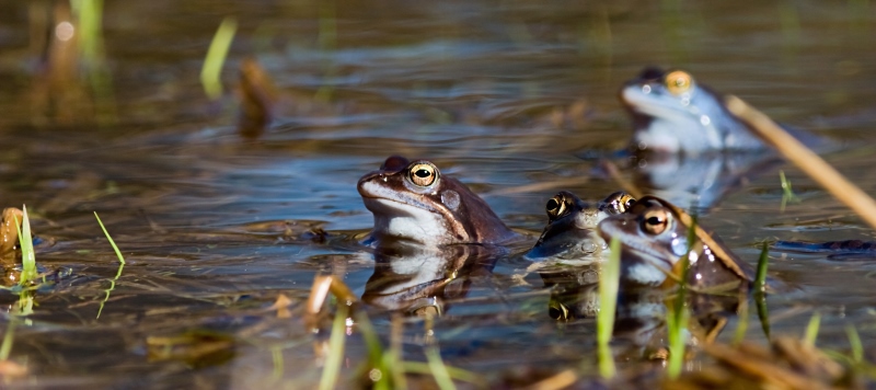
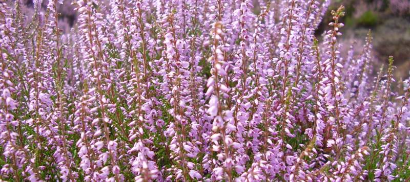
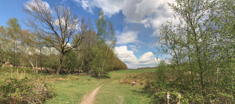
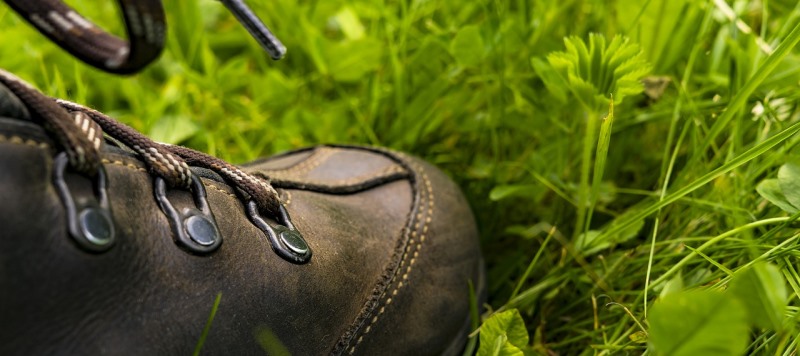
De natuur is ons lief, zo lief dat we er graag recreëren. Maar dat mag niet ten koste gaan van diezelfde natuur. Tegelijkertijd willen we iedere gast een fantastische tijd geven op de Sallandse Heuvelrug.
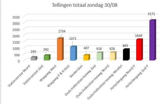
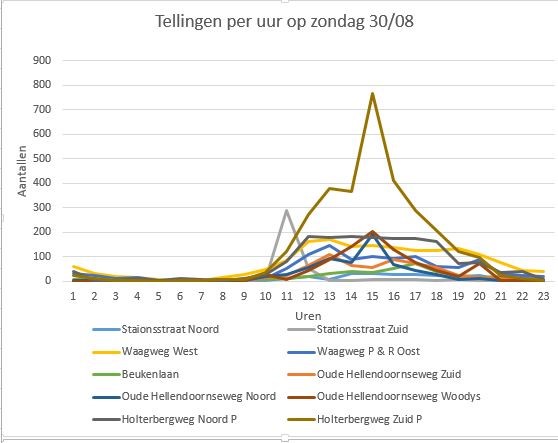
In dit project meten we met Robinson telsensoren hoe druk het is op welke plek. Dit combineren we met de dag van de week, de weersvoorspelling, vakanties en evenementen. Op basis daarvan en op basis van de wensen van de gasten adviseren en verleiden we hen tot de uitjes (routes) waar nog genoeg plek is. En die routes kunnen ze in hun app dan ook meteen downloaden. Aan de achterkant zit dan weer een weging die ervoor zorgt dat uiteindelijk alle plekken even vaak geadviseerd worden.
Via een WordPress widget kunnen ondernemers, bezoekerscentra, en toeristische websites hun gasten op deze manier verleiden tot een heerlijk dagje uit, zonder dat de natuur daar onder lijdt.
Opdrachtgever:
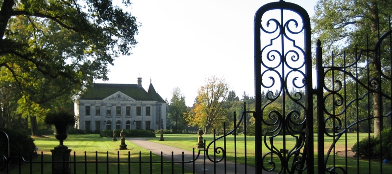
Gastvrij Overijssel & Nationaal Park de Sallandse Heuvelrug


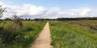
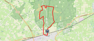
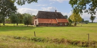
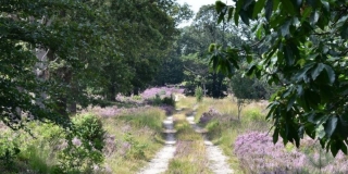
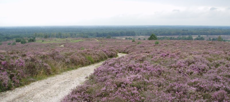
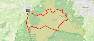
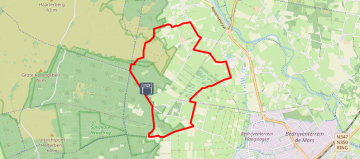
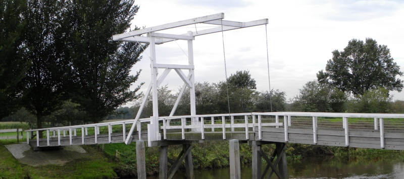
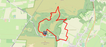
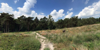
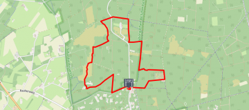
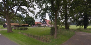
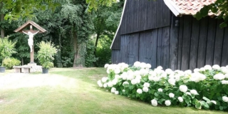
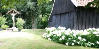
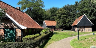
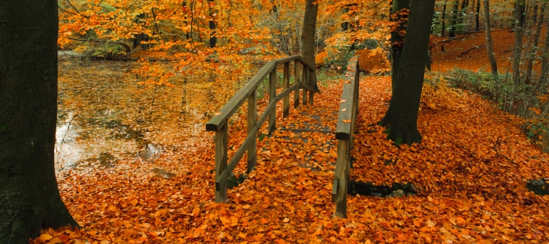
Markelo – Kuierroute (Elsenerbroek)
Length: 10.51 KM
Boeren op survival. Daar gaat deze route over. De verhalen van bewoners vertellen hoe zwaar het leven hier ooit was: het zompige land, de ontembare Regge, de economische malaise. Maar dankzij het harde werken en de ‘aait vedan’ (altijd doorgaan) mentaliteit is de Regge toch getemd en is het leven er inmiddels bijzonder aangenaam. Hoe aangenaam? Dat voelt u onderweg. Tip; neem iets te eten en drinken mee. Op de route liggen namelijk geen horecagelegenheden maar u komt wel langs heerlijke picknickplekken!
Route op mobiel ontvangen?
Vul hieronder uw e-mail in


Markelo – 60 kilometer kuieren
Length: 58.89 KM
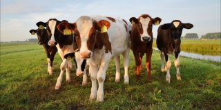
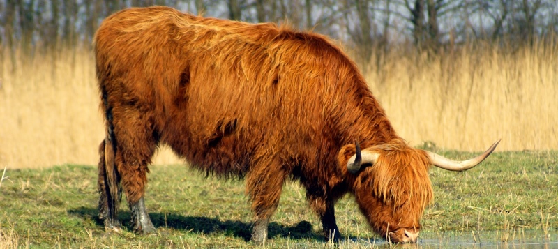
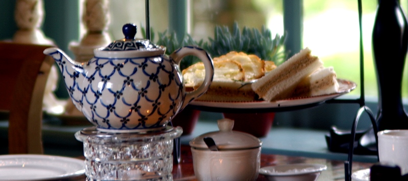
In het Twents betekent ‘kuieren’ praten. Maar het zou zo maar een synoniem kunnen zijn van genieten. Want het is volop genieten als je wandelt door dit Twentse land. Van weilanden met grazende koeien, akkers met wuivend graan en kleine boerendorpen. Al kuierend gaat het over zandpaden, door bossen en langs beken en hoort u af en toe een wielewaal. En onderweg wordt u getrakteerd op prachtige vergezichten over het typische essenlandschap dat eeuwenlang bewerkt is door hardwerkende boeren. Geniet ervan! Horeca onderweg: – Heerlijke ovenverse broodjes! Wapen van Markelo, midden in het dorp. – Twentse gastvriendelijkheid gecombineerd met een Engelse ambiance en een Franse keuken: De Herikerberg tussen Markelo en Goor. – Boerenterras naast een hippisch logement: K&K Pleats in Zeldam. – Taart, tosti of tapa`s: Café Spoolder in Bentelo. – Vroeg uit de veren? Geen probleem, Hof van Twente in Hengevelde is al om 08.00 uur open! Elke dag van de week. – Koffie drink je in Diepenheim op het plein, onder de platanen. – Ooit een jachthuis van de heren van Westerflier, nu een gastvrij onderkomen: De Viersprong, bij Markelo. – Genieten van thee met uitzicht over de glooiende akkers: De Hoestinkhof bij Stokkum.
Route op mobiel ontvangen?
Vul hieronder uw e-mail in


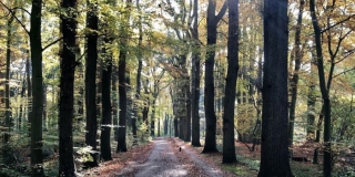
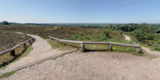
Holten – Over de Holterberg
Length: 9.09 KM
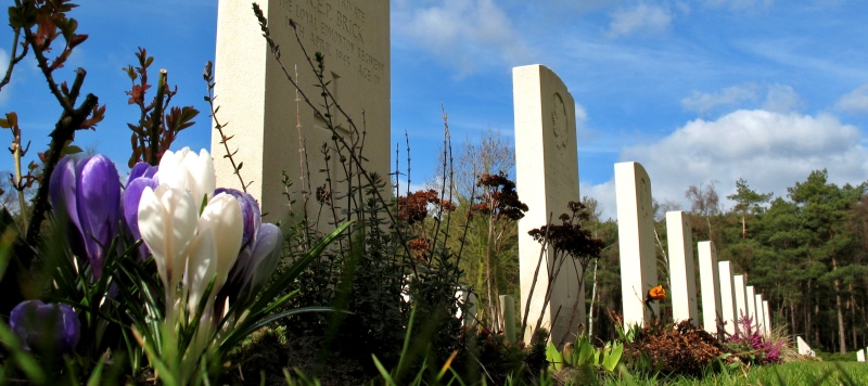
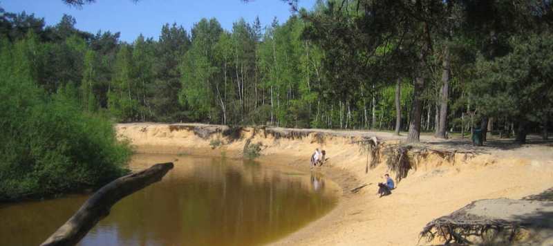
Het beginpunt van deze route is het stationnetje van Holten. Vanaf hier is de Holterberg direct niet te missen. Via het Beukenlaantje maakt u meteen een paar hoogtemeters richting de Holterberg. Aan de Beukenlaan, met haar meer dan 100 jaar oude statige beuken, ligt de Holterenk. Een enk is een aaneengesloten oud bouwland dat door meerdere boeren wordt gebruikt. Vaak worden de percelen afgescheiden door niet meer dan een paar grote veldkeien, de zogenaamde ‘schèidsteen’. U ziet er vast een paar liggen. Verderop komt u bij een zeer indrukwekkende plek; de Canadese Begraafplaats. Het informatiecentrum en de begraafplaats zijn gratis toegankelijk, een aanrader. Wist u dat dit een stukje Canadees grondgebied in Nederland is? Nadat u een prachtige ‘slinger’ heeft gemaakt door bos en heide komt u terug bij het station van Holten. In de omgeving zijn meerdere horeca-gelegenheden.
Route op mobiel ontvangen?
Vul hieronder uw e-mail in


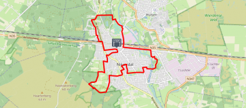
Holten – Numendal walk
Length: 5.11 KM
Het Numendal is in een ver verleden het decor van een Holtense sage; Old Minneke. Deze heks lokte boerenzonen naar een zandkuil in het bos, waarna niemand ze terug zag. Let ook eens op de straatnamen in deze omgeving: Heksenweg, Helhuizerweg, Diepe Hel… Voor Old Minneke hoeft u niet meer te vrezen, tegenwoordig lokt de uitbundige natuur u hier het bos in. Deze wandeling volgt een fabelachtig mooie route door bos en heide. De Panoramaweg, de naam zegt het al, kent prachtige vergezichten. Op het start/eindpunt van deze wandeling vindt u Natuurmuseum Holterberg, een bezoekje waard. Ook zijn hier meerdere restaurants met heerlijke terrassen en kunt u er midgetgolfen.
Route op mobiel ontvangen?
Vul hieronder uw e-mail in


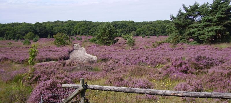
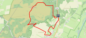
Markelo – Kuierroute
Length: 17.25 KM
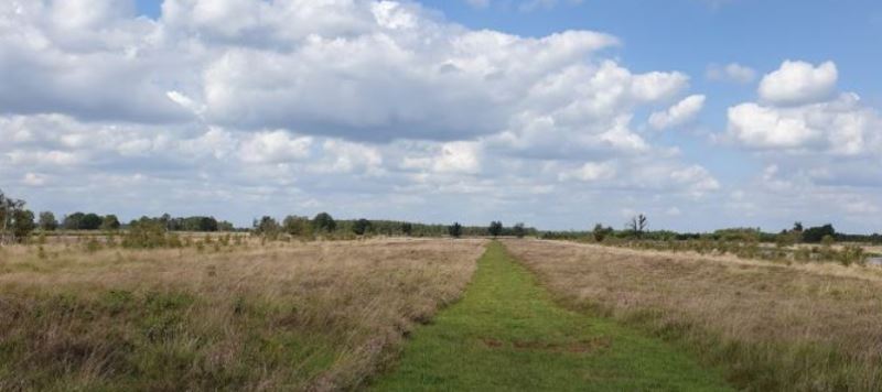
Weet u wat een goastok, een boake of ’n slepper is? Kuier samen met RoutAbel door het lieflijke heuvellandschap rondom Markelo en u komt het allemaal te weten. Ontdek dat dit kleine boerendorp rijk is aan tradities, die vaak hun oorsprong vinden in de religie en het boerenleven. Een zwaar leven, dat in het teken stond van ploeteren en zwoegen. Maar dankzij dat harde werken van deze boeren kunt u nu genieten van een eeuwenoud essenlandschap. Al kuierend wordt u onderweg getrakteerd op de mooiste vergezichten hierover!
Route op mobiel ontvangen?
Vul hieronder uw e-mail in


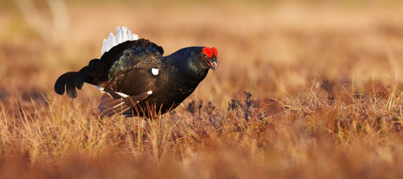

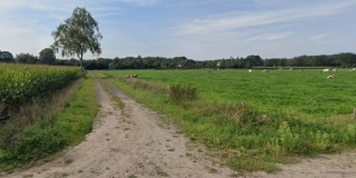
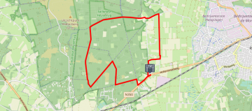
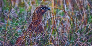
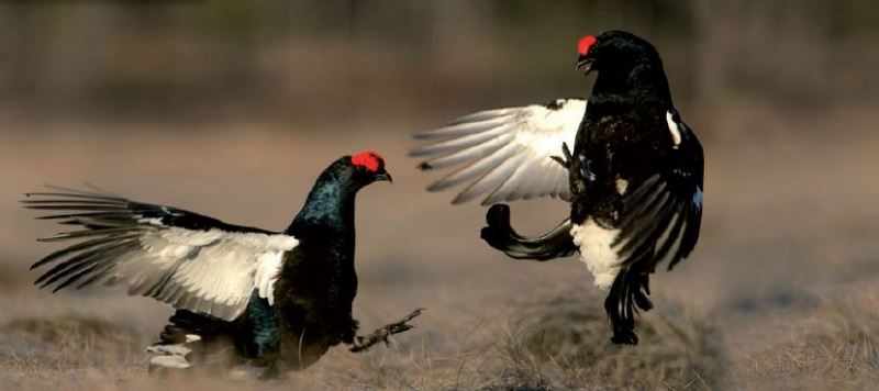
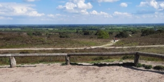
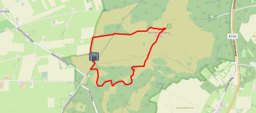
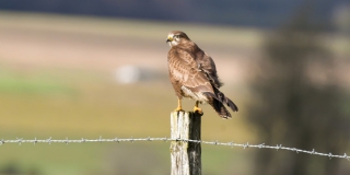
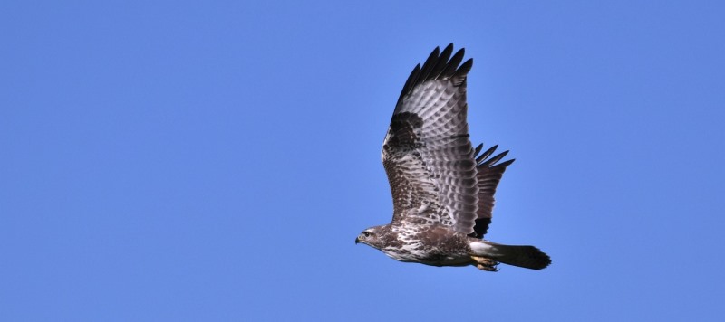
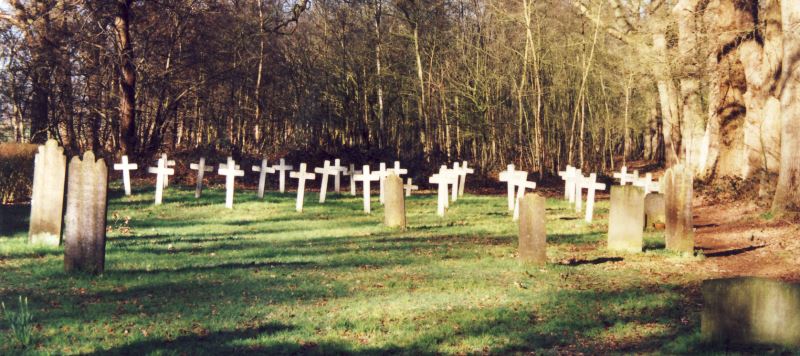
Holten – Korhaantjes en korhennetjes
Length: 11.69 KM
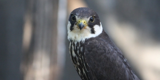
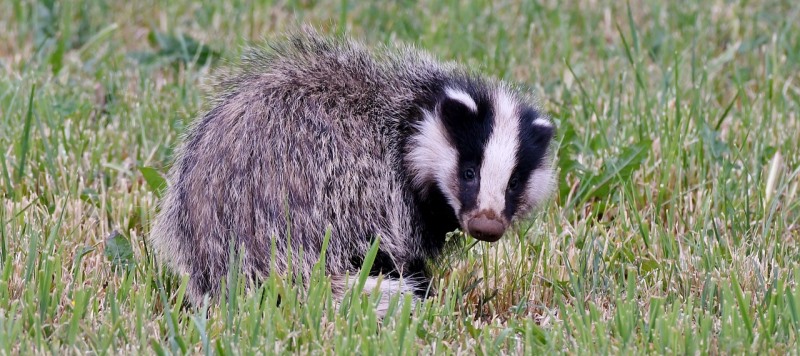
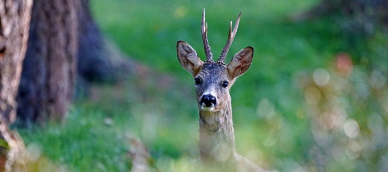
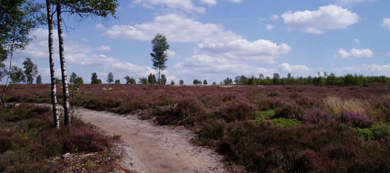
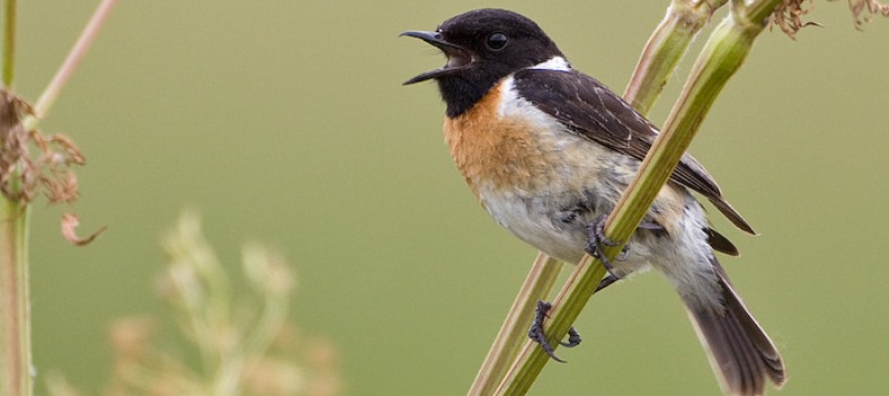
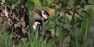
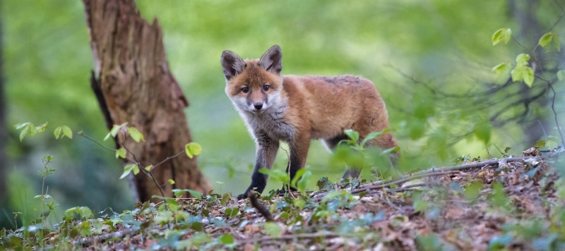
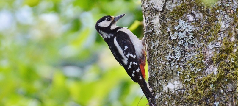
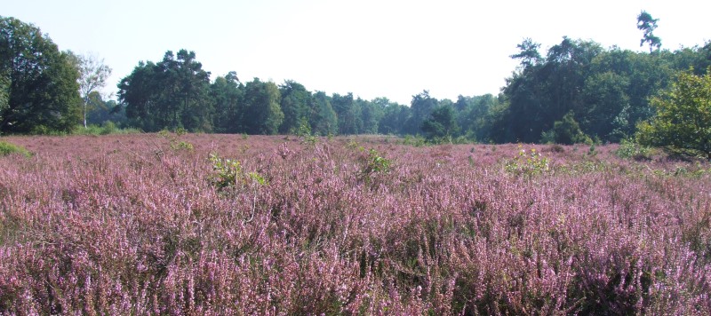
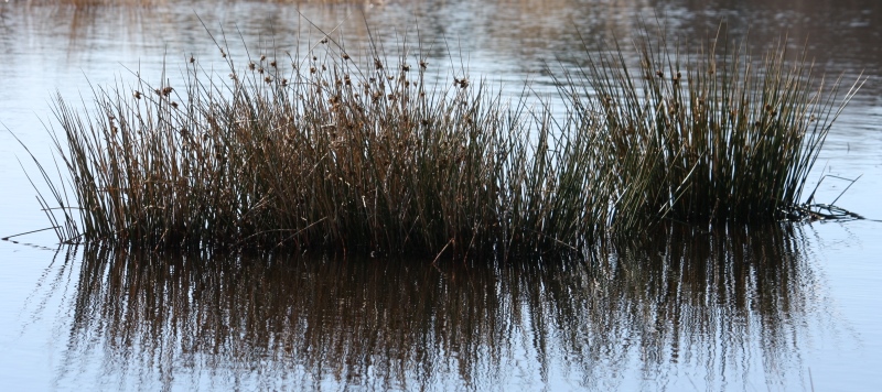
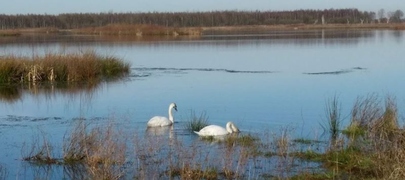
Op de Sallandse Heuvelrug ontrollen zich weidse vergezichten over heidevelden en bossen. Het is het leefgebied van de ree, maar ook schuwe dieren als de vos en de das leiden hier hun nachtelijk leven. Het is zelfs het enige gebied in Nederland waar de korhoen nog in het wild voorkomt. Deze zeldzame vogel wordt niet vaak gezien, maar misschien spot u er één? Tussen dit alles vindt de mens zijn weg op de kronkelende paden. Ervaar hoe de laatste ijstijd dit heuvelige landschap heeft gevormd door het verschuiven van enorm dikke lagen ijs. Deze gevarieerde wandeling voert u ook langs de Canadese Begraafplaats. ‘Lest we forget’, opdat wij niet vergeten, is hier het motto. Neem vooral een kijkje bij deze indrukwekkende plek. Horeca onderweg? Het terras bij Kinderboerderij Dondertman in buurtschap Espelo en de restaurants op de Holterberg ontvangen u graag.
Route op mobiel ontvangen?
Vul hieronder uw e-mail in


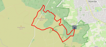
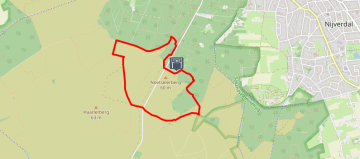
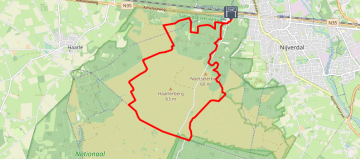
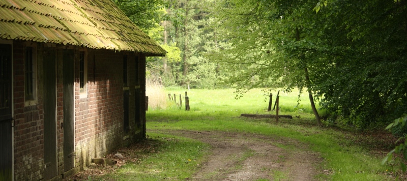
Nijverdal – Noetselerberg
Length: 6.63 KM
Vanaf de kleine openbare parkeerplaats nabij Camping Noetselerberg loopt u de Noetselerberg bij Nijverdal op. Heide en bos domineren het heuvelige landschap, dat in alle seizoenen bekoort. Reeën, dassen, vossen, spechten en ontelbaar vele andere vogelsoorten vinden hier een veilige habitat. Maak uw hoofd leeg tijdens deze fijne wandeling door de rijke natuur. Bij Bistro de Oale Ste (‘de oude plek’) kunt u na de wandeling terecht voor een smakelijke maaltijd of voor een drankje.
Route op mobiel ontvangen?
Vul hieronder uw e-mail in


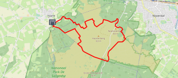
Haarle – Zuidbroek!
Length: 6.54 KM
Dit rondje kent meerdere gezichten! De merendeels onverharde paden leiden u door bossen, maar ook door agrarisch gebied. Wist u dat een ‘broek’ in het landschap een laaggelegen, moerassig gebied betekent? Dan zal het u niet verbazen dat u onderweg meerdere vennetjes tegenkomt, waar vogels graag op af komen.
Route op mobiel ontvangen?
Vul hieronder uw e-mail in


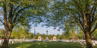
Rijssen – Ligtenberg and Holterberg
Length: 11.43 KM
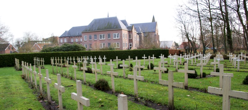
De buurtschap Ligtenberg ligt tussen Rijssen en Holten, aan de voet van de Holterberg. Het eerste deel van de wandeling is licht glooiend, daarna gaan we de Holterberg op. Deze wandeling wordt gekenmerkt door de rijke natuur en door de rust die u onderweg ervaart. Lopend door bos en heide komt u langs de Canadese Begraafplaats. Hier liggen 1394 vooral Canadese soldaten, gesneuveld in WO2. Het gratis toegankelijke interactieve bezoekerscentrum is uw bezoek meer dan waard. Het indrukwekkend ereveld, dat dagelijks wordt bijgehouden door een eigen team hoveniers, is ook te bezichtigen.
Route op mobiel ontvangen?
Vul hieronder uw e-mail in


Nijverdal – Small round
Length: 4.27 KM
Bij Parkeerplaats Noetselerberg, ligt het Uitzichtpunt Noetselerberg. Begin uw wandeling dus met deze traktatie voor uw ogen, niet te geloven dat u toch echt in Nederland bent. Op dit mooie rondje dichtbij het dorp Nijverdal loopt u grotendeels over onverharde paden door een bosrijk en heuvelig gebied. Let op; Parkeerplaats Noetselerberg is bedoeld voor ouderen en minder validen. Overige bezoekers parkeren hun auto ca 1,5 kilometer verderop bij Buitencentrum Sallandse Heuvelrug.
Route op mobiel ontvangen?
Vul hieronder uw e-mail in


Haarle – Met liefde gemaakt
Length: 13.89 KM
De Sprengenberg wordt door velen gezien als de mooiste plek van Salland. Ervaar zelf waarom, wanneer u hier rondzwerft door het donkere bos en over zandverstuivingen en heide . De Palthetoren zet de toon voor deze wandeling, want die is werkelijk een sprookje. De Koningsbelten vormen letterlijk een hoogtepunt. Geen horeca onderweg maar fantastische picknickplekjes in overvloed!
Route op mobiel ontvangen?
Vul hieronder uw e-mail in


Nijverdal – Round Hexel
Length: 9.97 KM
Deze wandeling voert u langs de uitlopers van de Sallandse Heuvelrug en het Twents Reggedal. Deels loopt u over prachtige bosrijke paden en deels door rustiek eeuwenoud landbouwgebied. Breng vooral een bezoek aan kaasmakerij en boerderijwinkel Zunakaas aan de Smalendijk. Rugzak mee dus voor de buitgemaakte lekkernijen!
Route op mobiel ontvangen?
Vul hieronder uw e-mail in


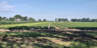
Enter – Dwars door boerenland
Length: 2.16 KM
Heerlijke korte wandeling over verrassend boerenland. Laarzen aan, want het kan drassig zijn. Horeca onderweg: Bij het begin- en eindpunt zit de biologische boerderij Het Exoo. In het winkeltje en op het terras kunt u eerlijk en heerlijke versnapperingen krijgen. U kunt de route inkorten tot 1,2 km. Na 800 meter krijgt u dan een seintje hoe u snel weer bij de boerderij komt.
Route op mobiel ontvangen?
Vul hieronder uw e-mail in


Haarle – Haarlerberg
Length: 12.68 KM
Vanaf Parkeerplaats De Pas gaat het De Sprengenberg op, onderdeel van de Sallandse Heuvelrug. Na ca 350 meter ziet u een van de oudste modellen ANWB-paddenstoelen. Dat geeft al aan dat de recreant ook in vroeger tijden dit gebied al wist te waarderen. En terecht, want de Sprengenberg, Haarlerberg en Noetselerberg bieden u fantastische vergezichten maar ook kronkelige bospaadjes en weidse heidevelden. Een worden met de natuur gaat hier zeker lukken. Dichtbij het start- en eindpunt van de wandeling ligt Herberg De Pas. De sfeervolle herberg uit 1891 nodigt uit tot een verkwikkend drankje of een heerlijke maaltijd.
Route op mobiel ontvangen?
Vul hieronder uw e-mail in


Enter – Zompen en klompen
Length: 9.82 KM
Heerlijke korte wandeling over verrassend boerenland. Laarzen aan, want het kan drassig zijn. Horeca onderweg: Bij het begin- en eindpunt zit de biologische boerderij Het Exoo. In het winkeltje en op het terras kunt u eerlijk en heerlijke versnapperingen krijgen. U kunt de route inkorten tot 1,2 km. Na 800 meter krijgt u dan een seintje hoe u snel weer bij de boerderij komt.
Route op mobiel ontvangen?
Vul hieronder uw e-mail in


Holten – Berg en bos
Length: 11.21 KM
In de buurtschap Espelo begint deze wandeling bij Kinderboerderij Dondertman. De kinderboerderij is door de ANWB meermaals uitgeroepen tot ‘leukste uitje van Overijssel’. Het bijbehorende terras is gratis toegankelijk voor wandelaars, voor of na uw wandeling is het hier goed toeven. Halverwege de wandeling vindt u ook meerdere horecagelegenheden met terras. Op die centrale plek op de Holterberg vindt u ook Natuurmuseum Holterberg, interessant als u meer wil weten over de flora en fauna in dit gebied. Voor het zover is wandelt u door boerengebied en langs de flanken van de Holterberg. Eenmaal op de ‘Hoolterbarg’ gaat de wandeling flink de lucht in. U wordt daarvoor beloond met prachtige vergezichten over de heiderijke omgeving.
Route op mobiel ontvangen?
Vul hieronder uw e-mail in

Holten – Sprengenberg
Length: 13.27 KM
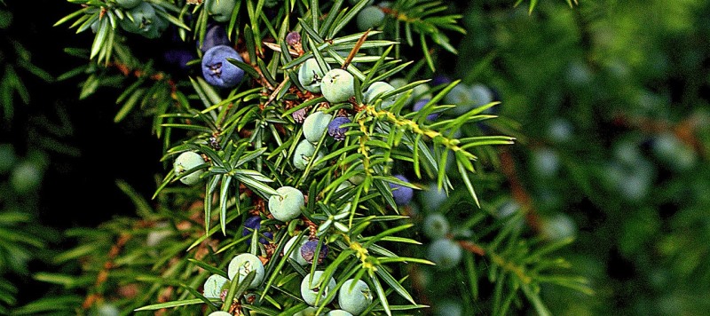
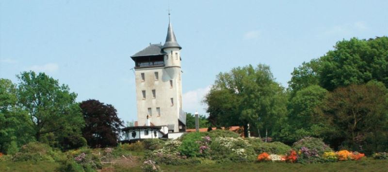
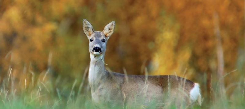
Op de Sprengenberg is de Palthetoren nooit ver weg. In 1898 werd het jachtslot gebouwd door een Twentse textielbaron. Enkele jaren later werd een toren met sterrenobservatorium toegevoegd. Het geheel heeft hiermee een sprookjesachtige uitstraling. Deze prachtig glooiende wandeling voert u uiteraard door bos en heide. U komt ook grote rhododendrons en jeneverbesstruiken tegen, aan afwisseling in het landschap geen gebrek. De Sprengenberg is een hotspot voor de ree, ziet u er één? Let goed op, dan volgen er meestal meer.
Route op mobiel ontvangen?
Vul hieronder uw e-mail in


Ommen – Tom en Jerry op de Beerze Bulten
Length: 14.68 KM
Laat u bij aankomst niet misleiden door een volle parkeerplaats. Aan de overkant betreedt u een wereld van rust en ruimte. Ruimte… waarin zand en wind jarenlang hun goddelijke gang konden gaan. En dat is tegelijk het bestaansrecht van dit gebied. Boeren en baronnen hebben nog geprobeerd hun landgoed en Saksische boerderijen te beschermen. Rondom hun statige landhuizen en akkers plantten ze naaldbomen of plaatsten wallen. Ervaar zelf wat een indrukwekkend landschap dit jarenlange kat-en-muis spel tussen zand en mens heeft opgeleverd. Horeca onderweg: – Op camping de Roos staat een theehuis aan een zijarm van de Vecht. U kunt er ook (biologische) inkopen doen voor een picknick onderweg. Tip: Als u toch in de buurt bent: Beerze is een bijzonder plaatsje met een beschermd dorpsgezicht.
Route op mobiel ontvangen?
Vul hieronder uw e-mail in


Nijverdal – Nijverdalseberg
Length: 6.66 KM
Het Buitencentrum Sallandse Heuvelrug is het startpunt van deze mooie route. U loopt via de flanken van het dorp Nijverdal de Nijverdalseberg op. Een afwisselende route, want u ziet akkers met weidevogels en even later bent u middenin in het bos. Hoort al een specht of een buizerd? De route kent ook een paar klimmetjes. In het Buitencentrum of in Eetcafé de Wieger kunt u nagenieten onder het genot van iets lekkers.
Route op mobiel ontvangen?
Vul hieronder uw e-mail in


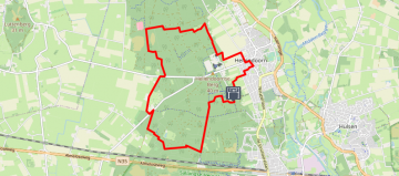
Nijverdal – Ode aan de boom
Length: 12.85 KM
Het 175-jarig bestaan van Nijverdal was in 2011 aanleiding voor IVN Hellendoorn – Nijverdal om een route langs de mooiste bomen van het dorp te ontwikkelen. Sommigen zijn misschien zo oud als Nijverdal, een enkeling zelfs ouder. En allemaal hebben ze de potentie om ons en ons nageslacht te overleven. De vanzelfsprekendheid van de aanwezigheid maakt dat ze nauwelijks de aandacht krijgen die ze verdienen… Maar vandaag wel. U staat stil bij bijzondere bomen en leest onverwachte weetjes in deze versie van de IVN-route van toen.
Route op mobiel ontvangen?
Vul hieronder uw e-mail in


Nijverdal – Sallandse berg
Length: 7.2 KM
Vanaf Buitencentrum Sallandse Heuvelrug wandelt u een prachtige route. Natuurlijk gaat u door bos en heide maar u ziet ook ‘ouderwets kleine’ akkertjes. Het Buitencentrum is het informatiecentrum van de Sallandse Heuvelrug, maar u kunt er ook terecht voor een hapje en een drankje. In de winkel zijn streekproducten te koop, maar bijvoorbeeld ook verrekijkers. Handig als u deze vergeten bent! Want op de route is veel te zien! De uitbundige natuur uiteraard, maar er is meer. Een schaapskooi, het voormalige werkkamp Twilhaar en een Joods monument. Voor kinderen is het Speelbos fantastisch. Naast het Buitencentrum vindt u hier nog 2 horecagelegenheden, keus genoeg dus.
Route op mobiel ontvangen?
Vul hieronder uw e-mail in


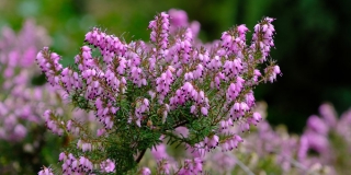
Nijverdal – Purper, paars en violet
Length: 12.25 KM
Purperkleurige heuvels en violet gekleurde dalen. In het voorjaar kleuren de felgekleurde azalea’s en rododendrons de glooiende heuvels. In de zomer neemt de purper bloeiende struikheide het schijnbaar moeiteloos van ze over. Ondertussen doet de zon haar best om door het vele naald- en loofhout, de grond te raken. Of het water, dat onder de grond volop bruist en borrelt zich daar iets van aantrekt is de vraag… Onderweg komt u geen horeca tegen. Maar in het Buitencentrum of bij Eetcafé de Wieger kunt u een kop koffie op het terras drinken.
Route op mobiel ontvangen?
Vul hieronder uw e-mail in


Hellendoorn – Hellendoornsche berg
Length: 11.6 KM
Deze bosrijke wandeling begint vanaf Landgoed de Uitkijk. Ontdek hier zeker het spectaculaire uitzicht vanaf het terras! Onderweg zie u dichte bossen maar ook zandverstuivingen, het landschap is hier nooit saai. Het laatste deel van de wandeling voert u langs het welbekende Avonturenpark Hellendoorn. Iets verderop in het dorp, kunt u terug in de tijd bij het Bakkerij- en IJsmuseum.
Route op mobiel ontvangen?
Vul hieronder uw e-mail in

Giethmen – Archemerberg
Length: 8.11 KM
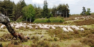
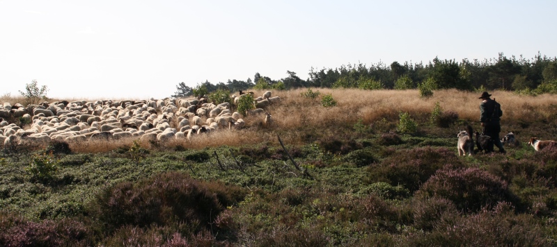
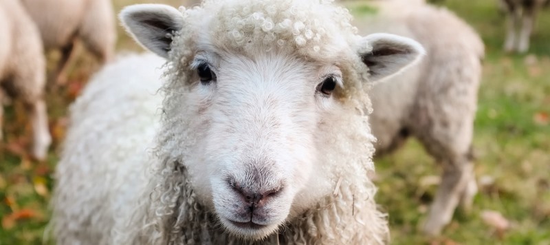
Deze heuvelachtige omgeving nodigt uit voor een wandeling vol hoogtepunten! U vertrekt vanaf Parkeerterrein Oude Raalterweg. Al klimmend over paden komt u langs jeneverbes en zandverstuiving, en kijk, daar is de heide alweer. Komt u hier de schaapskudde tegen? Die kans zit er in. De circa 150 schapen zorgen dat grassen niet te hoog worden en ‘beheren’ zo het terrein. Op de hoogste uitzichtpunten van deze gevarieerde wandeling kunt u zelfs Duitsland zien liggen!
Route op mobiel ontvangen?
Vul hieronder uw e-mail in


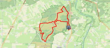
Lemele – Rondje berg
Length: 6.2 KM
Op de flanken van de Lemelerberg ligt Theehuis De Lemelerberg. Vanaf hier gaat u de Lemelerberg verkennen, en daar is genoeg te zien! De oogstrelende omgeving met natuurlijk heide, maar ook zandvlaktes, bronnetjes en jeneverbessen. Speelbos In Het Hol Van de Leeuw heeft zijn naam niet voor niets. Het metershoge beeld van de zittende leeuw houdt de omgeving goed in de gaten. Flinke klimmetjes tijdens deze wandeling, maar de uitzichten mogen er dan ook zijn. Bijvoorbeeld bij de Dikke Steen.
Route op mobiel ontvangen?
Vul hieronder uw e-mail in


Ommen – Op en Top!
Length: 12.35 KM
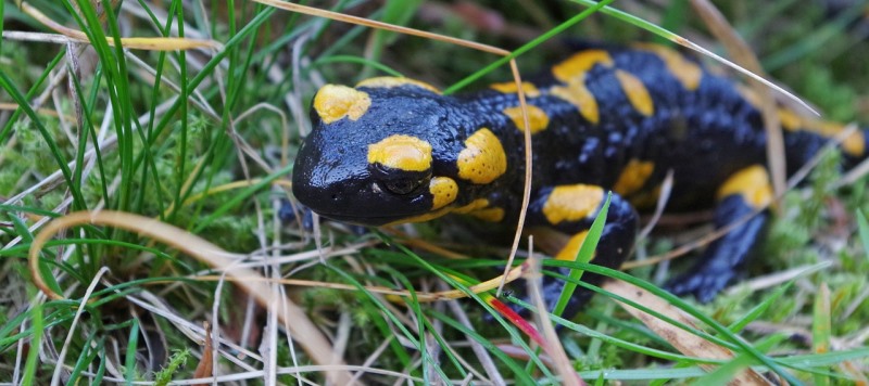
Niet voor niets is deze route al eens verkozen tot wandelroute van het jaar! U wandelt over kronkelende paadjes en statige lanen naar de top van de Archemerberg. Het uitzicht is er adembenemend, de stilte oorverdovend. Onderweg kunt u schaapjes tellen op de heide en wordt u toegezongen door de boomleeuwerik. En als u geluk heeft, kruist een hagedis uw pad, op zoek naar eten. Op en top natuur. Genieten dus, van deze zeer gevarieerde route! Onderweg treft u meerdere horecagelegenheden.
Route op mobiel ontvangen?
Vul hieronder uw e-mail in


Lemele – Lemeleresch
Length: 6.85 KM
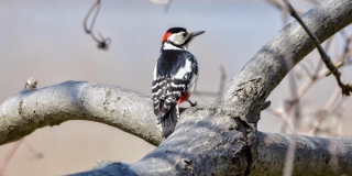
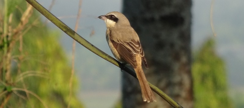
Een prachtige ronde vanaf Startpunt Lemeleresch. Zie zelf hoe het landschap van de Lemelerberg en de Archemerberg gevormd zijn door massa’s schuivend ijs en steen in de laatste ijstijd. Het heeft gezorgd voor overweldigende vergezichten vanaf de uitkijkpunten Lemelerberg en Archemerberg. Heide, bos, bronnen, zandvlaktes; het is allemaal te zien. De zeldzame levenbarende hagedis en de grote bonte specht vinden het hier een fijne plek. Na deze heerlijk heuvelige wandeling bent u het vast met ze eens!
Route op mobiel ontvangen?
Vul hieronder uw e-mail in


Lemele – Along the ’thick stone’
Length: 4.6 KM
Vanaf Parkeerplaats Dalmsholte loopt u een prachtig rondje over de Lemelerberg en de Archemerberg. De Ravijntjes zijn ontstaan nadat het ijs uit de laatste ijstijd smolt en wegliep. De Dikke Steen, een gigantische zwerfkei, stamt ook uit die tijd. In later tijden werd de steen gebruikt als grenssteen tussen 2 marken. Vanaf uitzichtpunt Archemerberg kunt u bij helder weer zelfs Zwolle zien liggen! Heerlijk slingerende wandeling over heuvels en door dalen.
Route op mobiel ontvangen?
Vul hieronder uw e-mail in


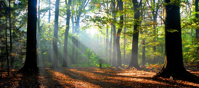
Holten – Bomen, bos en bitterbal
Length: 6.07 KM
Weet je hoe bosranden zijn ontstaan? En waarom je steeds minder kaarsrecht aangelegde bossen ziet? Deze route gaat over rechte en kronkelende paadjes, over heuvels en langs riviertjes. Dwars door het bos en de hei. Onderweg lees en hoor je wat bos en hei met elkaar te maken hebben. Zo komt je net wat dichter bij de natuur dan anders. En dat is precies de bedoeling van het NP De Sallandse Heuvelrug! Horeca onderweg: Onderweg kom je niets tegen. Nagenieten met een bittergarnituur? Op het einde van de route wachten een aantal terrasjes. De keus is aan u.
Route op mobiel ontvangen?
Vul hieronder uw e-mail in


Enter – Over exootisch land
Length: 3.34 KM
Heerlijke korte wandeling over verrassend boerenland. Laarzen aan, want het kan drassig zijn. Horeca onderweg: Bij het begin- en eindpunt zit de biologische boerderij Het Exoo. In het winkeltje en op het terras kunt u eerlijke en heerlijke versnaperingen krijgen.
Route op mobiel ontvangen?
Vul hieronder uw e-mail in


Vilsteren – Lovers only
Length: 2.09 KM
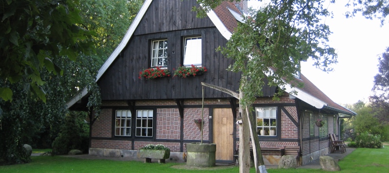
Een landgoed, maar dan anders. Niet met één monumentaal landhuis, maar met een heel dorp, inclusief molen, bakker en dorpsdokter. Snoezige slingerpaadjes, verstilde boerenerven en klassieke hagen met romantische hide-aways. Hier wandel je niet met zomaar iemand… Je zult onderweg maar betoverd worden…. Herberg de Klomp is het start- en eindpunt, mooi van binnen en van buiten.
Route op mobiel ontvangen?
Vul hieronder uw e-mail in


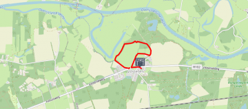
Testrondje – campus TU Twente
Length: 2.39 KM
Testrondje om verschillende nieuwe functies in de app uit te proberen
Route op mobiel ontvangen?
Vul hieronder uw e-mail in


Wiene – Kuierroute
Length: 7.51 KM
Groene weilanden, akkers en af en toe een boerderij. Eeuwenlang zag het landschap rond Wiene er zo uit. De aanleg van de spoorlijn en van de kanalen heeft dat wel veranderd. Doorgaande wegen werden afgesneden en buren en buurten werden van elkaar gescheiden. En dat was lastig in een hechte gemeenschap zoals Wiene waar het ‘noaberschap’ nog leeft. Maar het heeft ook veel goeds gebracht. Want overstromingen behoren nu tot het verleden, indrukwekkende aalscholvers vliegen af en aan en een geel, inheems plantje siert de spoorlijn. Horeca onderweg: – Voor of na het kuieren: lunchen in een historische herberg. In den Markenrichter in Ambt-Delden.
Route op mobiel ontvangen?
Vul hieronder uw e-mail in


Zeldam – Kuierroute
Length: 10.38 KM
Deze omgeving had eeuwenlang te kampen met wateroverlast. Tegenwoordig houden de bewoners droge voeten. En u ook. Of het moet van het vochtige gras zijn dat op de schouwpaden langs de kabbelende beekjes groeit. Horeca onderweg: Er is geen horeca onderweg. Wel eersterangs picknickplekken waar u geniet van het schouwspel om u heen!
Route op mobiel ontvangen?
Vul hieronder uw e-mail in


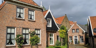
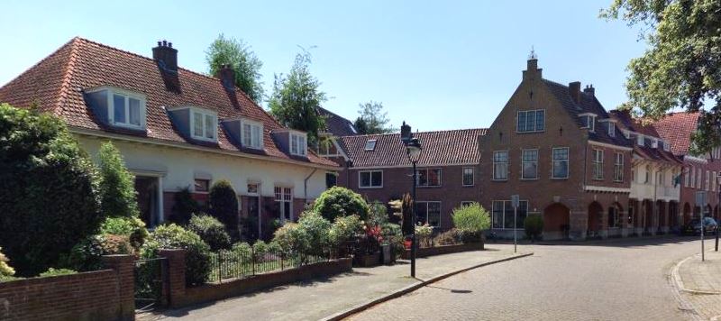
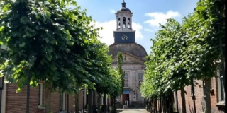
Hengelo – Trots op Tuindorp
Length: 4.34 KM
Verrassend, lieflijk en gevarieerd. Dat is Tuindorp ’t Lansink. Aan de gebogen straten staan witgepleisterde huizen met prachtige gevels die Engels aandoen. Rond een plein domineren weer panden met rode baksteen en Hollandse dakpannen. Als je niet beter weet, zou je denken dat het een dorp is dat op natuurlijke wijze is ontstaan. Niets is minder waar. ’t Lansink bestaat pas een eeuw en is bedacht achter de tekentafel. Over het ontwerp is goed nagedacht. Niet voor niets is de bouw in 3 fasen uitgevoerd. RoutAbel leidt u graag door dit bijzondere gedeelte van Hengelo en vertelt u het verhaal achter ’t Lansink.
Route op mobiel ontvangen?
Vul hieronder uw e-mail in


Tubbergen – Krachten bij de Kroezeboom
Length: 7.29 KM
Voor Christus plaatste men op kruisingen van leylijnen heidense heiligdommen. En bij de Kroezeboom komen maar liefst 37 van deze energiebanen samen. De Kroezeboom was dan ook, en is nog steeds, één van de meest heilige plekken in Twente. Wandel over de glooiende essen en ga terug in de tijd. De Fleringer Es biedt door zijn oude, glooiende landschap een prachtige wandeltocht met veel vergezichten. Al honderden jaren wonen hier boeren, die met hun bemestingsmethode voor de glooiingen in het landschap hebben gezorgd. Om de zandgronden vruchtbaar te maken, mengden zij heideplaggen met schapenmest en verspreidden dat over de akkers. Iedere eeuw werden de akkers zo één à twee centimeter hoger en dat al minstens duizend jaar lang! Horeca onderweg: – Café restaurant De Molen.
Route op mobiel ontvangen?
Vul hieronder uw e-mail in
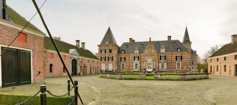
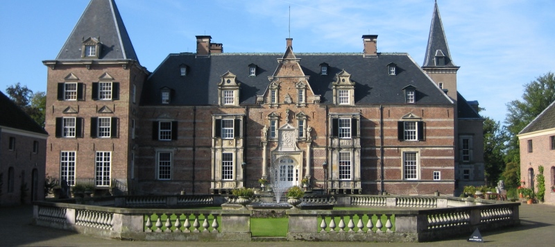
Delden – Baronnen in Delden
Length: 11.76 KM
In het rustieke stadje Delden, dat al in 1333 stadsrechten kreeg, is het van oudsher goed toeven. Gelegen aan de historische verkeersweg van Amsterdam naar Berlijn is Delden al eeuwenlang ingesteld op het ontvangen van gasten. Overal is de band voelbaar met het unieke Landgoed Twickel, een landgoed dat leeft en waar mensen met liefde wonen en werken. Het omvat een kasteel, watermolens, prachtige tuinen en nog veel meer. Horeca onderweg: – Theetuin in de Oranjerie van de kasteeltuinen van Twickel. Een heerlijk plekje. Van juni tot en met september kunt u hier tussen 11.00 en 16.30 uur terecht. – Hotel-restaurant het Witte Paard. Als het mooi weer is ga dan even lekker zitten op het terras onder de reusachtige kastanjebomen van deze bourgondische herberg. – Hotel-restaurant de Zwaan. Het hotel huist in een monumentaal pand waarin veel originele details bewaard zijn gebleven, zoals een prachtige tegelvloer, kleurig glas in lood en een stijlvolle muurschildering. Een mooi plekje om te eten en te slapen.
Route op mobiel ontvangen?
Vul hieronder uw e-mail in


Ootmarsum – Poaskearl of de kerstman
Length: 6.32 KM
Is het godenverering of geestenverdrijving? Van sommige Twentse gebruiken zullen we het nooit weten. In ieder geval zijn er opvallend veel regionale tradities rondom het paasfeest. Opvallend, want kerst wordt hier precies zo gevierd als in de rest van Nederland. Nee, dan Pasen. Dat is voor toeristen en oud-bewoners elk jaar weer een reden om terug te komen. Poaskearls, paasbest, paastak; onderweg hoor en leer je er alles over. Je wandelt door natte beekdalen, over glooiende essen en uiteindelijk tussen de oude vakwerkhuizen en kleine steegjes van het gastvrije Ootmarsum. Horeca onderweg: – Keuze uit diverse terrasjes in en om de markt in Ootmarsum – Probeer de krentenwegge met in rum gewelde krenten en rozijnen van bakkerij Schulten. Tip: Plan voldoende tijd in om ook uitgebreid de kunstwinkels en galeries in Ootmarsum te bekijken. Ze zijn ook op zondag open.
Route op mobiel ontvangen?
Vul hieronder uw e-mail in


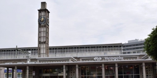
Hengelo – Het verhaal van Hengelo
Length: 4.62 KM
Hengelo, ooit een rustiek boerendorp, is bekend geworden als metaalstad én sinds kort door Jeffrey Spalburg. Deze zanger en cabaretier scoorde in 2013 een hit met het nummer Hengelo-o-o, waarin hij een ode brengt aan de stad waar hij zijn jeugd doorbracht. Maar over Hengelo is veel meer te vertellen. Hengelo heeft historie. Hengelo heeft een eigen verhaal. Een boeiend verhaal dat zelfs bij de eigen inwoners niet eens zo bekend is. RoutAbel leidt u graag door deze gastvrije Twentse stad en vertelt u over haar indrukwekkende opmars. Horeca onderweg: – Lunchen op een bekroond terras: Tuindorphotel `t Lansink – Genieten in het groene hart van Hengelo: Paviljoen De Ontmoeting in het Prins Bernhardplantsoen – Tijd voor terras? Keus genoeg op en rond het Burgemeester Jansenplein, midden in de stad. De meeste foto`s die getoond worden, zijn afkomstig van het Historisch Museum Hengelo. U vindt dit museum op de Beekstraat 51 (open: di t/m vr 13-17 uur en za/zo 14-17 uur).
Route op mobiel ontvangen?
Vul hieronder uw e-mail in


Vasse – Vers water en krentenwegge
Length: 7.96 KM
Hier in Twente welt helder water spontaan op uit de grond. Heerlijk verkoelend en dorstlessend, terwijl u één van de mooiste wandelingen in Twente maakt. De tocht voert door een afwisselend, eeuwenoud, glooiend landschap over holle weggetjes, langs kabbelende beekjes met glashelder water, langs watermolens en over beboste heuvels. Horeca onderweg: – Bij het startpunt zit Watermolen Bels, een gezellige theeschenkerij met een heerlijk terras. – Tip: In Vasse zit het Twentsch Wijnhuis; heerlijke wijnen, ruime keus. Iedere week staan er meer dan 40 wijnen op de proeftafel.
Route op mobiel ontvangen?
Vul hieronder uw e-mail in


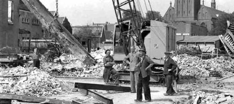
Hengelo – Waardige Wederopbouw (wandelroute)
Length: 2.56 KM
Saai en niet interessant; zo wordt de wederopbouwarchitectuur vaak bestempeld. Maar als je goed kijkt, ontdek je dat de architecten juist oog hadden voor detail en op een gedurfde manier om gingen met zowel bestaande als nieuwe materialen. Hier in Hengelo zijn daar, ‘dankzij’ de meer dan veertig bombardementen tijdens WOII, genoeg voorbeelden van te vinden. De stad ging direct na de oorlog vooruitstrevend aan het werk. En dat zie je terug. In het stratenplan, in gebouwen en in woonwijken. De wederopbouwpanden van toen zijn de monumenten van nu. Hengelo is er trots op en RoutAbel laat u graag zien waarom! Horeca onderweg: – Genieten in het groene hart van Hengelo: Paviljoen De Ontmoeting in het Prins Bernhardplantsoen. – Tijd voor terras? Keus genoeg op en rond het Burgemeester Jansenplein, midden in de stad. De meeste foto`s die getoond worden, zijn afkomstig van het Historisch Museum Hengelo. U vindt dit museum op de Beekstraat 51 (open: di t/m vr 13-17 uur en za/zo 14-17 uur).
Route op mobiel ontvangen?
Vul hieronder uw e-mail in


Vasse – Vers water en krentenwegge
Length: 12.61 KM
Hier in Twente welt helder water spontaan op uit de grond. Heerlijk verkoelend en dorstlessend, terwijl u één van de mooiste wandelingen in Twente maakt. De tocht voert door een afwisselend, eeuwenoud, glooiend landschap over holle weggetjes, langs kabbelende beekjes met glashelder water, langs watermolens en over beboste heuvels. Horeca onderweg: – Prima terras én prima appeltaart: De Liskoel in Vasse. – Tante Sien in Vasse: al meer dan 130 jaar een begrip.
Route op mobiel ontvangen?
Vul hieronder uw e-mail in


Delden – Trendy Twickel
Length: 8.17 KM
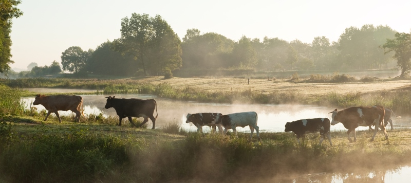
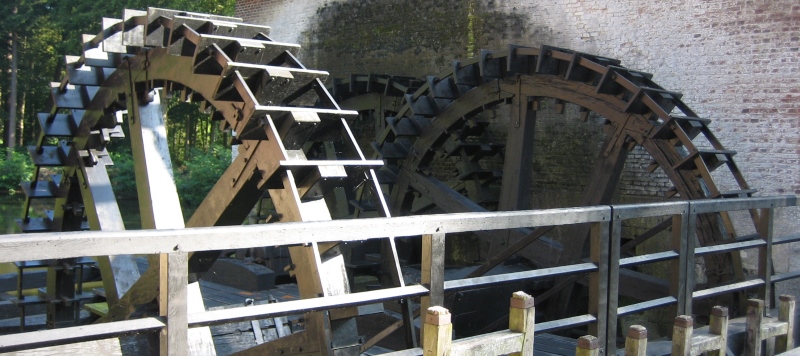
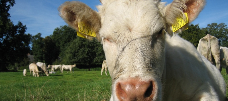
De wandeling start op de Deldeneresch. Langs grazende koeien en biddende roofvogels. Al snel wordt de grond onder uw voeten minder vast. Vlonders zorgen ervoor dat u het moeras veilig kunt oversteken. Dan is er ruimte voor de statige lanen die horen bij een eeuwenoud landgoed. Dwars door het sprookjesachtige Twickelerbos vol met verrassende vaarten en stroompjes die niet zonder elkaar zouden kunnen bestaan. Bijgestaan door de met engeltjes versierde watertoren en een ooit erg nijvere Noordmolen regelen ze de wateraan- en afvoer van de omgeving. Horeca onderweg: – Kids zijn gemakkelijk te verleiden voor deze wandeling. Ervoor en erna kunnen ze eindeloos spelen bij `t Hoogspel – In de Landgoedwinkel van Twickel is alles te koop voor een biologische picknick. – `s Winters oranjerie, `s zomers theehuis! Sfeervol, maar u moet er wel een kaartje voor de Kasteeltuin voor aanschaffen: Oranjerie Twickel Let op: bij een klein stukje van de route zijn honden niet toegestaan. Bent u met de hond, dan krijgt u daar een tip hoe u kunt lopen om dit stuk te mijden.
Route op mobiel ontvangen?
Vul hieronder uw e-mail in


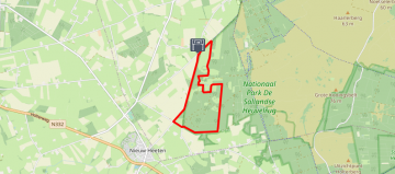
De Lutte – Wild wandelen bij Jos
Length: 4.19 KM
Jos is een natuurboer. De boerengrond van Natuurboer Jos Eldering ontwikkelt zich langzaam maar gestaag tot rijke en ruige natuurgrond. Een droomplek waar veel bijzondere planten, vogels en insecten graag vertoeven. Je komt er via het erf. Kijk, ruik en luister hoe het ook kan in Nederland. En…, je mag er -met respect- ook van plukken en proeven. Een beetje dan! En geniet ook van het landschap. Dit is zeker in de lente één van de mooiste wandelingen van Nederland. Door coulissen, langs beken en over wilde weilanden. Aan het eind van de wandeling kom je weer bij Boer Jos. Ga dan zeker even kijken in de skybox boven de stal.
Route op mobiel ontvangen?
Vul hieronder uw e-mail in


De Lutte – Godenverering in de Lutte
Length: 15.17 KM
Al wandelend door een glooiend landschap ontdekt u hoe het geloof hier door de eeuwen heen zijn sporen heeft nagelaten. Van een offerplaats voor de Germaanse godin Tanfana tot diverse kleinschalige mariakapelletjes. Klimmen en dalen over de heuvelrug die het stuwende ijs hier 150.000 jaar geleden heeft achtergelaten. Slingerende bospaadjes voeren u van top naar top over de Tankenberg, de Hakenberg en de Paasberg. Steeds opnieuw wordt u beloond met spectaculaire uitzichten. Maar pas op, hier waakt de hellehond! Horeca onderweg: – Hotel Restaurant de Wilmersberg op een buitengewoon mooie plek, op de uitlopers van de Twentse heuvelrug. Vooral het grote terras aan de achterkant is een heerlijke plek met een fantastisch uitzicht over het Twentse landschap. – Diverse andere horeca in het centrum van De Lutte.
Route op mobiel ontvangen?
Vul hieronder uw e-mail in


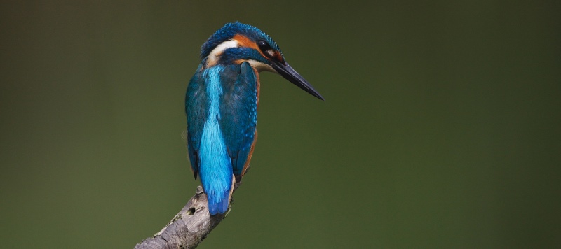
Hertme – Kort door de bocht
Length: 6.47 KM
Langs de mooie Bornsche beek, ooit een belangrijke scheepvaartroute, wandelt u vanuit Hertme stroomafwaarts richting de Loolee. Het water is er kraakhelder, de ijsvogel lijkt uiterst tevreden en de eigenwijze Gelderse roos duikt op waar hij maar kan. Alleen al vanwege de fascinerende naam moet u even langs bij Pleisterplaats Rabo H. Scheele. Een authentiek gebeuren, vernoemd naar een belangrijk politicus uit de 17e eeuw. Het water blijft boeien, net als het verhaal van landgoed Weleveld en het Spookhuis van Havezate Grotenhuis. Deze wandeling zal u nog lang bij blijven… Horeca onderweg: – Natuurlijk koffie met krentenwegge. Ook lekkere streekproducten. Pleisterplaats Rabo Scheele – Van oudsher de beste plek. Dicht bij de Hertmese kerk. Restaurant `t Oale Bakkershoes – Gastvrij en geschiedenis in één. Rustpunt Erve Daggel
Route op mobiel ontvangen?
Vul hieronder uw e-mail in


De Lutte – Kiek op Natuurmonument Egheria
Length: 7.92 KM
“Good kiek’n” zeggen ze in Twente. En dat gaat u vast en zeker doen; goed om u heen kijken. Er valt zoveel te zien tijdens deze heerlijke wandeling door het Twentse land. Volop genieten van de natuur. Kleefkruid en co zijn ruim vertegenwoordigd. Inspiratie genoeg voor de mooiste kiekjes. Zeker met de kiek-tips die we geven. Misschien het proberen waard? Net als de mindfulness-oefeningen, voor een nog bewustere beleving van de route. In alle opzichten een bijzondere wandeling. Tip: Neem een gevulde rugzak mee voor onderweg. Er zijn volop picknick-plekjes. Op bankjes of lekker in het gras.
Route op mobiel ontvangen?
Vul hieronder uw e-mail in


Zenderen – Ontdek het rijke, roomse leven
Length: 8.24 KM
De natuur rond Zenderen is dé plek om innerlijke rust te vinden, want hier heerst nog echte stilte. In de middeleeuwen hebben monniken dat ook ontdekt. Zij bouwden kloosters en legden monniken- en kerkepaden aan. Daar zult u ook over lopen. Lekker eten en drinken konden de monniken ook. Die traditie wordt voortgezet in Restaurant Het Seminar. Michelin voorzag dit restaurant van een Bib Gourmand. Geniet hier heerlijk van het rijke, roomse leven. Horeca onderweg: – Restaurant De Kloostergang, gewoon goed en gezellig. – Pleisterplaats Rabo H. Scheele, boerenterras waar historie en gastvrijheid hand in hand gaan.
Route op mobiel ontvangen?
Vul hieronder uw e-mail in


Saasveld – Door de ogen van Mondriaan
Length: 6.19 KM
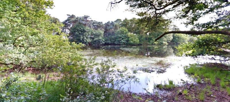
De wandeling gaat door het fraaie coulisselandschap rond het kerkdorp Saasveld en door oerbos het Molenven. Dit natuurgebied is één van de belangrijkste bosreservaten van Nederland. De natuur mag hier volledig haar gang gaan; omgewaaide bomen en dood hout worden niet opgeruimd. Het reservaat bestaat voor een groot deel uit moerasbos en verboste heide. Vogelliefhebbers komen hier écht aan hun trekken: er zijn veel watervogels en roofvogels. Oeroude bossen hebben iets mysterieus. De natuur en de fantasie van de mens hebben hier eeuwenlang ongebreideld hun gang kunnen gaan. Ook Piet Mondriaan zag de mystiek en schilderde hier zijn ‘Ven bij Saasveld’ waarbij hij de geheimzinnige atmosfeer perfect wist neer te zetten. Horeca onderweg: – Restaurant `t Molenven. – In de buurt: IJsboerderij Oude Hesselink. Ambachtelijk roomijs en sorbetijs. Tip: Het Molenven kan vrij nat zijn, dus trek stevige schoenen aan.
Route op mobiel ontvangen?
Vul hieronder uw e-mail in


De Lutte – Dinkel op z`n best
Length: 4.74 KM
Kenners zijn lyrisch over het natuurlijke karakter van de Dinkel. Door de vele bochten verrast hij steeds weer. Zo kan er achter de volgende bocht zomaar een lekker zandstrandje liggen. Waarom helemaal naar zee rijden als je hier heerlijk in het mulle zand kunt zitten en af en toe kunt pootje baden in de Dinkel. Een terrasje pakken bij `t Paviljoen of lekker picknicken aan de oever, wat wil je nog meer? Toch is er in het Lutterzand niet alleen strandplezier te beleven. Het is ook een heel bijzonder natuurgebied waar de zeldzame jeneverbes groeit en waar de ijsvogel en oeverzwaluw nog voorkomen. Horeca onderweg: – Paviljoen met terras in het bos. Ongedwongen provinciaals. Lekkere appeltaart. – Meer van deze tijd: Mooie omgeving, mooie kaart en lekkere streekproducten! Restaurant Florilympha Tip: Picknicken aan de oevers van de Dinkel? Bij Bloemenbeek kunt u een gevulde picknickmand reserveren. Tel. 0541-551224. Let op: Honden mogen mee, wel aanlijnen graag!
Route op mobiel ontvangen?
Vul hieronder uw e-mail in

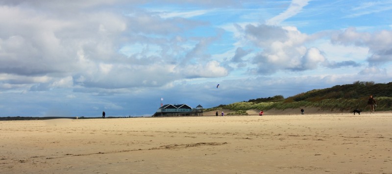


Domburg – Bos, Duinen en Zee
Length: 7.82 KM
Korte wandeling, goed voor mens en dier, de hond mag mee. Het eerste stuk door de duinen de hond aangelijnd houden i.vm. loslopend reewild. Daarna mag de hond op het strand helemaal los gaan. Horeca onderweg: Strandpaviljoen Berckenbosch, heerlijk plekje.
Route op mobiel ontvangen?
Vul hieronder uw e-mail in


De Lutte – Pootje baden in het Lutterzand
Length: 5.55 KM
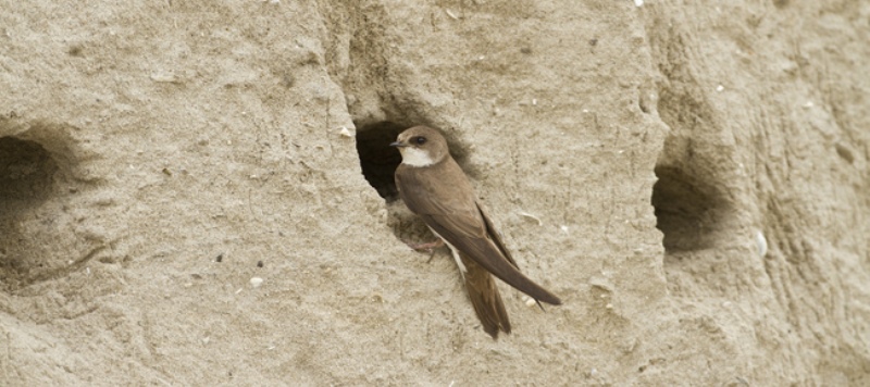
Het Lutterzand is van oudsher een populaire bestemming voor Tukkers die een dagje op pad gaan. Waarom helemaal naar zee rijden als je hier heerlijk in het mulle zand kunt zitten en af en toe kunt pootje baden in de Dinkel. Een terrasje pakken bij ‘t Paviljoen of lekker picknicken aan de oever, wat wil je nog meer? Toch is er in het Lutterzand niet alleen ‘strand’-plezier te beleven. Het is ook een heel bijzonder natuurgebied waar de zeldzame jeneverbes groeit en waar de ijsvogel en oeverzwaluw nog voorkomen. Horeca onderweg: Bij het begin en eindpunt zit Restaurant en terras Paviljoen ’t Lutterzand.
Route op mobiel ontvangen?
Vul hieronder uw e-mail in


Almelo – De Aa van Almeloo
Length: 5.84 KM
Begin- en eindpunt: Bibliotheek Almelo, Het Baken 3, Almelo. Ben je met de auto, dan kun je ook starten op de parkeerplaats op de Gravenallee. Daar kun je gratis parkeren (zie P op de kaart). Omschrijving van deze stadswandeling: Het stelsel van waterlopen, kolken en bleken is helaas niet meer. Alleen de Aa is gespaard gebleven en het Kolkje, dicht bij het uit de textieltijd stammende Wevershuisje en de Herengracht, doet tegenwoordig afwisselend dienst als schaats- of roeivijver. Om Huize Almelo heen loopt u verder richting de lange Gravenallee. De Graaf zag het bezoek al vanaf 5 km aankomen. Via de Loolee, -loo staat voor bos en lee voor water- langs het kanaal met zijn rijke flora en fauna. Mooie doorkijkjes naar de stad. De haven komt vanzelf weer in zicht! Horeca onderweg: – Ook als u geen zin heeft in moussaka. Mooiste terras aan het water. Kreta aan de Klara Zetkinstraat – ZUID. Modern in één van de oudste panden van de stad. Jugendstil. Aan de Grotestraat-Zuid – Aan de kade. Voor bier- en waterliefhebbers. Proeflokaal België aan de Almelose Aa TIP: Op donderdagochtend en zaterdag de hele dag is er in Almelo een gezellige warenmarkt op het Markt- Waag- en Centrumplein. Zuivel, verse groente en oosterse invloeden.
Route op mobiel ontvangen?
Vul hieronder uw e-mail in


Denekamp – Ridders, adel en aanzien
Length: 13.35 KM
Deze tocht voert u over het prachtig onderhouden landgoed Singraven. Of u nu loopt tussen het prille lentegroen, over de koele, lommerrijke paden op een warme zomerdag of onder de bonte kleuren van de herfst, in elk seizoen is dit een geweldige ervaring. Op het landgoed bevinden zich een kasteel, een havezate en een watermolen. Bij kasteel Singraven en havezate Het Everloo waant u zich in vroeger tijden. Horeca onderweg: – Restaurant De Watermolen ligt op één van de mooiste plekjes van Twente. Vooral het zonneterras achter het restaurant is een aanrader. Bij minder goed weer kunt u ook lekker bij het haardvuur zitten in het gezellige restaurant. – Havezate Het Everloo is ook geweldig, maar helaas alleen open op zondag en in het hoogseizoen ook op zaterdag. Tip: Als u kasteel Singraven wilt bezoeken, houdt er dan rekening mee dat het is opengesteld van april tot november op dinsdag en woensdag om 11.00 uur en 14.00 uur.
Route op mobiel ontvangen?
Vul hieronder uw e-mail in


Ootmarsum – Hemeltje Lief – 4kids
Length: 4.64 KM
Ook volwassenen waren ooit bang voor boze geesten. Geesten brachten ongeluk, ziekte en mislukte oogsten. De boeren hier deden er dus alles aan om ze buiten te houden: Bijvoorbeeld met grote vuren of veel lawaai. Toen de mensen in god gingen geloven, hoefden ze geen geesten meer af te schrikken. Vanaf dat moment konden ze hun god gaan vereren. Ze gingen bidden voor mooi weer, vrede en gezondheid. Dat scheelde een hoop gedoe. Tijdens deze route lees en hoor je alles over hoe het er vroeger was en soms nog steeds is. Horeca onderweg: – Hemels lekker: een High Tea in het stadspark van Ootmarsum. De thee is maar bijzaak. De hapjes die ze erbij serveren, vergeet je nooit meer! – Bij bakkerij Schulten verkopen ze lekker ijs en heerlijke krentenwegge. Tip: Doe sportieve kleren en schoenen aan. Want onderweg kom je een sportcircuit tegen!
Route op mobiel ontvangen?
Vul hieronder uw e-mail in


Ootmarsum – Mooi kort
Length: 6.89 KM
Heeren en boeren. Oude boerderijen en voorname patriciërswoningen. Stad en land. Het één kan niet zonder het ander. Sterker nog: De boeren en de inwoners van Ootmarsum halen het beste in elkaar naar boven. Dat proef je bij de lekkere adresjes in het middeleeuwse centrum. Je herkent het in de eeuwenoude rituelen en gebruiken. En je ziet het bij de exposities in de vele galeries. De plaatselijke kunstenaars laten zich maar al te graag inspireren door de glooiende essen waarmee hun stad omringd wordt. Horeca onderweg: – Bakkerij Schulten in Ootmarsum met de lekkerste krentenwegge. – Theeschenkerij Engels’ Tuin in Ootmarsum: monumentaal pand en een prachtig terras onder oude beuken in het stadspark van Ootmarsum. Heerlijke high tea en alles is huisgemaakt. Tip: In Ootmarsum zijn ook op zondag de winkels en galerietjes open.
Route op mobiel ontvangen?
Vul hieronder uw e-mail in


Ootmarsum – Stadswandeling
Length: 1.68 KM
Ootmarsum beleefde door zijn gunstige ligging op een kruispunt van handelswegen zijn bloei tot ca. 1600. Maar toen Twente aan het begin van de vorige eeuw zinderde van industrialisatie, bleef de tijd in Ootmarsum stilstaan. Het lag te ver van alle belangrijke wegen en kanalen die destijds werden aangelegd. De stijgende welvaart ging aan Ootmarsum voorbij en alles is zo gebleven als het was … Vakwerkhuizen, oude gevels en boerenwoningen, je stapt zo honderden jaren terug in de tijd. Nu is Ootmarsum uitgegroeid tot hét toeristisch centrum van Twente. Horeca onderweg: – Teveel om op te noemen, maar toch willen we je even tippen op de krentenwegge bij bakkerij Schulten, bv die met rum en rozijnen, heerlijk om mee te nemen.
Route op mobiel ontvangen?
Vul hieronder uw e-mail in


Lattrop – Good goan
Length: 9.47 KM
De route gaat stroomafwaarts door een nieuw ingericht gebied dat, als het nodig is, veel overtollig water kan bergen. Net voor de Duitse grens verruilt u de oevers van de Dinkel voor die van het Dinkelkanaal, de Geele Beek en de Rammelbeek die verderop de grens met Duitsland vormt. Maar zover komt u niet. Dwars door de weilanden, misschien rust op één van de palen een havik of buizerd, loopt u uiteindelijk langs het Omleidingskanaal terug. De sterrenwacht komt vanzelf in zicht. Wel voor het donker thuis zijn, want dit is één van de donkerste plekken van Nederland… Horeca onderweg: – Bij het begin- en eindpunt: Mooi vlonderterras met uitzicht op de Dinkel. Cosmos Sterrenwacht – Koffie en fun for kids in ’n Veldhook.
Route op mobiel ontvangen?
Vul hieronder uw e-mail in


Ootmarsum – Naar de bron
Length: 13.66 KM
Misschien wel de mooiste wandeling van Twente. De tocht gaat door het prachtige natuurgebied Springendal. Het gebied is afgesloten voor gemotoriseerd verkeer, dus u hoort alleen de geluiden van de natuur. U loopt door het bos en over de hei, langs door bomen omzoomde weilanden en akkers, en langs historische boerderijen. U hoort de bronnen borrelen, beekjes kabbelen en zelfs watervalletjes klateren. De tocht gaat een stukje door Duitsland en u loopt langs de schapen op de heide van de Paardenslenkte. Horeca onderweg: – Landgasthof Koninghoek (D): op het terras een prachtig uitzicht op de omliggende weilanden. Tip: De winkels in Ootmarsum zijn ook op zondag open.
Route op mobiel ontvangen?
Vul hieronder uw e-mail in


Ootmarsum – Kraakhelder water
Length: 5.22 KM
De tuin van Nederland, dat is de bijnaam van het Springendal. En niet voor niets. U loopt over bruggetjes, door het bos en over de hei, langs door bomen omzoomde weilanden en langs historische boerderijen. Een romantisch gebied met borrelende bronnen, kabbelende beekjes en klaterende watervalletjes. Door de aanwezigheid van al dat pure water is het Springendal één van de rijkste botanische gebieden van Nederland. Planten bloeien er aantoonbaar eerder dan op andere plekken. Aan het einde van de route wacht ambachtelijk gemaakt boerderij-ijs. Puur, maar vooral erg lekker. Horeca onderweg: – Onderweg zitten ook nog twee campings met bij beide de gelegenheid voor een drankje of een ijsje.
Route op mobiel ontvangen?
Vul hieronder uw e-mail in


Vasse – Op theevisite bij de Witte Wieven
Length: 10.34 KM
Langs houtwallen en beken door een prachtig coulissenlandschap. Op de oevers van de Hazelbeek groeien de kwetsbare goudveil, moerasvaren, boswederik en verschillende orchideeën. Op de heide staan prehistorische grafheuvels die dit gebied een bijzondere sfeer geven. Witte wieven, sterke verhalen en heerlijke Engelse thee maken de wandeling helemaal compleet. Horeca onderweg: – Theehuis Dennenoord: op een prachtige plek onder de bomen, met een overheerlijke, Engelse kaart.
Route op mobiel ontvangen?
Vul hieronder uw e-mail in


Lattrop – Er staat een boom in de gang
Length: 15.01 KM
Havezate Brecklenkamp biedt een prachtig wandelgebied, door kleinschalige weilanden met grote bomen, waaronder de koeien op warme zomerdagen loom de schaduw zoeken. U komt door het natuurgebied de Bergvennen, dat alleen voor wandelaars toegankelijk is. Dit gebied is een lust voor het oog en u vindt er zeldzame flora en fauna. De wandeling voert u verder langs de Duitse grens. Aan de ene kant van de weg ziet u de Nederlandse weilanden en akkertjes, aan de andere kant het uitgestrekte Duitse bos Forst Bentheim. Horeca onderweg: – Boerenterras bij de bakspieker van Havezate Brecklenkamp: ‘n köpke koffie bij de familie Scholten. – Café-restaurant ’n Veldhook, Lattrop: mochten de kinderen hun energie nog niet kwijt zijn geraakt tijdens de wandeling, dan is deze uitspanning met indoorspeeltuin en springkussen de ideale plek. – Bakkerij Brunninkhuis, Lattrop. – Gasterij De Smid, Lattrop.
Route op mobiel ontvangen?
Vul hieronder uw e-mail in


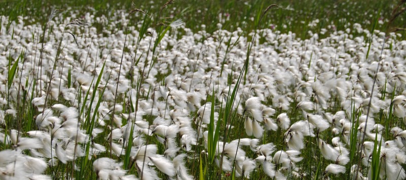
Kloosterhaar – Levend hoogveen
Length: 4.54 KM
De wandeling gaat over vlonders en door de Engbertsdijksvenen. Eén van de weinige plaatsen in Nederland waar nog levend hoogveen te vinden is. Levend, niet om wat er in en op de veenlaag gebeurt, maar omdat het veen nog steeds aangroeit. Daarvoor is een constante, hoge waterstand nodig. Vier zandkaden die om het gebied heen gelegd zijn, houden het water vast. Tot groot genoegen van dankbare salamanders en hagedissen! Kijk overigens niet raar op als u slangen ziet kronkelen. Ze zijn schuw, maar stamp voor de zekerheid flink met uw voeten voordat u gaat zitten. Horeca onderweg: – Geen Tip: Trek geen sandalen of open schoenen aan, maar stevige schoenen of laarzen.
Route op mobiel ontvangen?
Vul hieronder uw e-mail in


Oud Avereest – Ogen en oren wijd open – 4Kids
Length: 7.12 KM
Kijk goed op je scherm en zorg dat je in de buurt van de rode lijn blijft. Als dat lukt kom je veilig weer terug in Avereest, waar de fiets of auto staat! Onderweg kom je langs oude moerasgronden waar je vroeger goed moest oppassen voor struikrovers. Nu hoef je gelukkig alleen maar te zorgen dat je geen natte voeten krijgt. Op de hei scharrelen graag reeën, op zoek naar voedsel. Doe heel stil, want als ze schrikken, sprinten ze er razendsnel van door. Over heuvels en langs heel oude vennetjes, ga je weer richting het bos. Haal eens diep adem en snuif de boslucht op? Ruik je het verschil met de heide of langs het water? Horeca onderweg: – Géén! Neem een knapzak met wat eten en drinken mee.
Route op mobiel ontvangen?
Vul hieronder uw e-mail in
Ommerschans – t Vergeten verleden
Length: 9.64 KM
Lieflijke laantjes, groene velden en prachtige vergezichten. Wandelen in en om Ommerschans is geen straf. Dat was ooit wel anders. Rond 1819 werd hier op deze plek een dwangkolonie gesticht. Het doel? Het heropvoeden van bedelaars en landlopers. Onder erbarmelijke omstandigheden werkten en woonden zij hier in een afgesloten complex. Het gebouw is verdwenen, maar de herinnering blijft. Dankzij de Stichting Participatie Ommerschans die de roerige geschiedenis weer zichtbaar maken in het landschap. Horeca onderweg: – Iets van de route af, maar een ommetje waard: de zoete taartjes van bakker Schutte aan de Meppelerweg. Tips! Er zijn 4 ‘Pauperpadroutes’: 1. Veenhuizen: dwangkolonie (Drenthe) 2. Frederiksoord- Wilhelminaoord: ‘vrije’ kolonies (Drenthe en Overijssel) 3. Ommerschans: dwangkolonie (Overijssel) 4. Merksplas (B): dwangkolonie De routes zijn een initiatief van het Recreatieschap Drenthe en worden ondersteund door Rijksdienst voor Cultureel Erfgoed. Naast deze routes is er ook een Pauperpad-arrangement beschikbaar. Kijk op www.pauperpad.nl voor alle informatie. Met dank aan: De Historische Vereniging Avereest, Vereniging de Ommerschans en wandelgids Tineke Poortman hebben de foto’s beschikbaar gesteld (deze mogen niet zonder toestemming worden vermenigvuldigd).
Route op mobiel ontvangen?
Vul hieronder uw e-mail in


IJhorst – Heksen en hazen in de hoofdrol
Length: 7.32 KM
Ontoegankelijke veengronden en zompige moerasbossen met een sterk zuigende werking. De monniken van klooster Dickninge moeten het als roeping gevoeld hebben om het te ontginnen. Is die middeleeuwse energie nog steeds voelbaar? Of spelen er andere krachten? Dit oeroude beekdal zit vol geheimzinnige plekken en verhalen. Met in de hoofdrol: heksen, spookhazen, witte wieven en moordende vagebonden. Horeca onderweg: – Halverwege in Halfweg: het Vergulde Ros, authentiek. Met Smyrnakleden op tafel. www.vergulderos.nl
Route op mobiel ontvangen?
Vul hieronder uw e-mail in


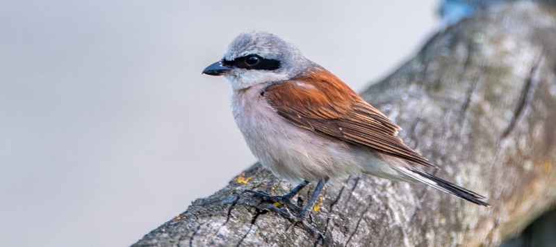
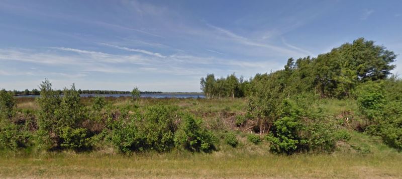
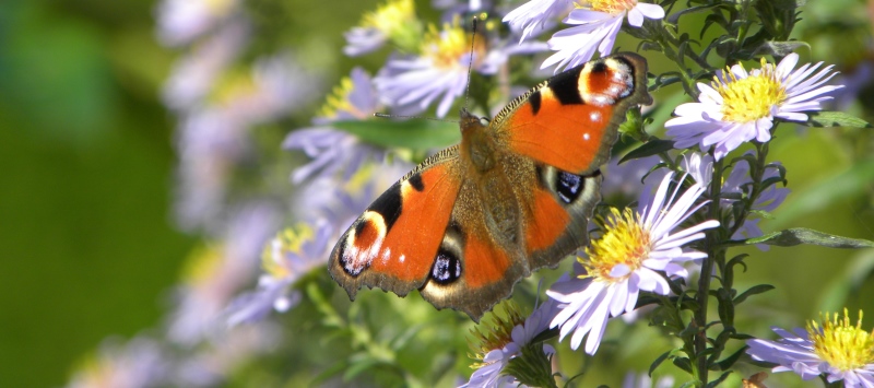
Zwartemeer – Op zoek naar Zorro
Length: 3.81 KM
De klauwier; een prachtige, maar helaas zeldzame vogel die, net als Zorro, gemaskerd door het leven gaat. Hier, in het Bargerveen, heeft deze zangvogel het prima naar zijn zin. Dit grootste hoogveengebied van Nederland herbergt namelijk ontelbaar veel insecten. Minder leuk voor u als wandelaar, maar de klauwier is er dol op. RoutAbel leidt u langs de plekken waar u de grootste kans heeft om hem te spotten. Dus laarzen aan, anti-muggenmiddel mee en ga verend over het hoogveen op zoek naar Zorro. Horeca onderweg: geen Honden zijn toegestaan mits aangelijnd. Tip: Van half mei tot half augustus verblijft de grauwe klauwier in dit gebied. De route is samen met Vogelbescherming Nederland, SOVON vogelonderzoek Nederland, Staatsbosbeheer, Bettie Wiegmanfonds en Stichting Bargerveen ontwikkeld. Vogelbescherming Nederland heeft de unieke beeld- en geluidsfragmenten aangeleverd.
Route op mobiel ontvangen?
Vul hieronder uw e-mail in


Zwartemeer – Dagje Wetlands
Length: 9.78 KM
Wetlands klinkt als een festival, maar dat is het niet. Tenminste niet voor muziekliefhebbers. Dit waterrijke gebied, stampvol insecten, trekt jaarlijks eindeloos veel vogels aan. Waaronder ook wel erg vreemde vogels. Ziet u bijvoorbeeld een hagedisje of salamander gespietst op een doorn of prikkeldraad? Dan is de klauwier, want daar gaat het over, weer aan het ‘barbecueën’. Horeca onderweg: geen Honden zijn toegestaan mits aangelijnd. Tip: Van half mei tot half augustus verblijft de grauwe klauwier in dit gebied. De route is samen met Vogelbescherming Nederland, SOVON vogelonderzoek Nederland, Staatsbosbeheer, Bettie Wiegmanfonds en Stichting Bargerveen ontwikkeld. Vogelbescherming Nederland heeft de unieke beeld- en geluidsfragmenten aangeleverd.
Route op mobiel ontvangen?
Vul hieronder uw e-mail in


Dwingeloo – Ongestoord genieten
Length: 13.15 KM
U kunt niet alleen eindeloos maar ook ongestoord genieten. Telefoonproviders hebben hier geen bereik door de aanwezigheid van de radiotelescoop. U heeft het niet nodig, want de route is helemaal off-line. De natuur blijft boeien en verbazen door de hoogteverschillen. En de afwisseling tussen natte heidevelden en droge zandgronden is uniek. Dat is mooi, zeker voor de variëteit van de dieren die er leven, maar trek wel stevige schoenen aan, want het kan soms nat zijn. Horeca onderweg: – Theehuis Anserdennen: Heerlijke vers gebakken taart. – Voor picknickliefhebbers: Op circa driekwart van de route komt u een mooi plekje tegen. Tip voor vogelliefhebbers: Neem een verrekijker mee om de vogels bij de Davidsplassen vanuit de kijkhut te bewonderen.
Route op mobiel ontvangen?
Vul hieronder uw e-mail in


Lemele – Lemelerberg
Length: 3.64 KM
Een stuwwal van zestig meter hoog, dat is de Lemelerberg! Tijdens het ontstaan, in de laatste ijstijd, zag dat er uit als een woeste massa ijs, steen en grind. Loofbomen, zandverstuivingen en heide vormen tegenwoordig het decor van deze prachtig glooiende wandeling. In elk jaargetijde is deze korte wandeling perfect om er even kort maar krachtig helemaal uit te zijn.
Route op mobiel ontvangen?
Vul hieronder uw e-mail in