
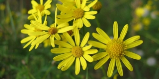
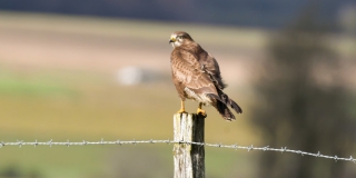
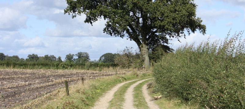
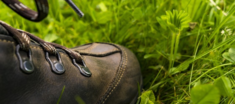
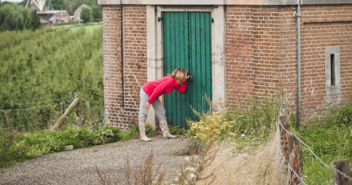
Texts, long or short, smooth or businesslike; Ingrid writes them. No problem. She is also a visual thinker, visualises quickly and is creative. This comes in handy when creating content for the app, promotional cards, books, websites and what not. Is one of the few to water the plants in the office, caring as she is. Often goes out with a camera and shoots the most beautiful pictures. Which in their turn come in handy for AbelLeisure!
Author Archives: Fred
Wil Sistermans
The man behind the scenes. Or should we say ‘behind the screen’? He sees a lot of data go by… He develops the back-end of our AbelLife Route App and sets up dashboards for reading data from sensors. The world of Intelligent Public Space Management provides plenty of new challenges for this technical man.

Geert Weijers
As a project manager, he likes to keep an overview. And if adjustments need to be made, no problem. This native of Twente with a background in tourism and events likes to look for possibilities and solutions. Ensuring that a project can be completed above expectations; that makes him happy. As an ‘outdoorsman’, Geert often goes into the woods with the dog and pedals away for miles on his mountain bike. He also loves music, good films and motorcycling.
Janine Drabbe
Ever since AbelLeisure started, this behind-the-scenes organiser has been busy with the company. She makes sure all loose ends are tied up. And, not unimportantly, she gets rid of what Jeroen (her better half) leaves behind. Now keeping the financial records in order, she is also visible in front of the scenes. To relax, she likes to get on her cycling bike and is regularly on the tennis court. A sporty lady, in other words.
Michel Ruiterkamp
Michel is our technical man. Born and raised in Gelselaar, this local energetically sets to work. In the workshop, he ensures thorough preparation. Once in the field, he immediately sees how the product blends into its surroundings. This is how he makes ‘outside’ more beautiful. Michel cannot live without music. In his spare time, he plays guitar with his band, where he is also good at singing, and he enjoys going to concerts.
Lenny Bulthuis
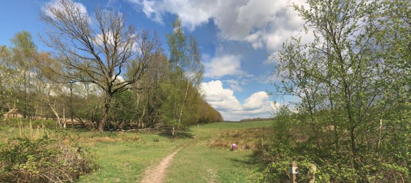
Working from Groningen, Lenny is working on the project ‘In het spoor van De Ploeg’. As a child of the Groninger Hogeland, the landscape, culture and heritage are very dear to her. She also has a great love of the arts and feels a great connection with the artists of the Groninger art group De Ploeg.
All this knowledge comes in handy in her work, such as shaping the project concept and bringing entrepreneurs and institutions together.
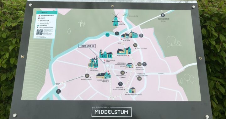
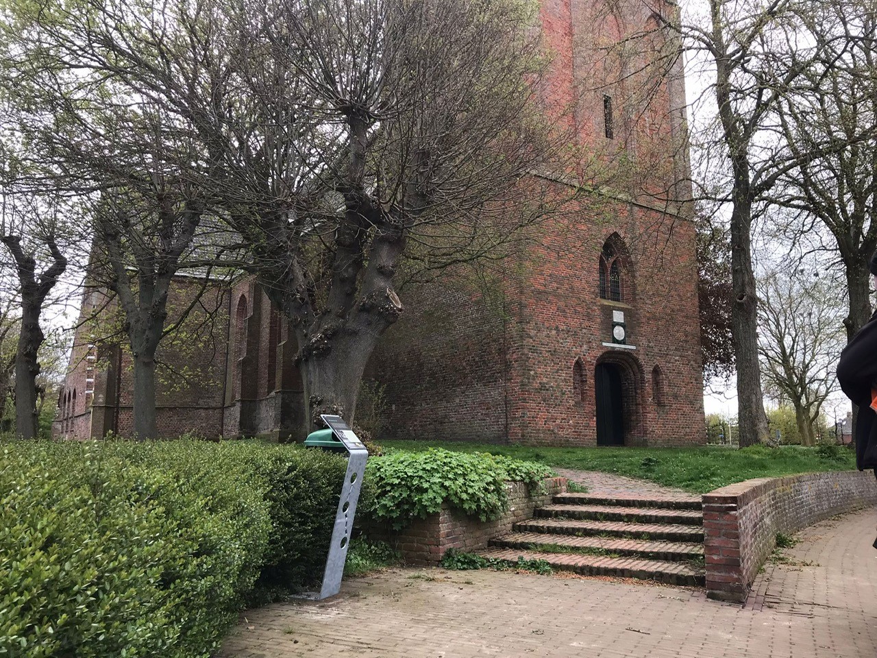
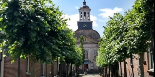
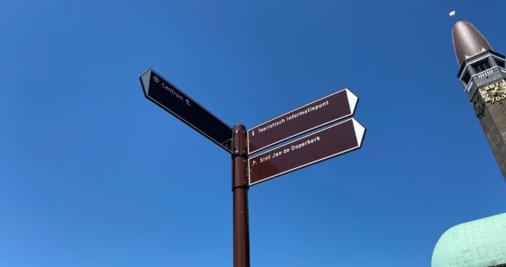
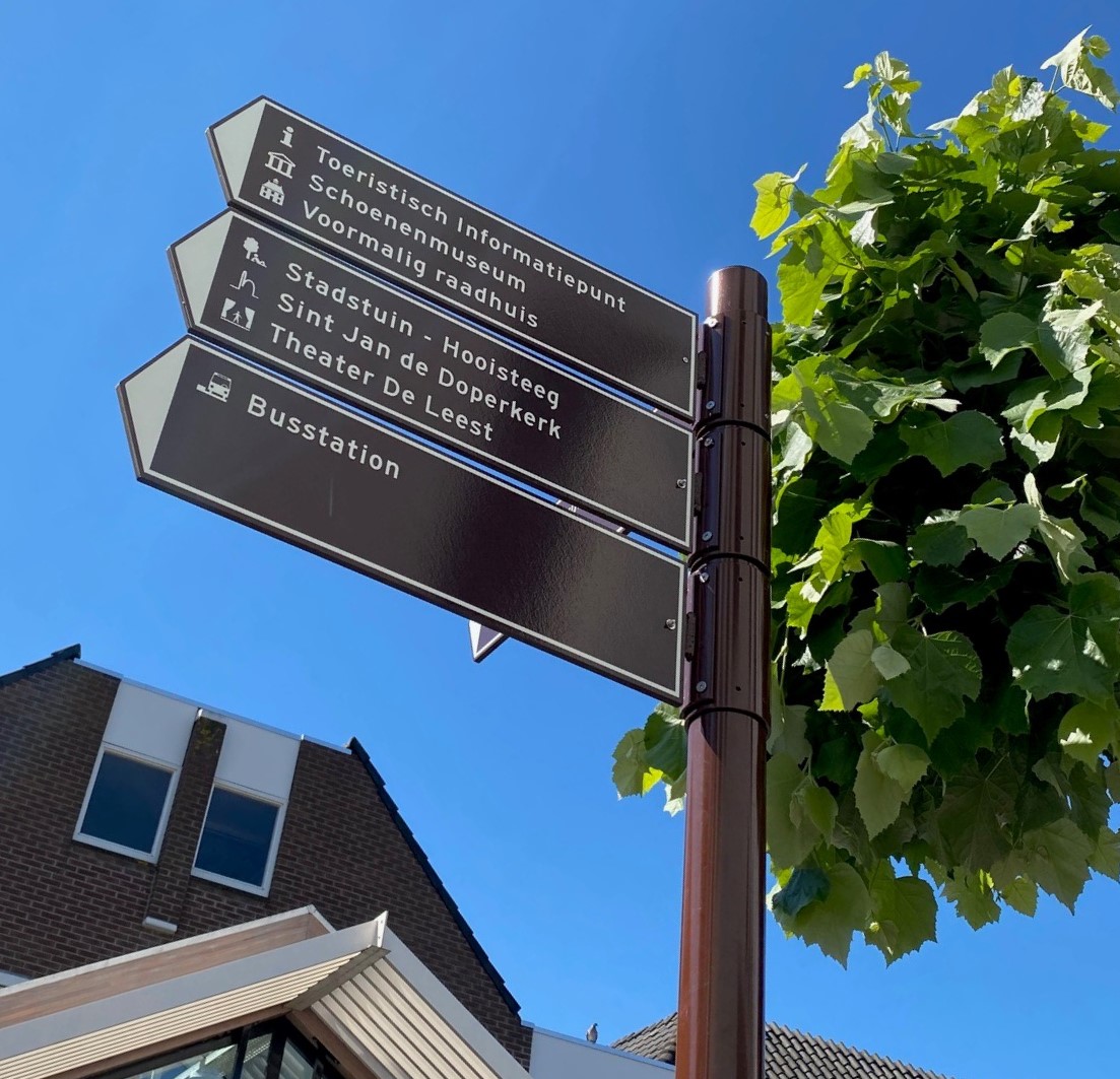
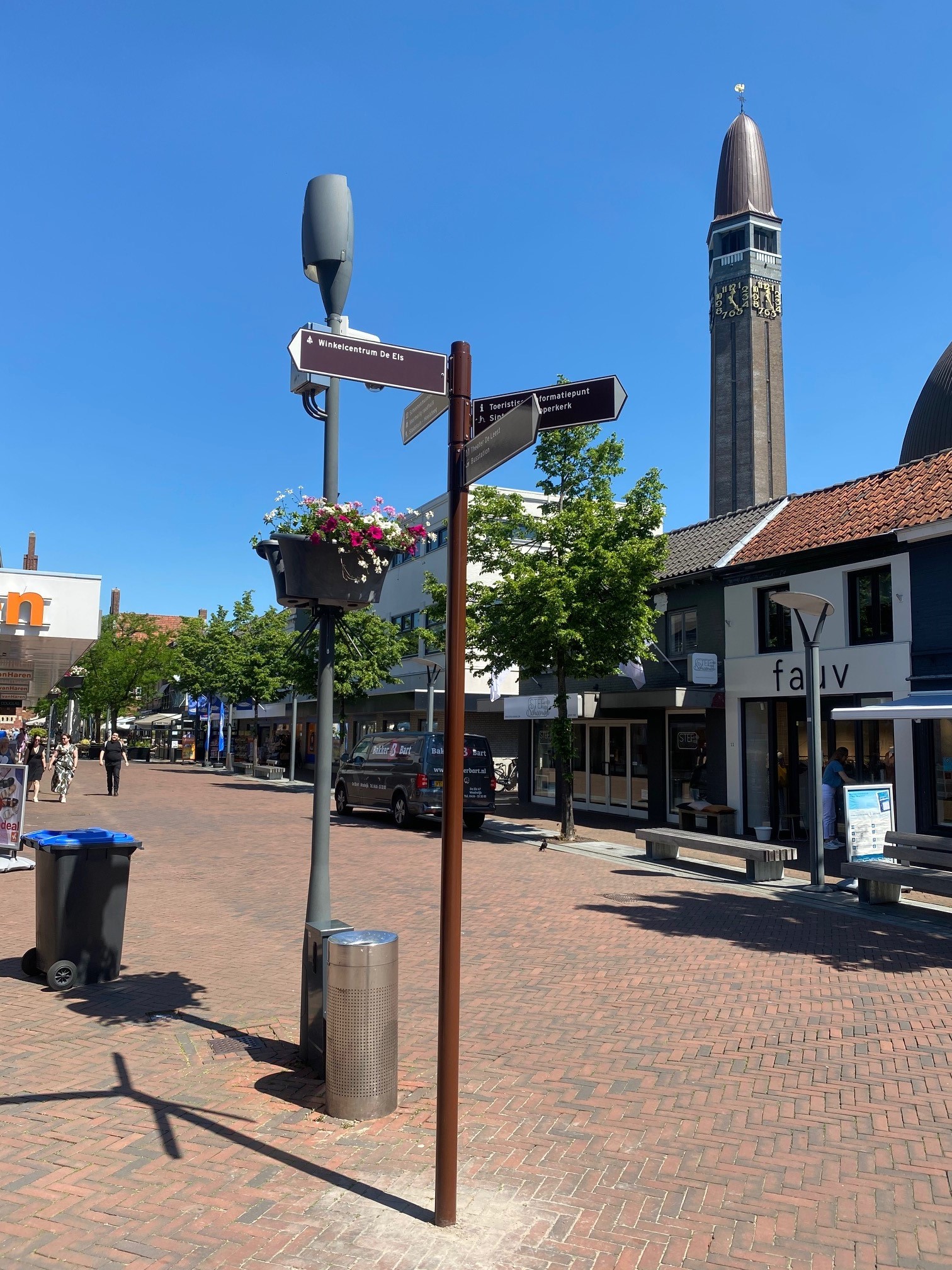
Information panels Middelstum
Assignment
Producing and installing a 3D information panel in the centre of Middelstum, producing and installing seven smaller information panels giving more info on the history of the village and signposting a walking tour.
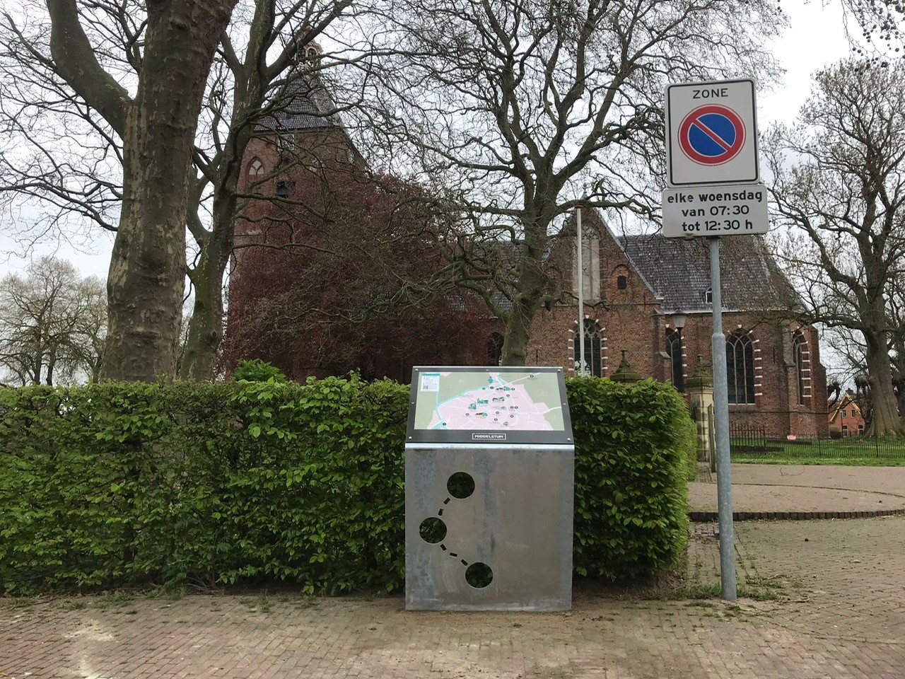
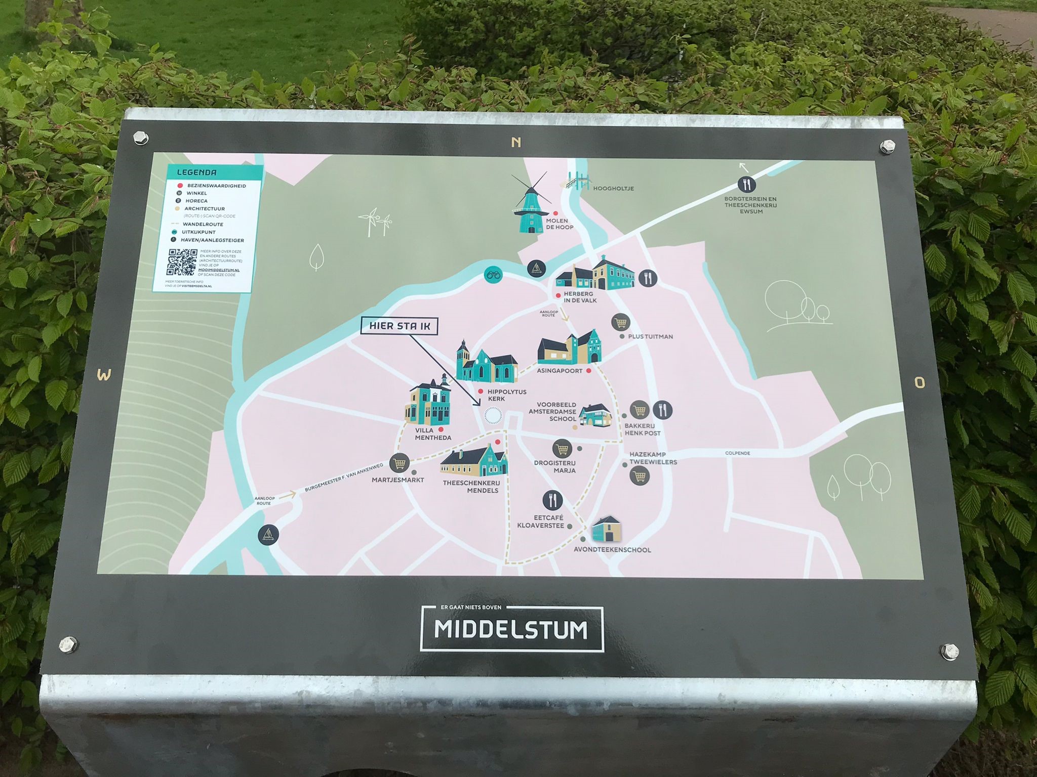
Created
A large information panel (900×600 mm) produced from BioPanel placed on a corten steel frame. The panel features a map of Middelstum, indicating the various historical places and the walking route. This panel is located near the church, in the middle of the village.
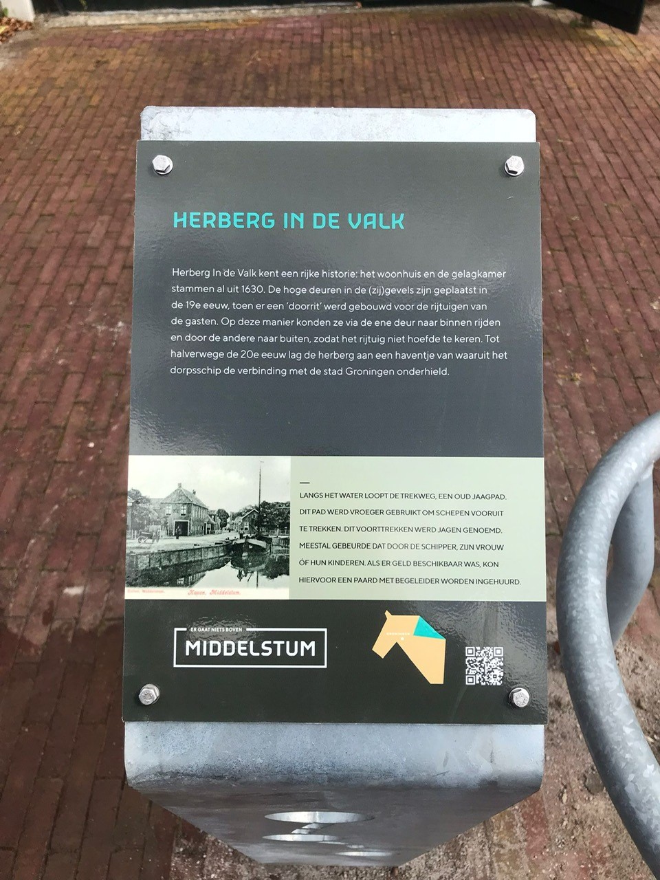
In addition, seven smaller information panels (A4) were made, with information about the respective building or historical site. These panels have also been placed on corten steel frames.
One of the panels was funded by the project In het Spoor van De Ploeg and provides info on the Evening Drawing School in Middelstum, where Ploeg painter Jan Altink used to teach.
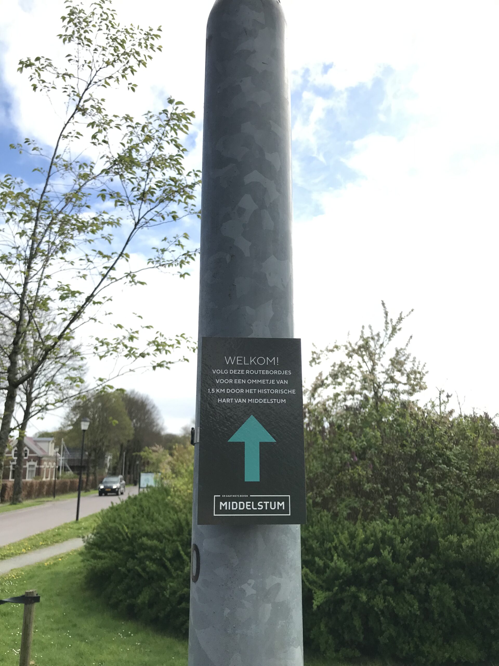
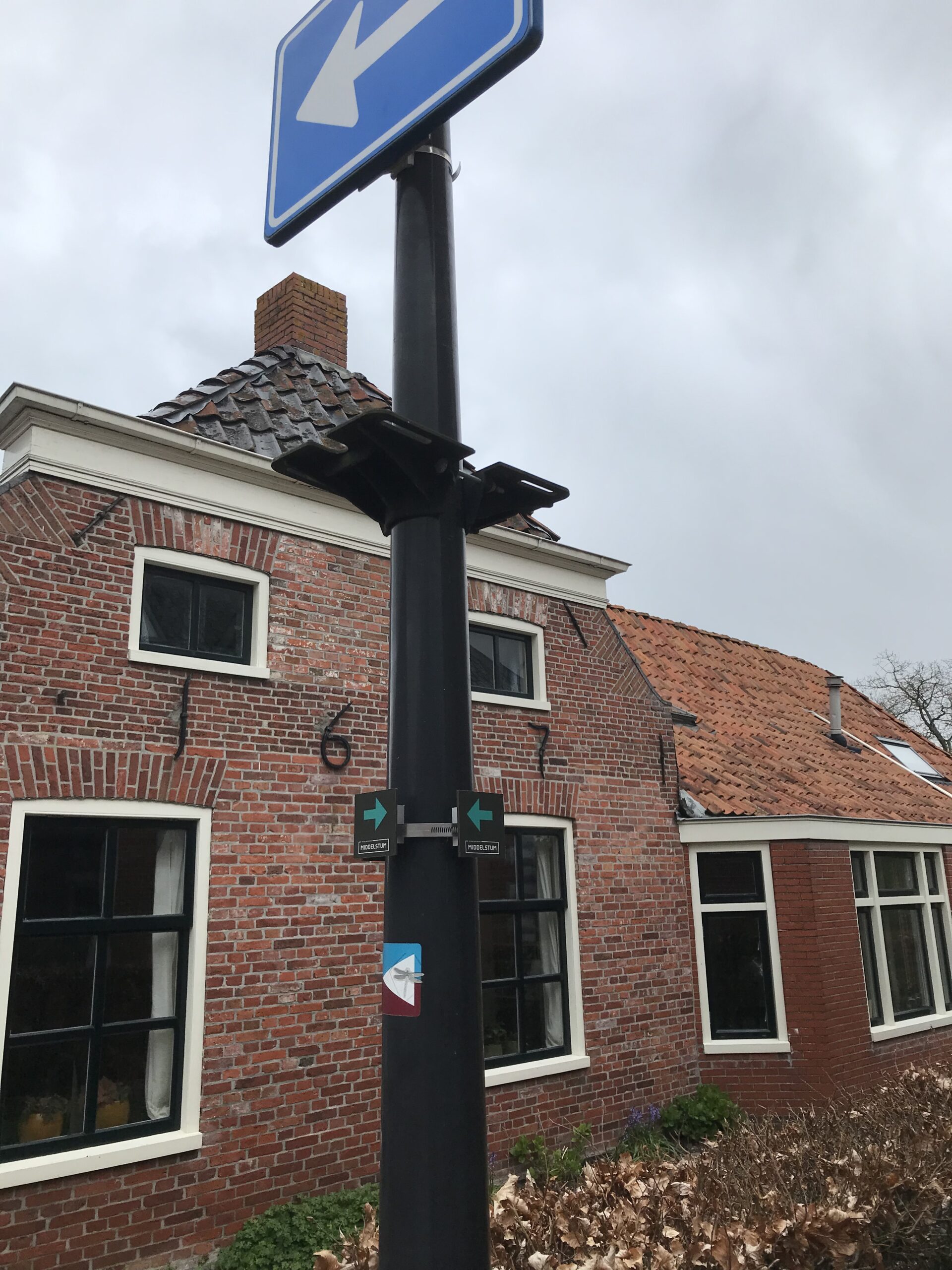
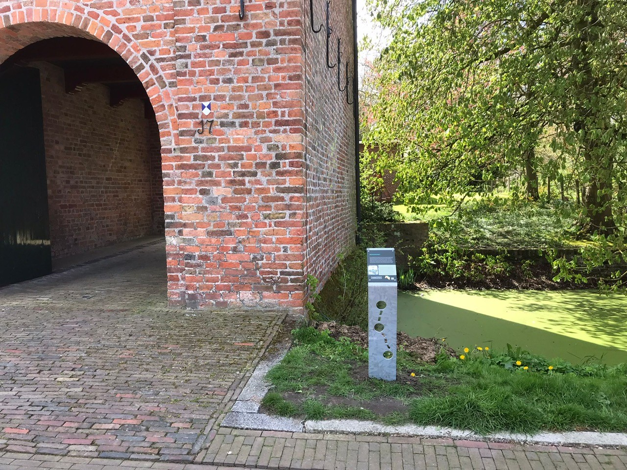
The footpath is marked by small signs with route arrows. In the neighbourhood of the two local jetties/harbours, signs have been mounted drawing the attention of passers-by to this walking route. The route is signposted both left and right.
The design is in line with the brand style of Marketing Groningen and Marketing Eems Delta.
Customer
Municipality of Eemsdelta and Trade Association Middelstum
Limburg Trail
Many tourists associate Limburg with the Heuvelland region. But Limburg is more than that: the National Parks Maasduinen, the Meinweg, the Groote Peel and the intermediate areas such as the Leudal or the various stream valleys South Limburg have great, tourist potential. Now they are still ‘stand-alone’ areas, while walking between these landscapes is also beautiful. The natural beauty in Limburg does not stop at the border of a landscape!
In this project, we will connect the three National Parks and the South Limburg National Landscape and tell the story of the landscape.
We do this by connecting existing walking routes and junction networks throughout Limburg and combining them with regional dishes and special overnight accommodation. We explicitly involve entrepreneurs in the realisation and open up the Limburg Trail via existing junctions and the RoutAbel app.
We do all this sustainably and with a focus on continuity. Once the Limburg Trail has been developed (and the development project thus ended), that’s when it all begins. The project results, including a revenue model, will be transferred to a local foundation that will continue to do maintenance and promotion from the proceeds of the Limburg Trail, thus ensuring continuity. Our goal is for this to become a current, successful trail with history.
We do this by working with route agencies, volunteers and entrepreneurs to set out the Limburg Trail as a continuous, multi-day walking route from northern to southern Limburg and vice versa. The Limburg Trail thus meanders from Mook to Eijsden over the most beautiful hiking routes in Limburg.
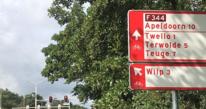
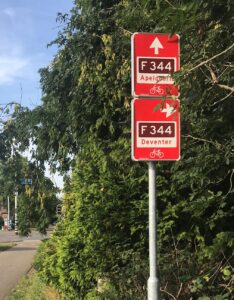
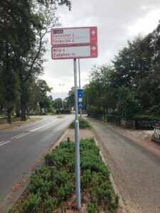
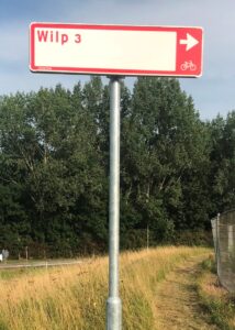
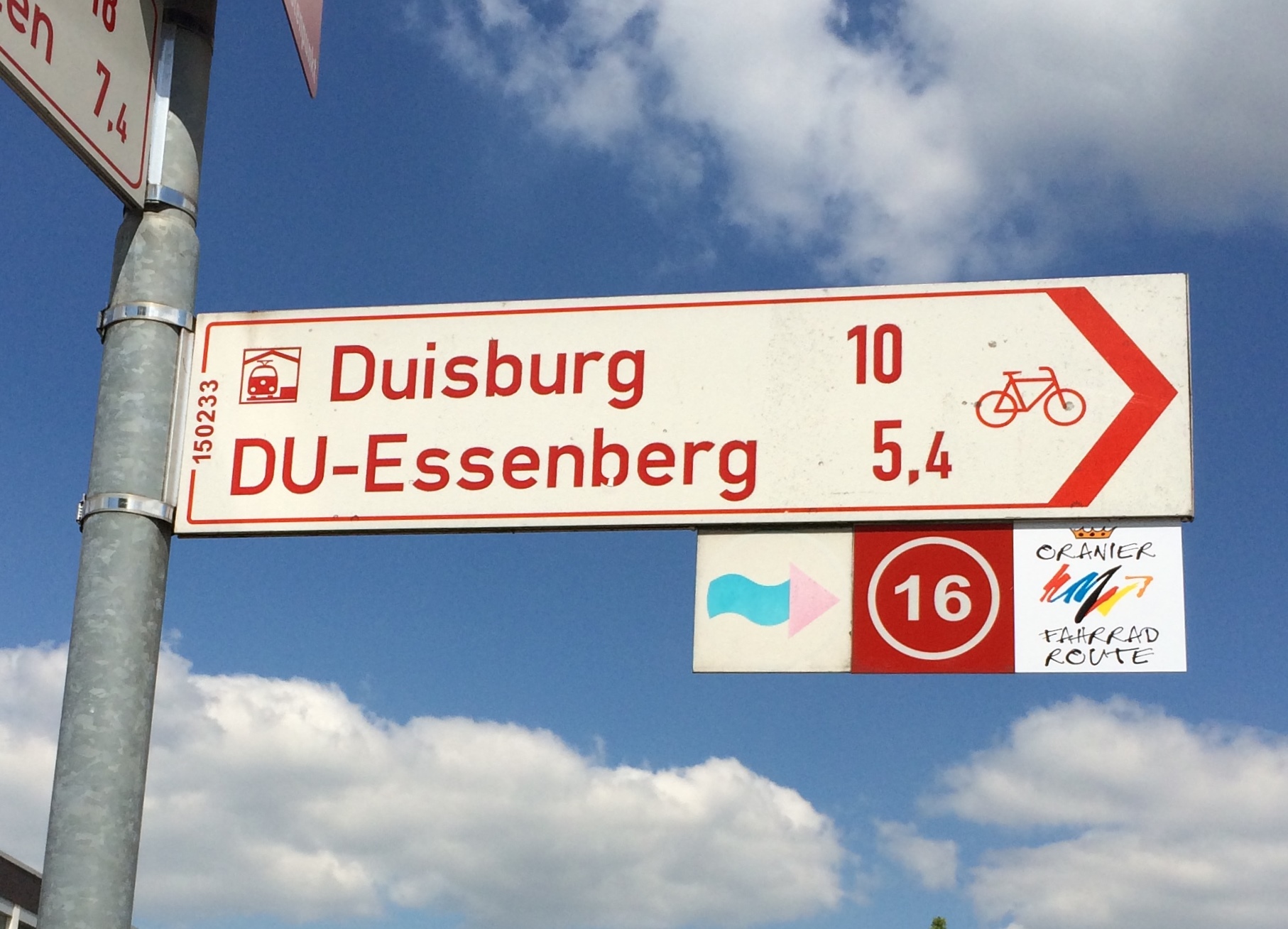
Signposting express bicycle route F344
Assignment
Sustainably signposting the F344; a new express cycle route between Apeldoorn and Deventer. These cities are part of the Cleantech Region, which aims to become the most sustainable region in the Netherlands.
Pictures: AbelLeisure
Picture: Witteveen+Bos
Created
We have produced and supplied 370 BioPanel signs, both bicycle signposts and DOR signs. Our BioPanel is made from renewable raw materials, is circular and has minimal C02 emissions. Thanks to this sustainable signage, NBD has reduced as much as 3072 kg of CO2 compared to its aluminium variants.
Read more at: www.cleantechregio.nl
Customer
Cleantech Region and NBD (National Signposting Service)
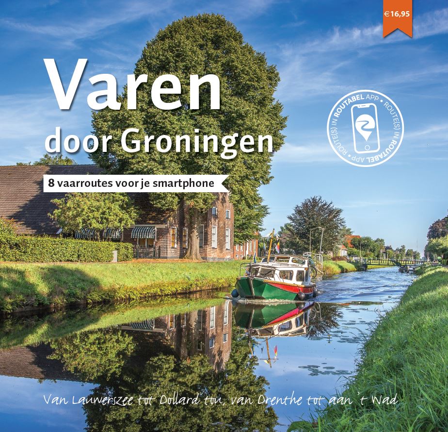
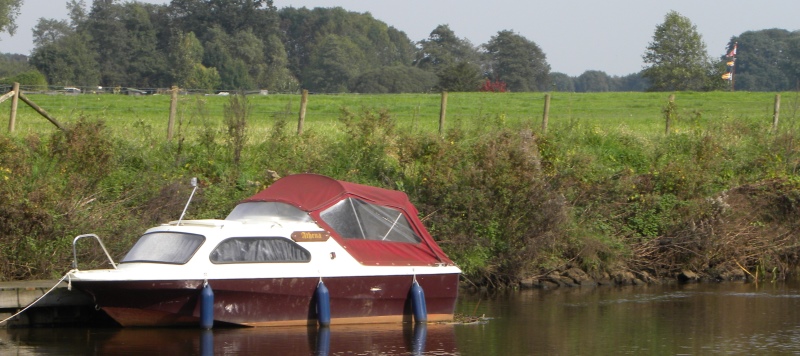
Sailing through Groningen
Assignment
HISWA Association and 12 enthusiastic water sports entrepreneurs have joined forces to put the province of Groningen on the map as a boating destination. For a day’s sailing on one of the lakes or a multi-day trip through this versatile province. AbelLeisure was asked to develop eight digital sailing routes, a book and information panels so that (even) more people will discover Groningen from the water.
Created
Boating book & digital routes
AbelLeisure has developed eight multi-day boating routes, attractively presented in a photo-rich book. For each route, you will also find a number of tips for exploring Groningen further on foot or by bike. This will make your stay in Groningen even more fun! The routes are linked to the unique themes of Marketing Groningen, each of which tells you its own story about the special nature, culture and history:
• Wadden Sea World Heritage Site
• Battle against the water
• Peat colonies
• Borderland, Fortress Land
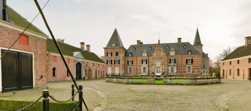
• Borgen, the castles of Groningen
• Grain Republic
• Hanseatic League & trade
All eight boating routes are available in the RoutAbel app, which navigates you and tells you special stories along the way. Stories about centuries-old fortified towns, the peat colonies or the battle against the water. And you get tips: where to moor, which bridge to operate yourself and where is the nicest terrace? You can download the RoutAbel app for free in the Apple or Google appstores.
Information panels
In addition, 11 information panels have been developed from BioPanel, a bio-based plastic composed of renewable, plant-based raw materials. These panels show a sailing route that can be started from the respective marina. They have been placed at participating marinas.
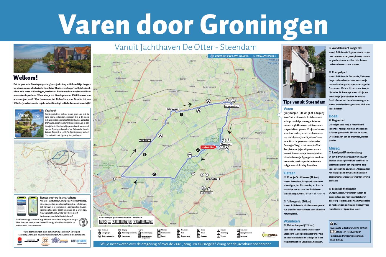
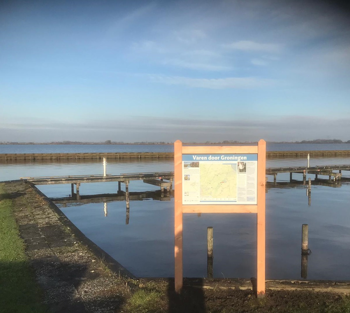
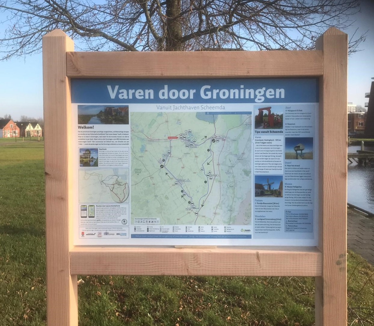
Opdrachtgever
Sailing through Groningen is a collaboration between HISWA Association, Marketing Groningen, Routebureau Groningen, AbelLeisure and eleven marinas. Made possible partly thanks to a contribution from the Province of Groningen.
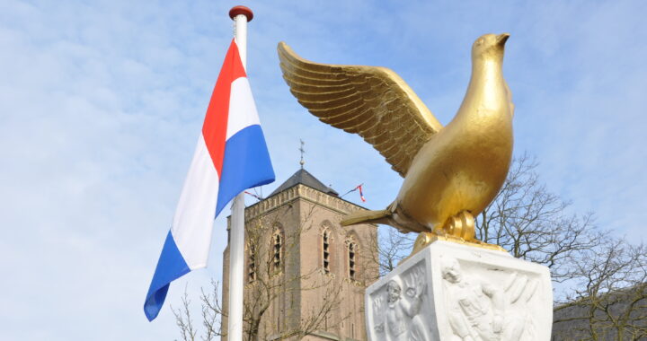
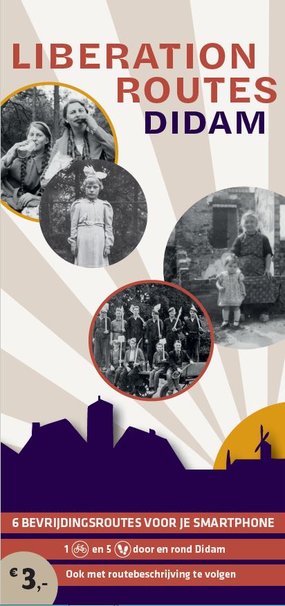
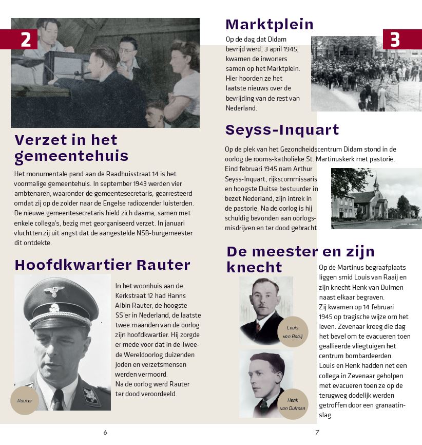
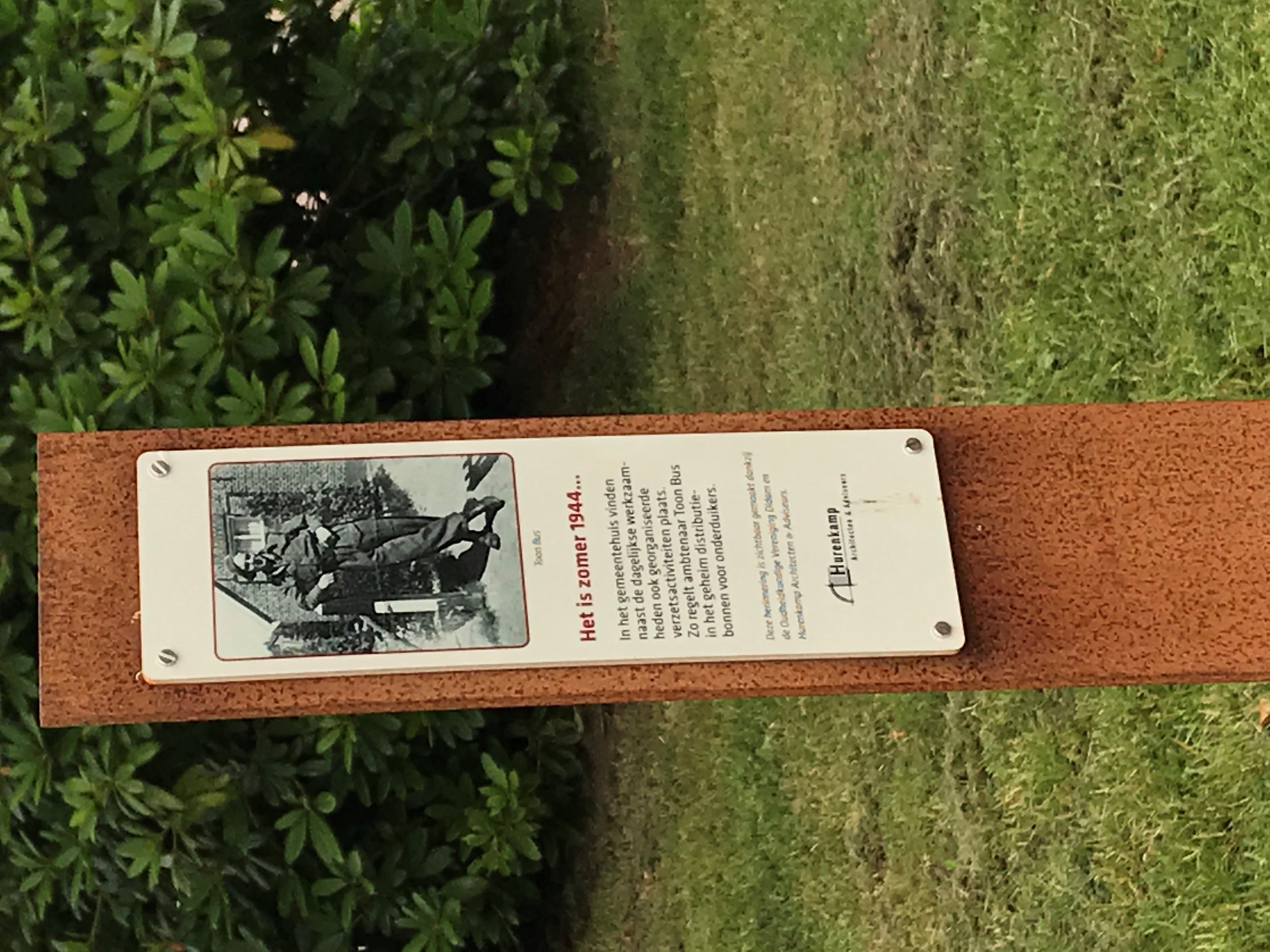
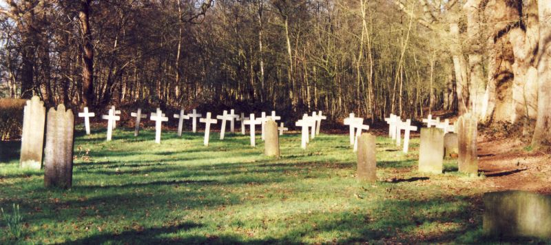
Didam Liberation routes: memorial posts, route booklet and digital routes
Assignment
Developing digital Liberation routes in and around Didam, memorial poles and a route booklet so that local stories about the war and liberation are captured.
Created
– Six digital routes (5 walking/1 cycling) in our RoutAbel app with stories, photos and videos about the war time in Didam.
– Eighteen corten steel memorial poles. These are placed along the routes, so you experience the stories about the war and about the liberation at the place where they actually took place.
– Colourful route booklet with brief info and two inserts with a walking and a cycling route. In addition to the digital version, the other routes can also be downloaded via a QR code.
Together, these three products narrate the far-reaching events that took place in and around Didam in the period 1940-1945.
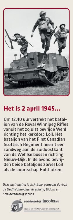
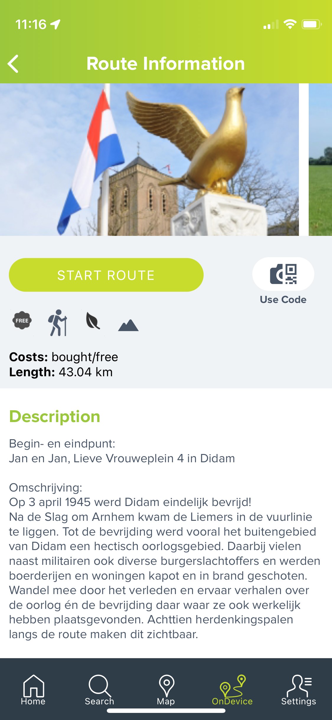
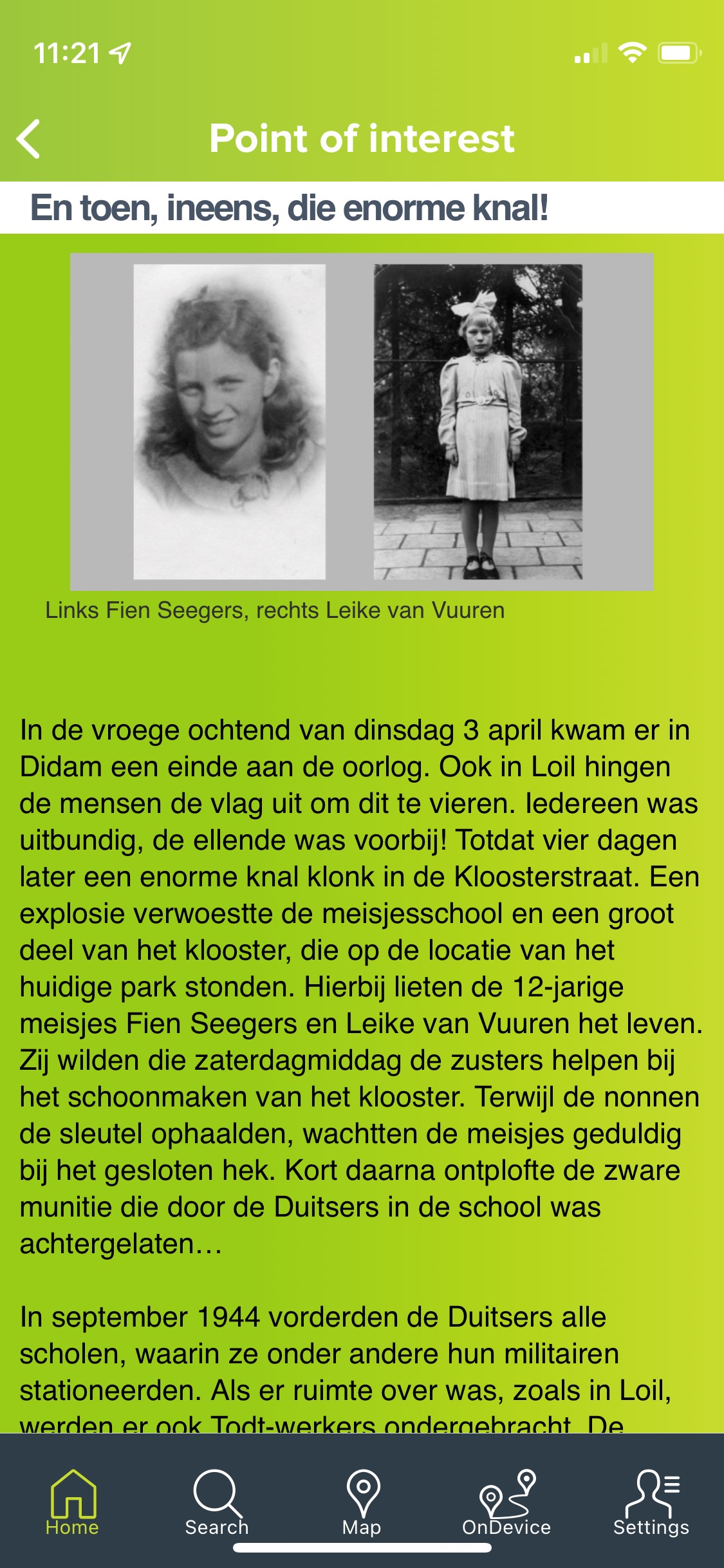
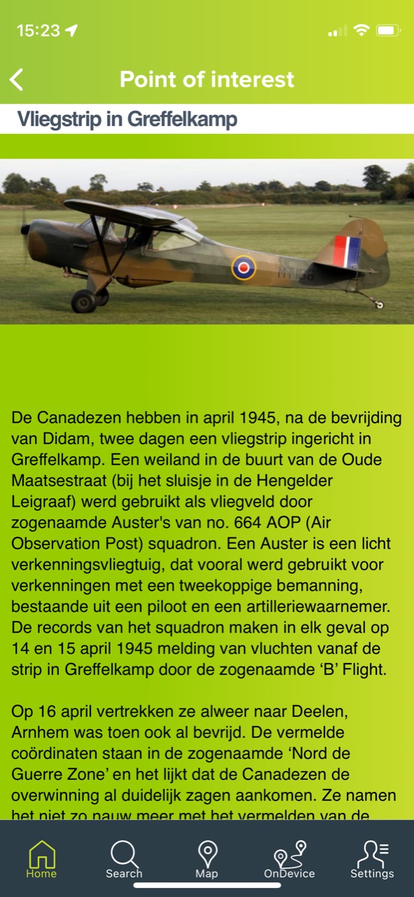
Customer
Archaeological Society Didam
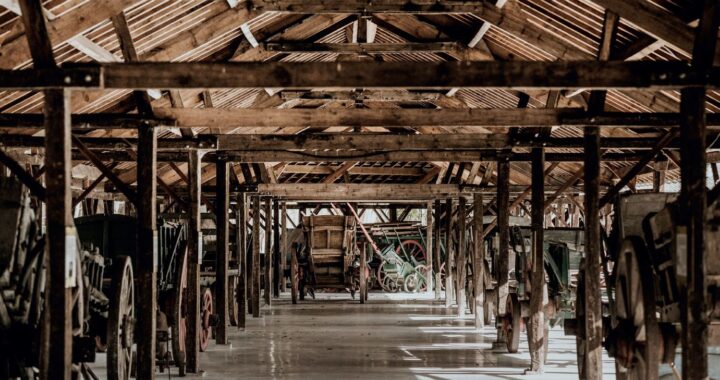
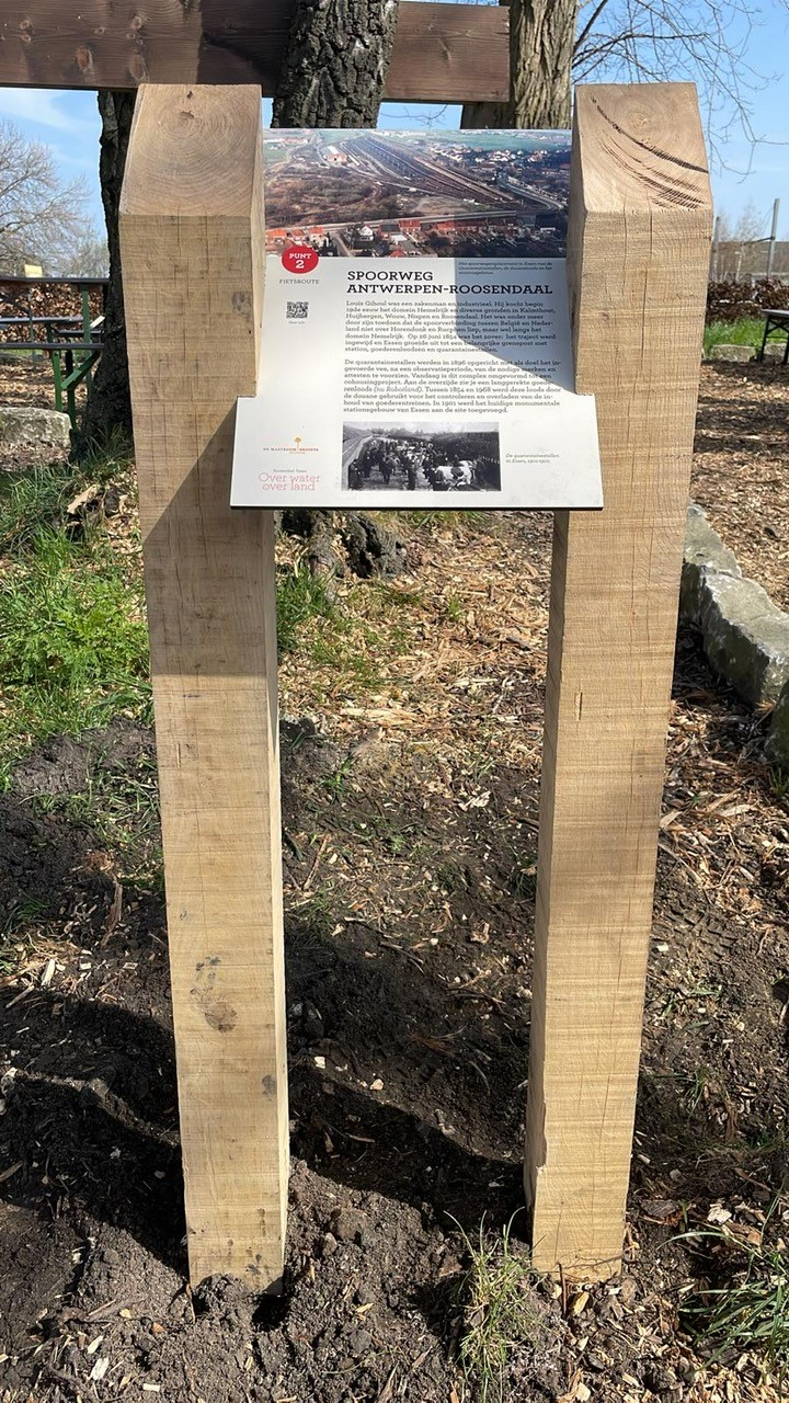
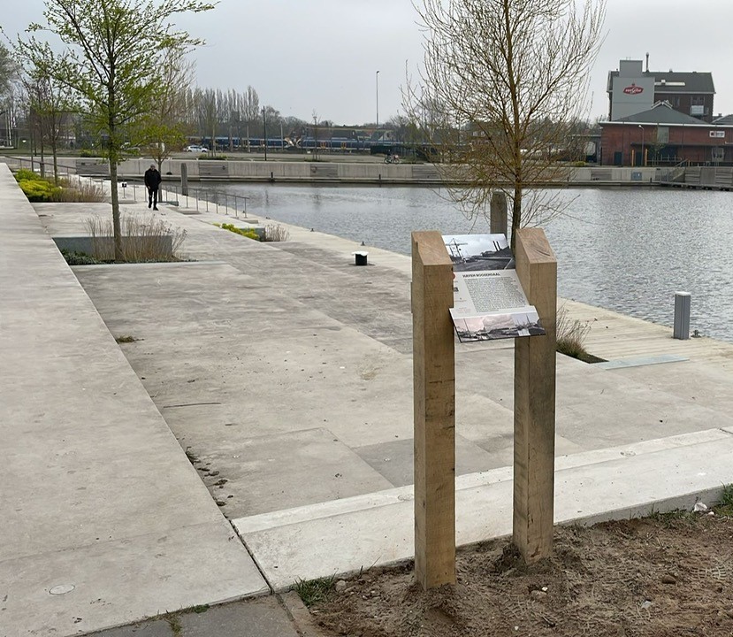
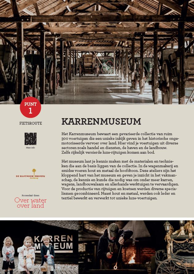
Lecterns exhibition ‘Over water, over land’ in Roosendaal and Essen (B)
Assignment
Realising and placing eight lecterns on the route of the temporary duo exhibition ‘Over water, over land’ (on the theme of transport) in Roosendaal and the Belgian town of Essen, at points in the landscape that are relevant within this theme. The aim of this exhibition is to highlight the connections over water and land between the two places.
Created
Eight lecterns consisting of an oak frame between which a sustainable BioPanel (A3 size) is placed. The wood comes from a Dutch estate.
Customer
Museum Tongerlohuys in Roosendaal and the Cart Museum in Essen (B)
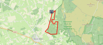
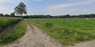
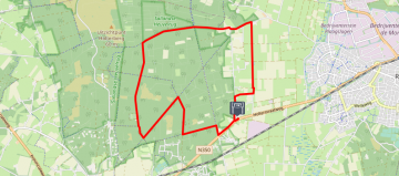
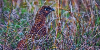
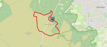
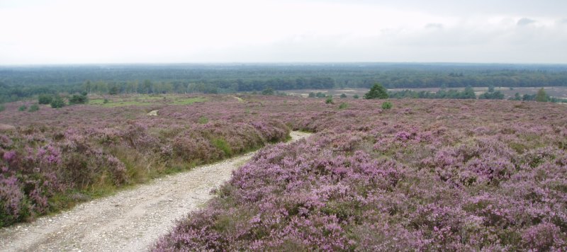
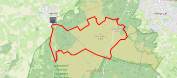
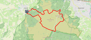
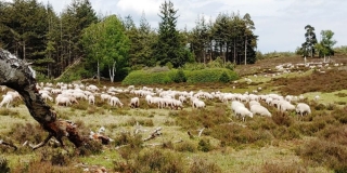
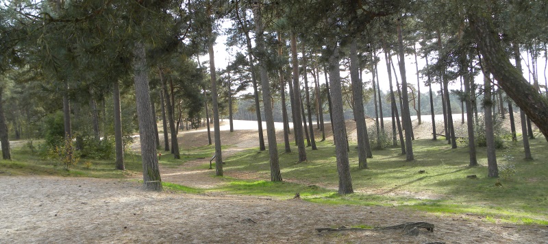
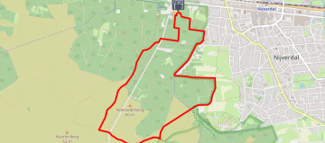
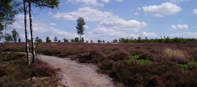
Tourist radar Sallandse Heuvelrug
Nature is precious to us, so precious that we love to recreate there. However, this should not be at the expense of that same nature. At the same time, we want to give every guest a fantastic time on the Sallandse Heuvelrug.
In this project, we use Robinson counting sensors to measure how busy it is in which place. We combine this with the day of the week, the weather forecast, holidays and events. Based on this and on guests’ wishes, we advise and tempt them to the trips (routes) where there is still enough space. And they can then immediately download those routes in their app. At the back end, there is a weighting that ensures that all places are recommended equally often.
Via a WordPress widget, entrepreneurs, visitor centres and tourist websites can in this way tempt their guests into a lovely day out without harming nature.
Customer
Gastvrij Overijssel & Nationaal Park de Sallandse Heuvelrug


Signposts in Waalwijk
Assignment
Providing sustainable, eco-friendly pedestrian signposts to be placed in the centre of Waalwijk.
Created
39 signposts, made of BioPanel, double-sided for flag mounting. By using BioPanel, the municipality of Waalwijk saves over 500 kg of CO2!
Customer
RBT De Langstraat in Waalwijk
The Spanish Road
Assignment
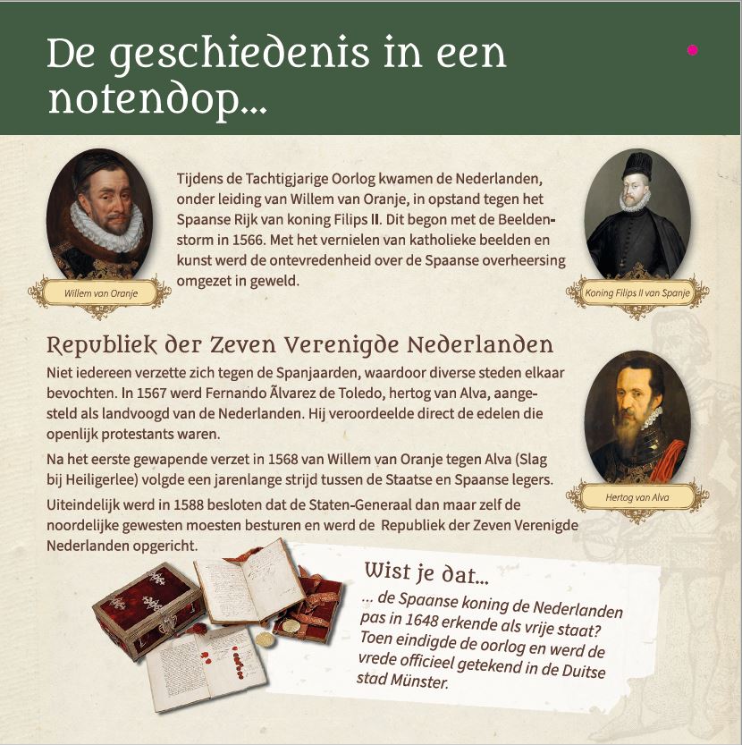
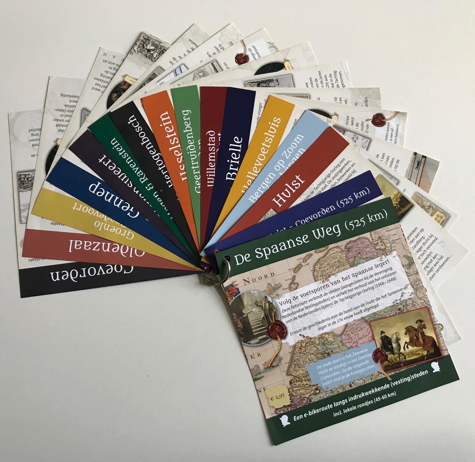
Developing a long-distance E-bike route with several local loops for 20 cities, some of which are united in the Association of Dutch Fortress Cities. The route connects the cities and tells the story of the origins of the Netherlands. This origin story is largely anchored in the Eighty Years’ War. This cultural route will be the start of broad European cooperation. A cooperation that should lead to the development of the ‘Spanish road’; a cultural, European route where people will experience European history on the basis of the route the Spanish army took through Europe in the 17th century. Cycling the Spanish road will be a journey where people will experience European identity in a new way.
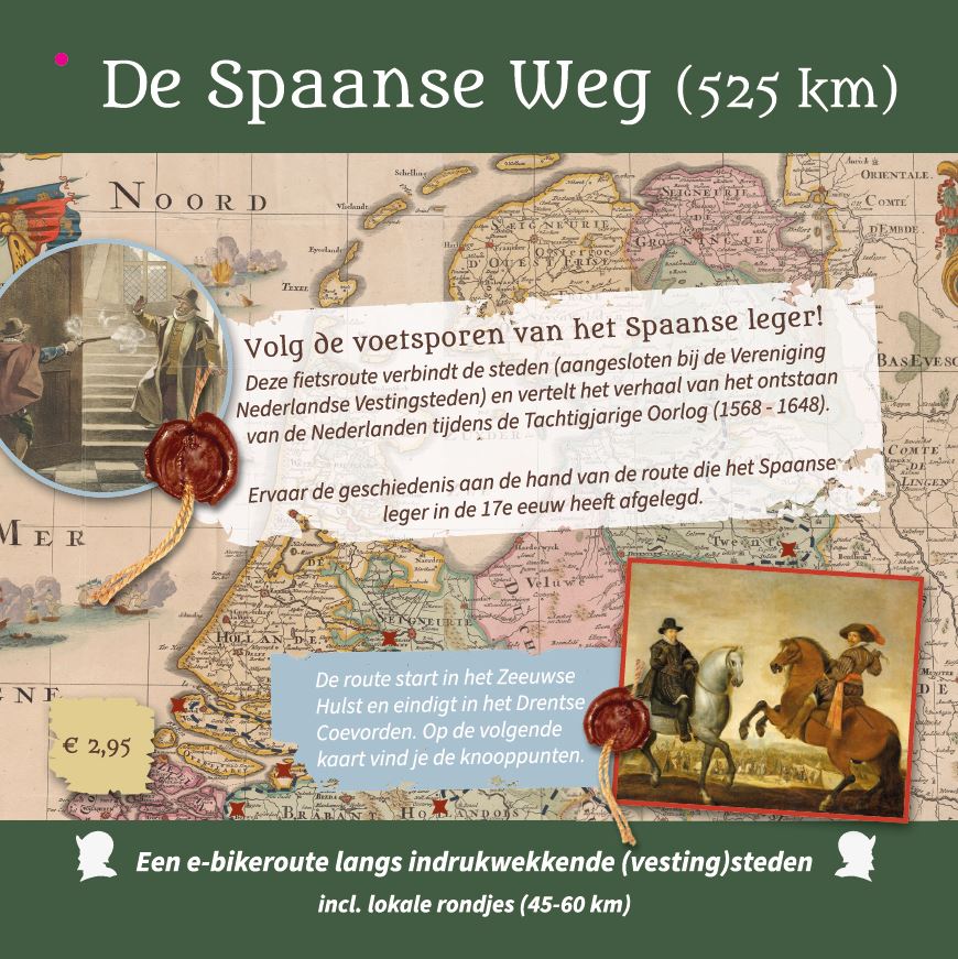
Gemaakt
We have created a route chart with loose sheets secured with a ring. The basis for the route and the historical stories are the 20 fortified towns. These towns lie along a ribbon of over 500 kilometres. For each city, an E-bike tour has been developed with start and finish in the city. These local tours have been combined into one long-distance E-Bike route from Hulst in Zeeland to Coevorden in Drenthe. Thus, one has the choice of cycling the Spanish Way in an arrangement form, staying overnight along the way in the participating cities, or on a stage-by-stage basis. The route fan is on sale for €2.95. In addition to these route fans, each town has received its own fan sheet to promote the Spanish Way.
Customer
The Spanish Road is an initiative of Bernou Wagenaar, policy officer for Tourism Municipality of East Gelre, in cooperation with the Association of Dutch Fortress Cities.
Participating cities:
– Hulst
– Bergen op Zoom
– Steenbergen
– Willemstad
– Klundert
– Brielle
– Hellevoetsluis
– Geertruidenberg
– Heusden
– IJsselstein
– ‘s-Hertogenbosch
– Megen
– Ravenstein
– Grave
– Stevensweert
– Gennep
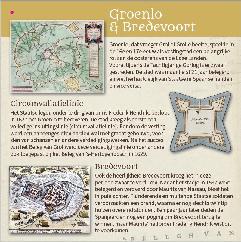
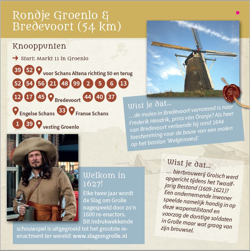
– Bredevoort
– Groenlo
– Oldenzaal
– Coevorden
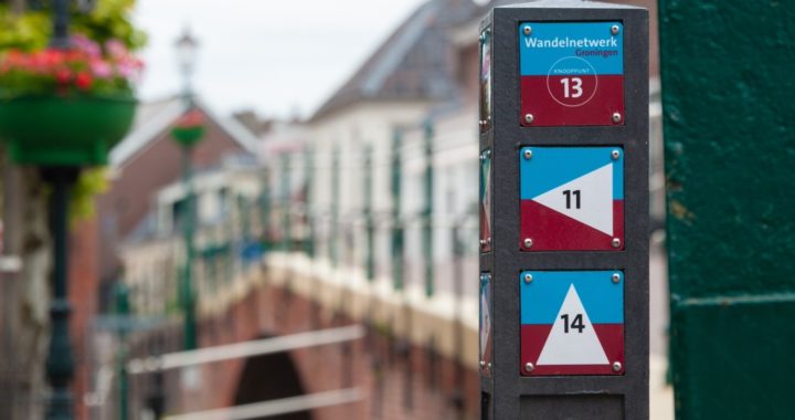
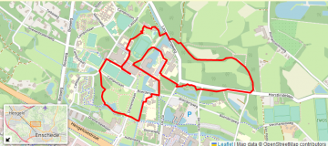
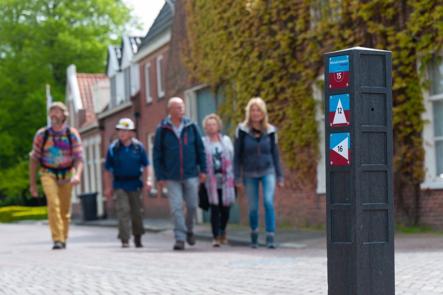
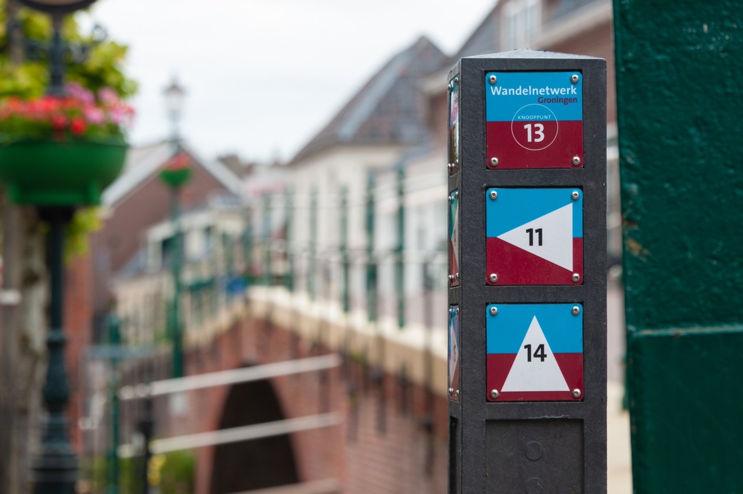
Walking network Groningen
Assignment
Routebureau Groningen has designed a walking route network through Groningen to make the province more attractive to walkers. This network will be signposted using junctions on recycled posts.
Gemaakt
The walking network throughout the entire province was implemented with route signs made of BioPanel, a bio-based plastic consisting of renewable, plant-based raw materials. We covered the entire project and produced and supplied BioPanel.
Customer
Route office Groningen and Folkersma Routing and Sign
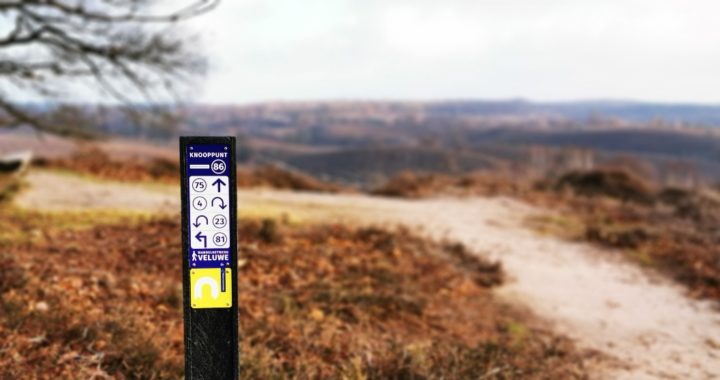
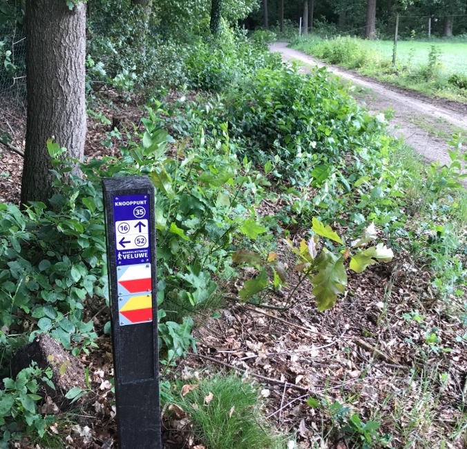
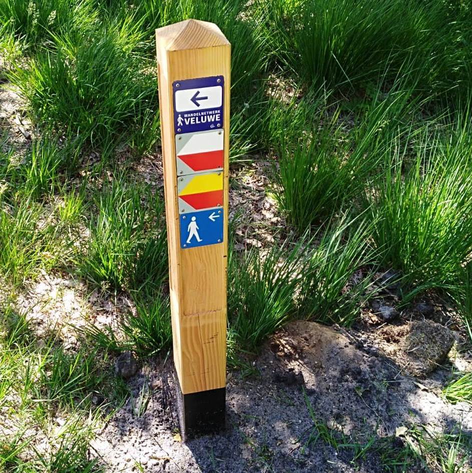
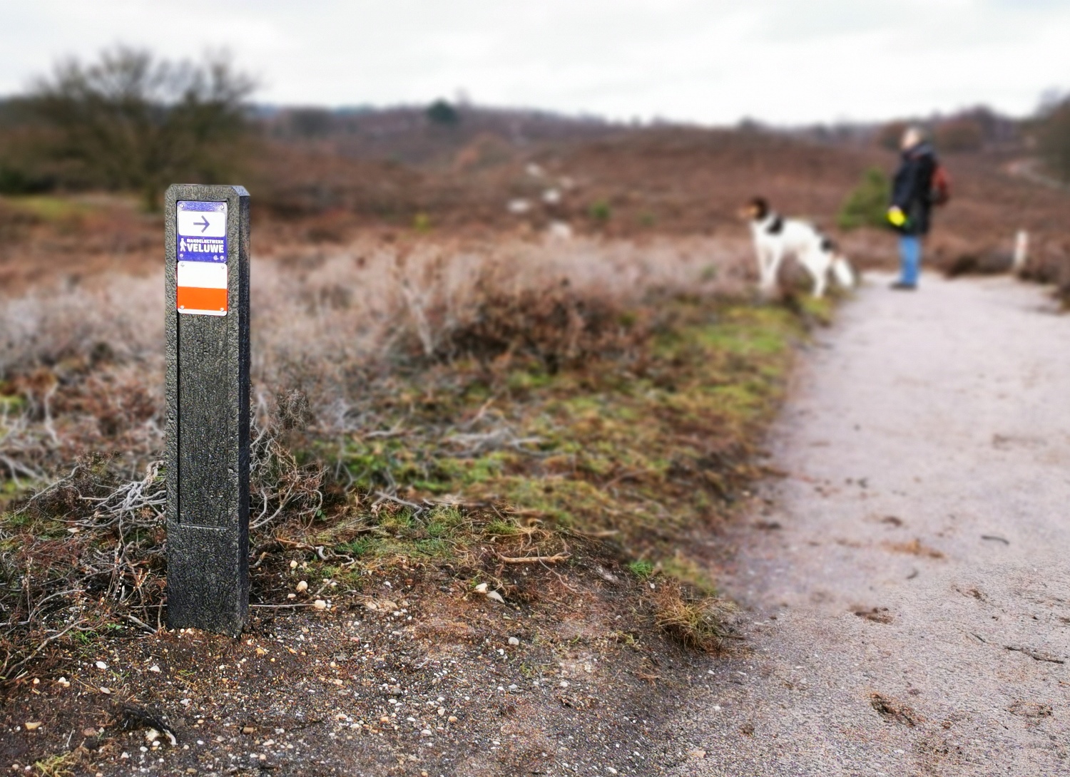
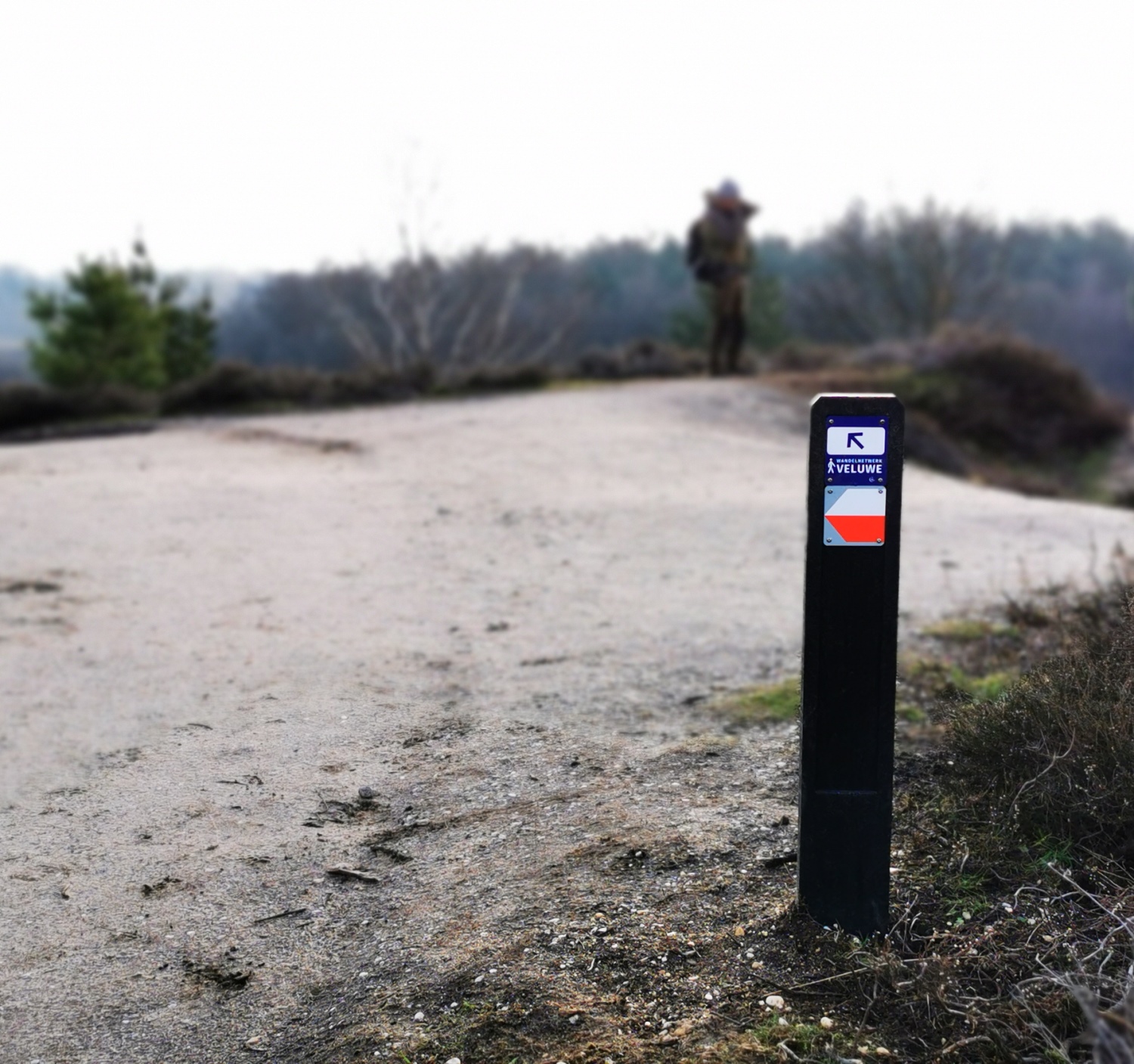
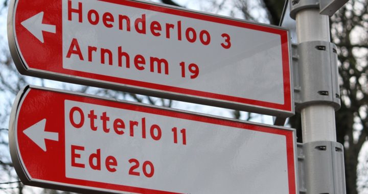
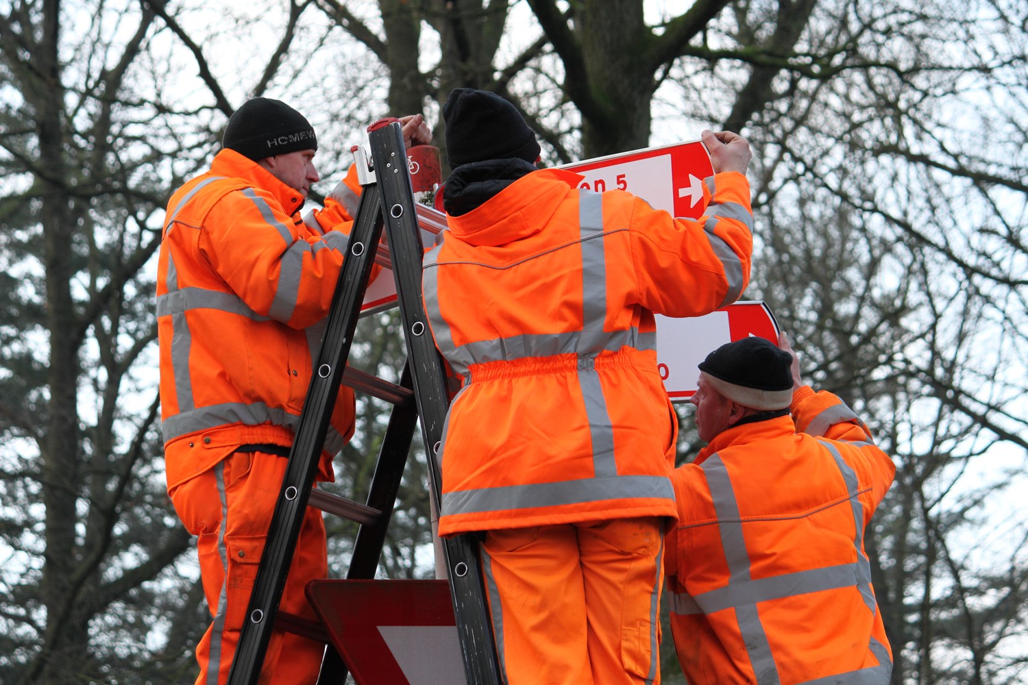
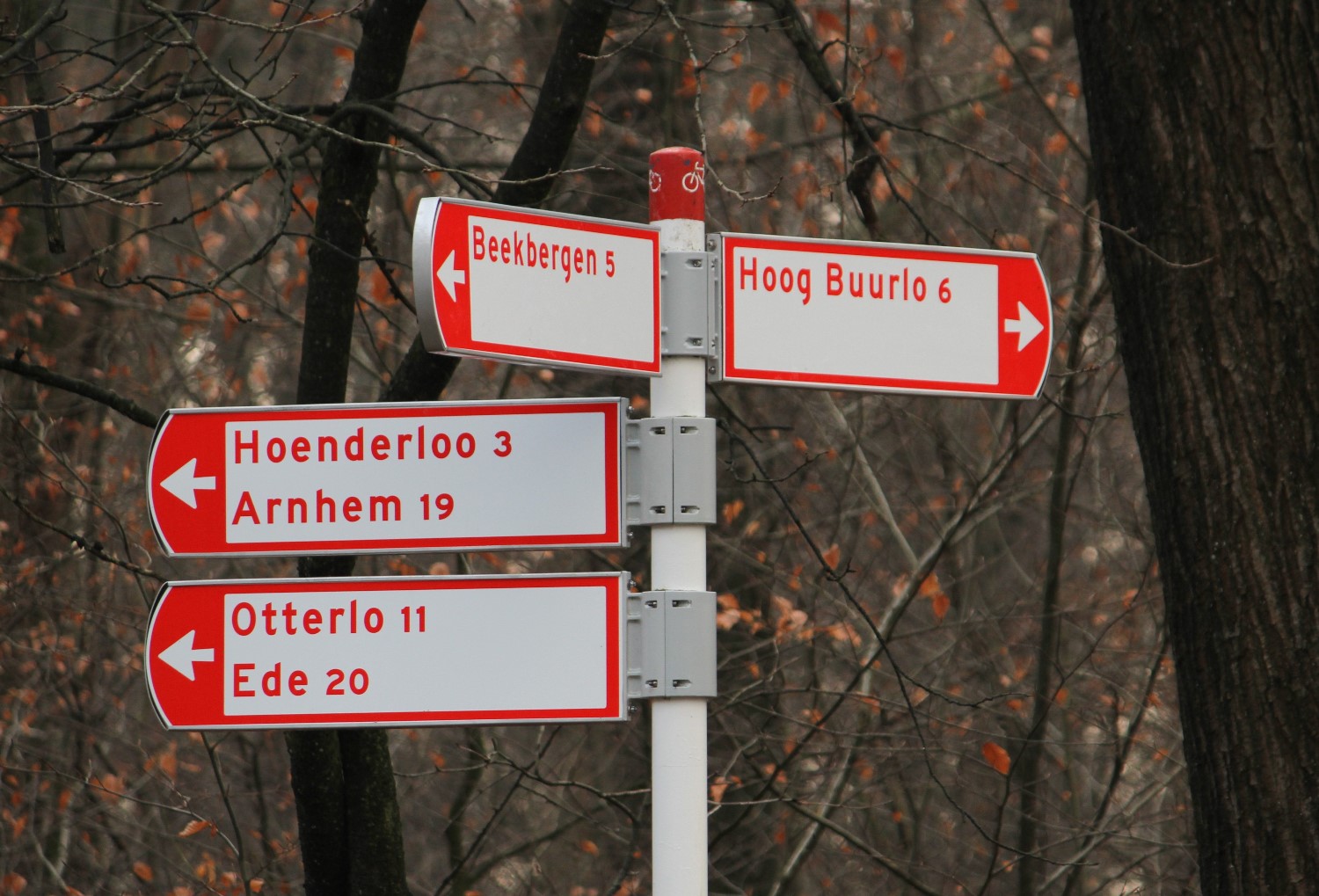
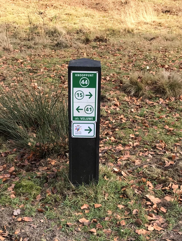
Walking network Veluwe
Assignment
Routebureau Veluwe has designed a walking route network across the Veluwe to make the area more attractive to walkers. This network will be signposted using junctions on recycled and wooden (Douglas) poles.
Created
A start has been made on the realisation of signage in two areas, namely Hoenderloo and Veluwezoom. The other areas will follow next. The route signs are made of Biopanel, a bio-based plastic consisting of renewable, plant-based raw materials. For the junction posts in areas of the Forestry Commission, wooden posts were chosen, made from Douglas fir trees that come from these areas. This project was covered, produced and installed by us.
BioPanel: Sustainable signage
In collaboration with Wageningen University and Transmare Compounding AbelLeisure has developed BioPanel, a bio-based plastic sheet material consisting of 100% renewable plant materials. This sheet material forms the basis for route markings used for the walking network across the Veluwe. Read more about Routebureau Veluwe’s experiences with BioPanel here.
Customer
Route office Veluwe
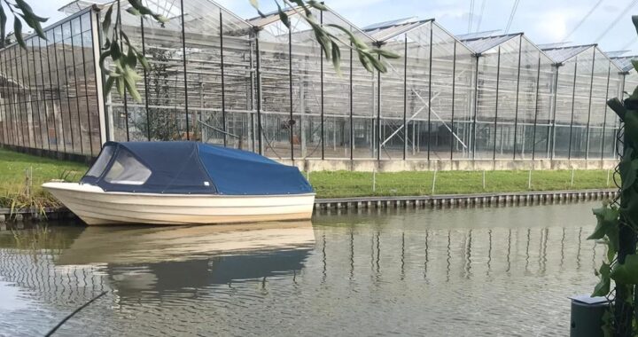
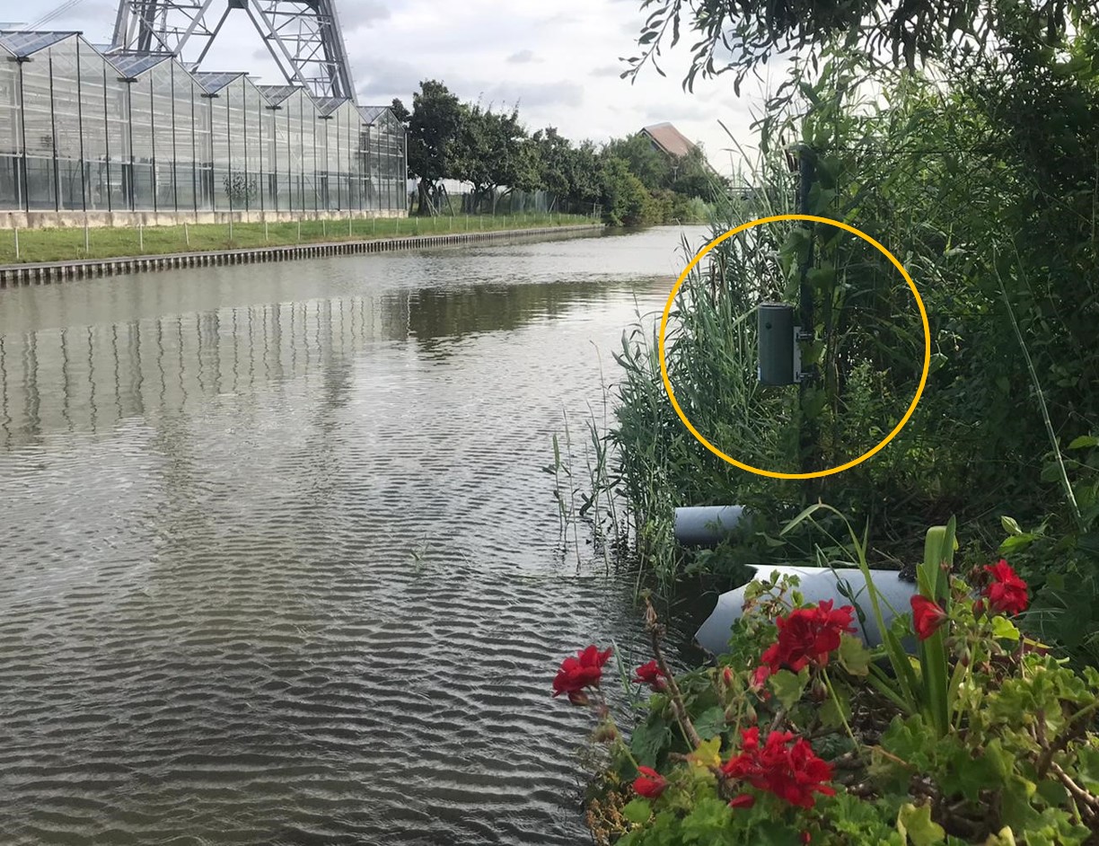
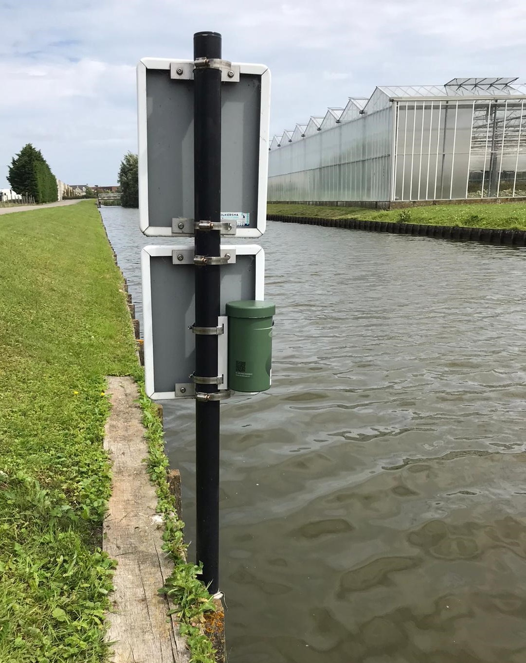
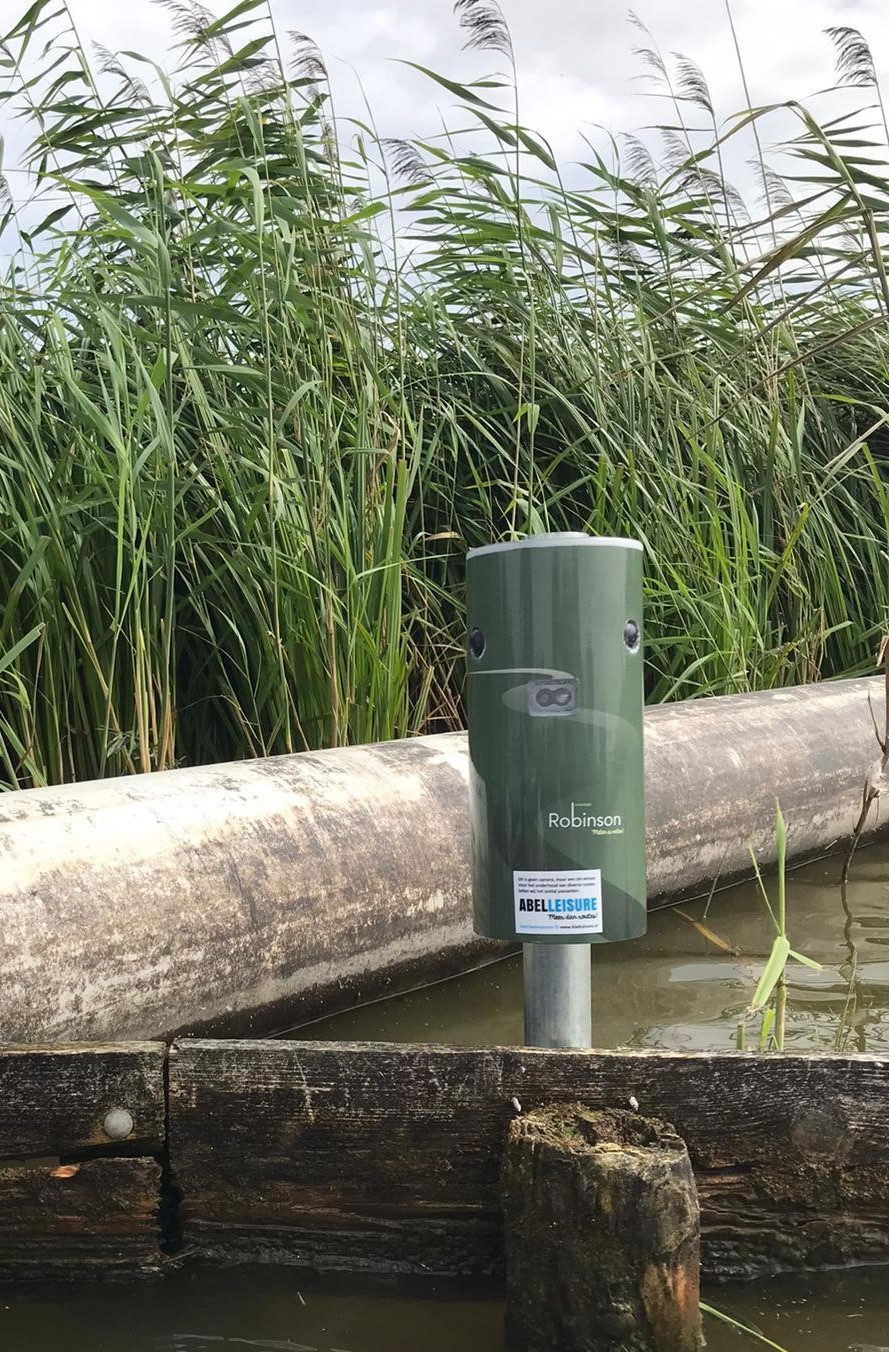
Monitoring crowds Midden-Delfland
Assignment
Mapping the crowding of canals in Central Delfland.
Created
Developing heatmaps that provide a clear picture of how busy the canals in Midden-Delfland are. In addition, the analyses and data are made suitable for the client’s GIS system. To obtain the information for these analyses, we installed Robinson counting sensors at 15 locations.
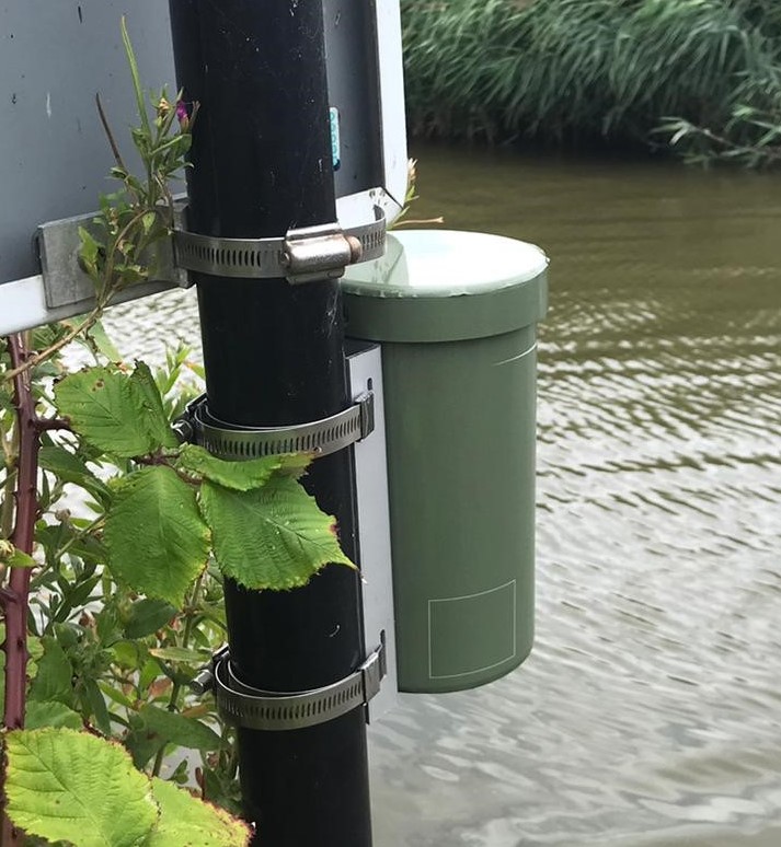
Customer
Hoogheemraadschap of Delfland
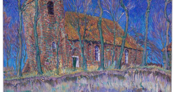
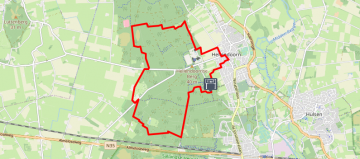
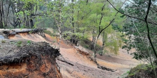
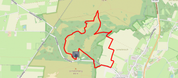
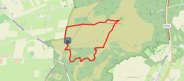
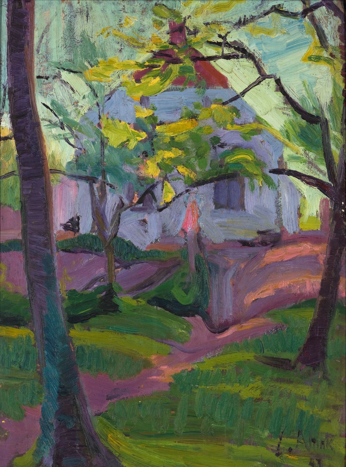
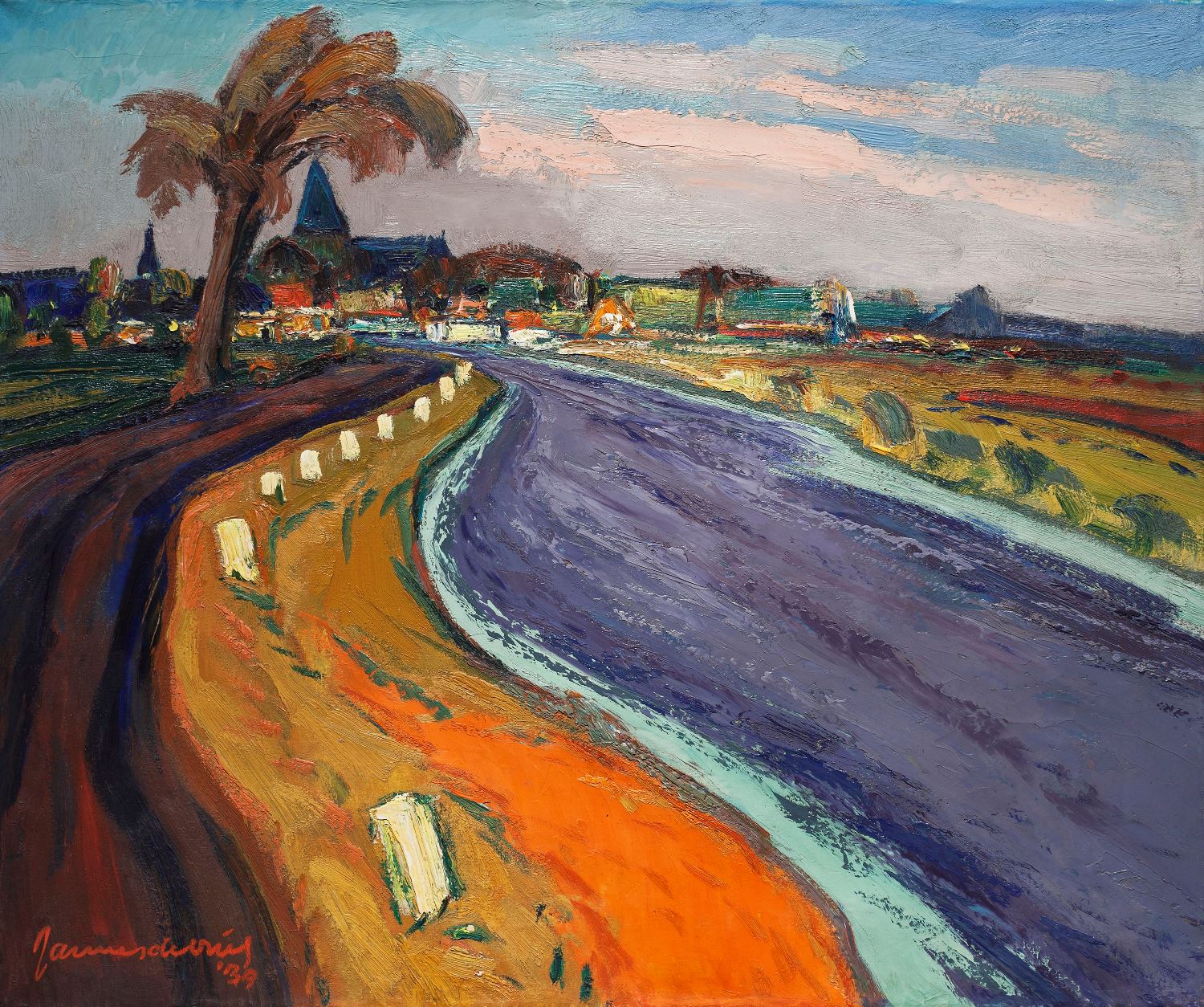
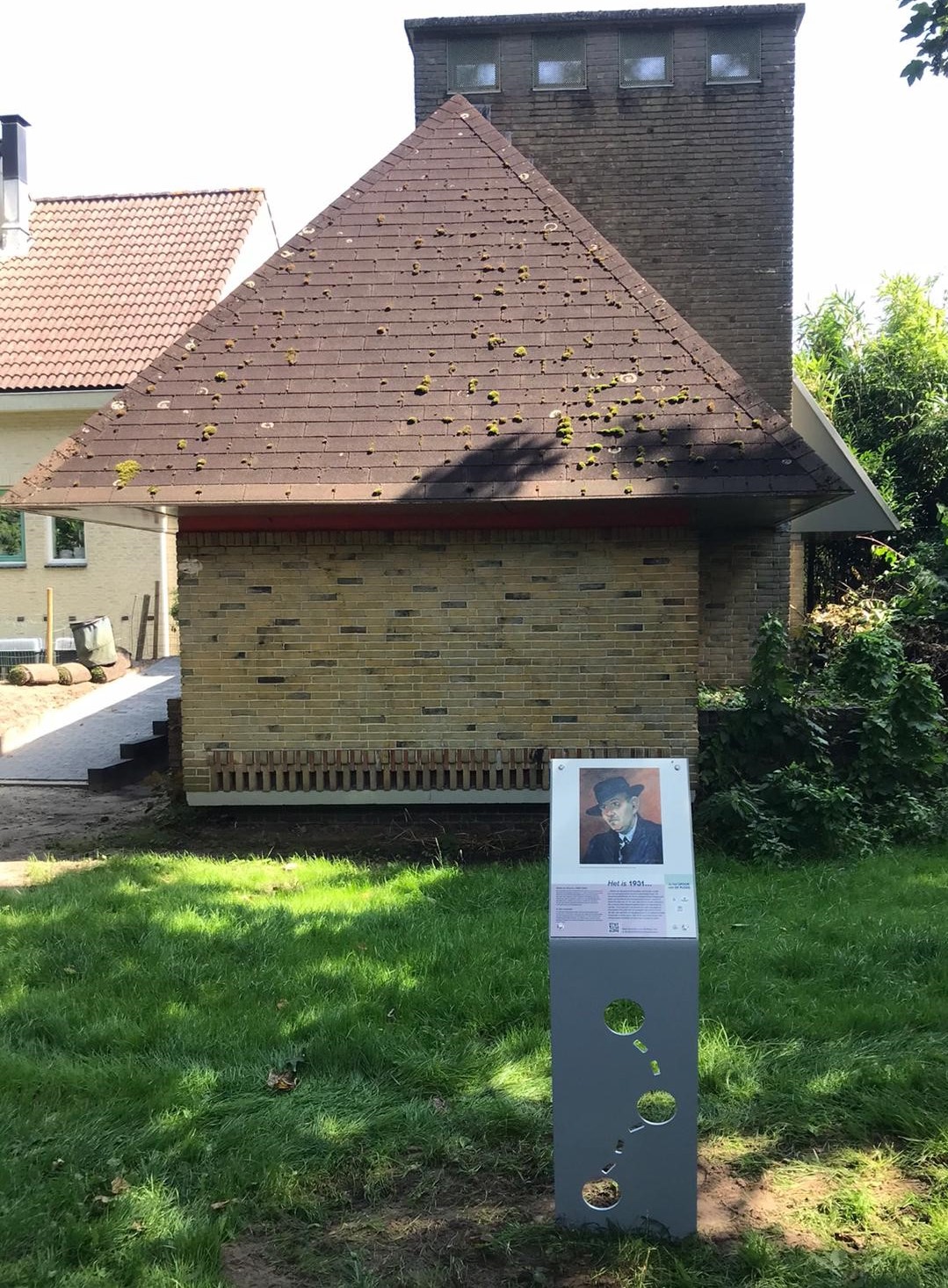
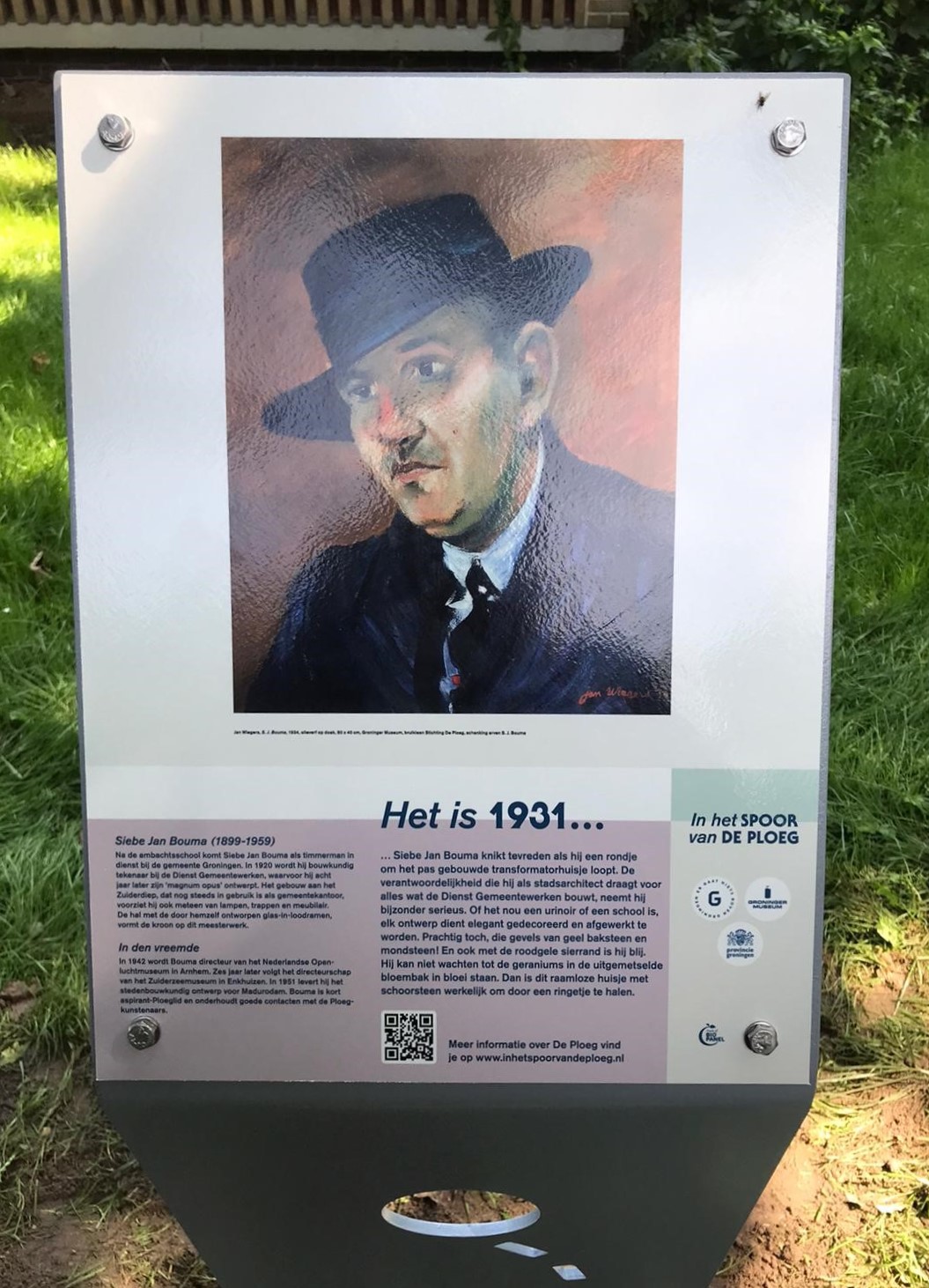
In the footsteps of De Ploeg
Assignment
The aim is to give greater regional, national and international exposure to the life and works of the artists of Groningen Kunstkring De Ploeg in the landscape of the province of Groningen.
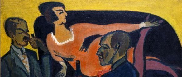
Part of this project are twelve e-bike routes along special places of artists of Kunstkring De Ploeg. The routes lead past places where Ploeg artists liked to sit, work or discuss. Through the Ommelanden with its vastness, wind and space. See the Groningen countryside through the eyes of De Ploeg. And see the wind stripes in the sky, discover the multitude of shades of yellow in the ripe grain and fall in love with the idyllic villages with their brick-built churches.
Kunstkring De Ploeg
In 1918, a number of young artists founded Kunstkring De Ploeg as a reaction to the artistic climate in Groningen. The name De Ploeg was coined by Jan Altink, one of the founders. It refers to the cultivation and reclamation of Groningen’s fallow ‘art fields’. And they did so successfully… Now, more than a hundred years later, it is impossible to imagine Dutch art history without the Groningen expressionism of De Ploeg.
Created
- Nine De Ploeg e-bike routes through the province of Groningen via cycling junctions. The lengths vary from over 50 km to multi-day routes of over 160 km
- Digitised versions of these experiential e-biker routes for the RoutAbel app that navigates you and tells special stories along the way. Enhanced with photos and (art) historical background information about De Ploeg art group
- Matching, handy route booklets, available free at the Groninger Store in the Forum and the Groninger Museum in Groningen
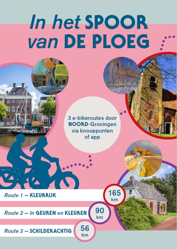
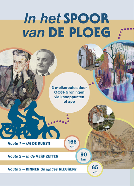
- Surprising and inspiring De Ploeg markings in the landscape at special Ploeg locations along the e-bike routes
- Monitoring of routes with the Robinson telsensor and the platform Slim Buiten!
- Day and multi-day arrangements for De Ploeg
- Development of a business model for sustainable preservation of the routes
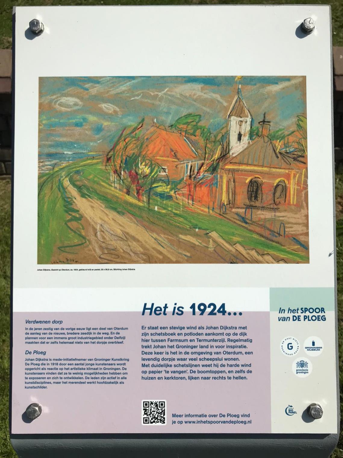
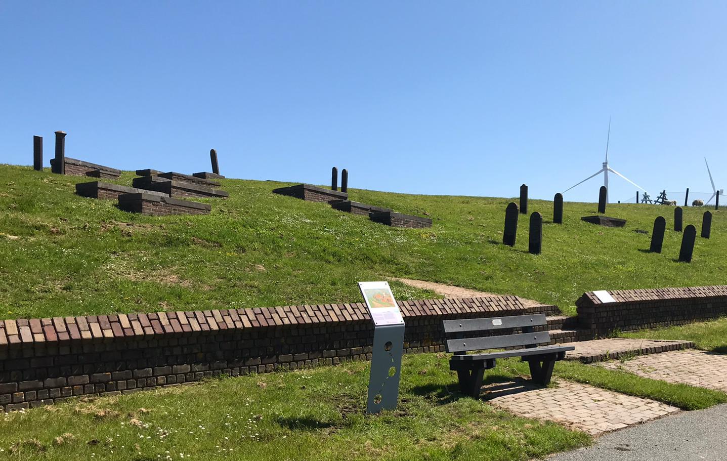
Read more at www.inhetspoorvandeploeg.nl
Customer
Foundation De Ploeg in Stad en Ommeland
In collaboration with the Groninger Museum, Marketing Groningen and the Province of Groningen
Dutch Cycling Embassy
The Dutch cycling embassy aims to share our expertise and technology worldwide as the world’s number one cycling country, facilitating cycling worldwide as the most modern, efficient and sustainable way of transport. More »
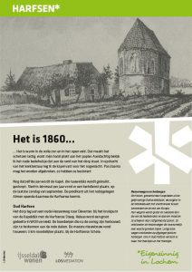
Information panel Oude Begraafplaats Lochem
Assignment
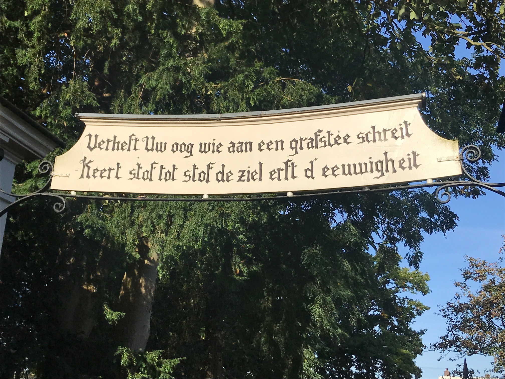
Producing and installing an information panel next to the entrance of the Old Cemetery in Lochem and producing smaller information panels that provide more info on the graves and the trees that are located there. The look & feel needed to have a link to the existing, historical sign above the entrance that features texts by the poet A.C.W. Staring.
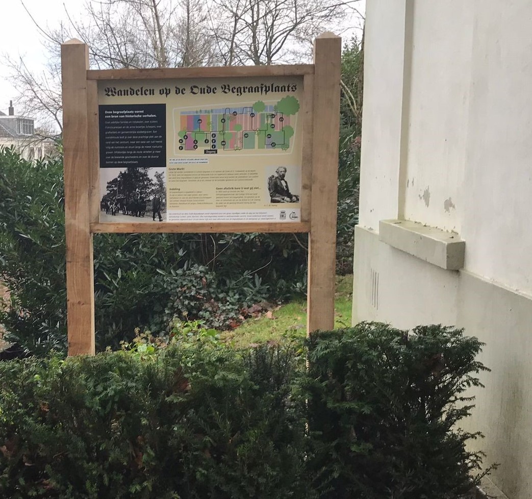
Created
An information panel produced from BioPanel placed in an oak frame. The panel features information that tells the story of the cemetery in an appealing way. The panel shows a walking route along the graves. The numbers on the map refer to particular graves. This panel is located next to the entrance of the site.
In addition, twenty smaller information panels with background information have been made and are located at various (numbered) graves. Along the walking route there are also ten panels with descriptions of certain trees.
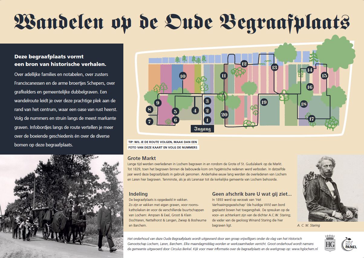
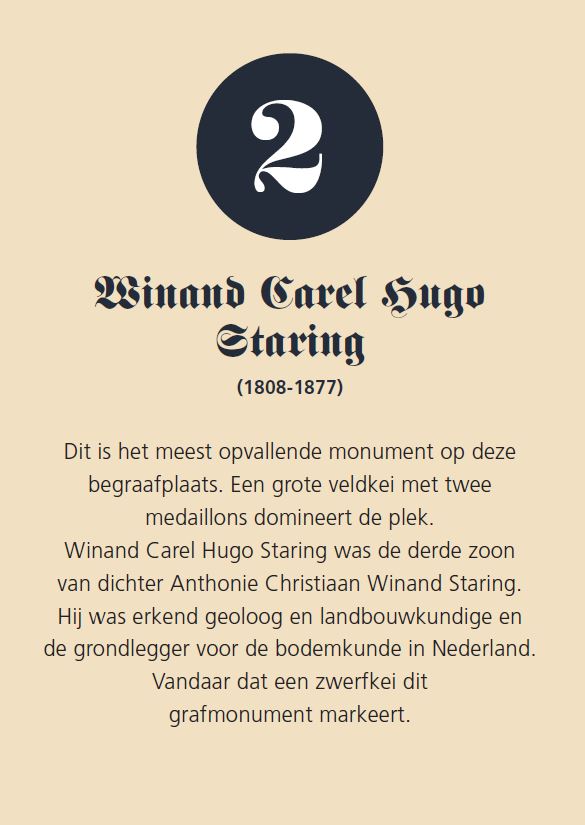
Customer
Historical Genootschap Lochem
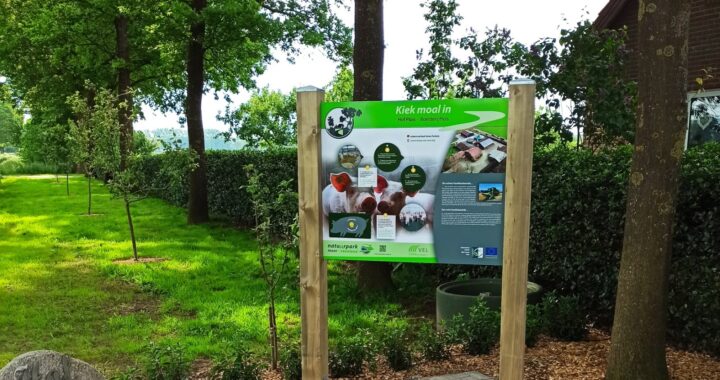
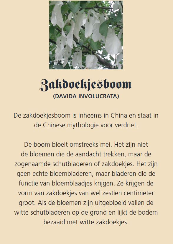
Information panels Naturpark Moor-Veenland
Assignment
Providing 18 information panels for German, agricultural farms located within the Naturpark Moor-Veenland. Via junction routes, you will be guided past these farms while cycling.
Created
18 information panels printed on both sides. We took care of both text and layout. The texts are in both German and Dutch. Some panels feature interactive elements. The International Moor-Veenland Nature Park is located in the regional triangle of Landkreis Emsland, Grafschaft Bentheim and the province of Drenthe.
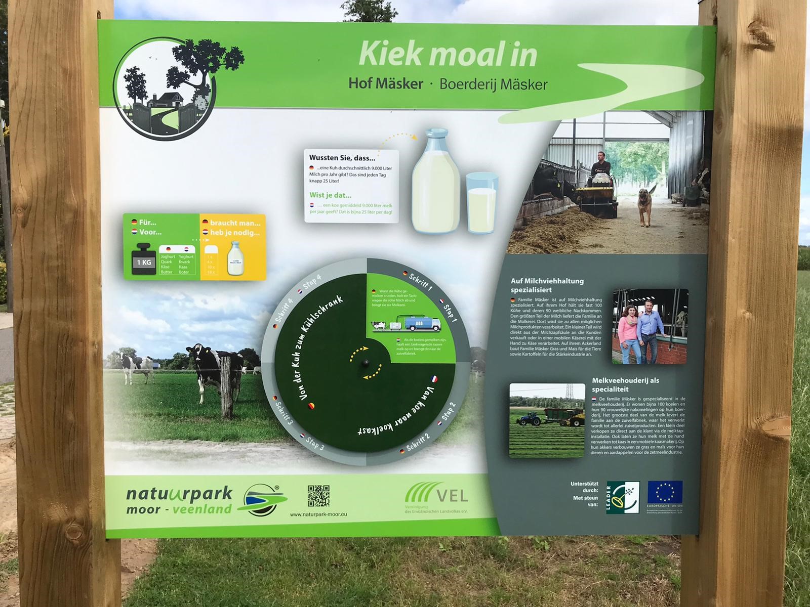
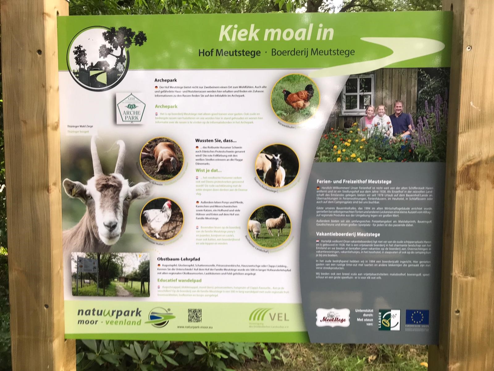
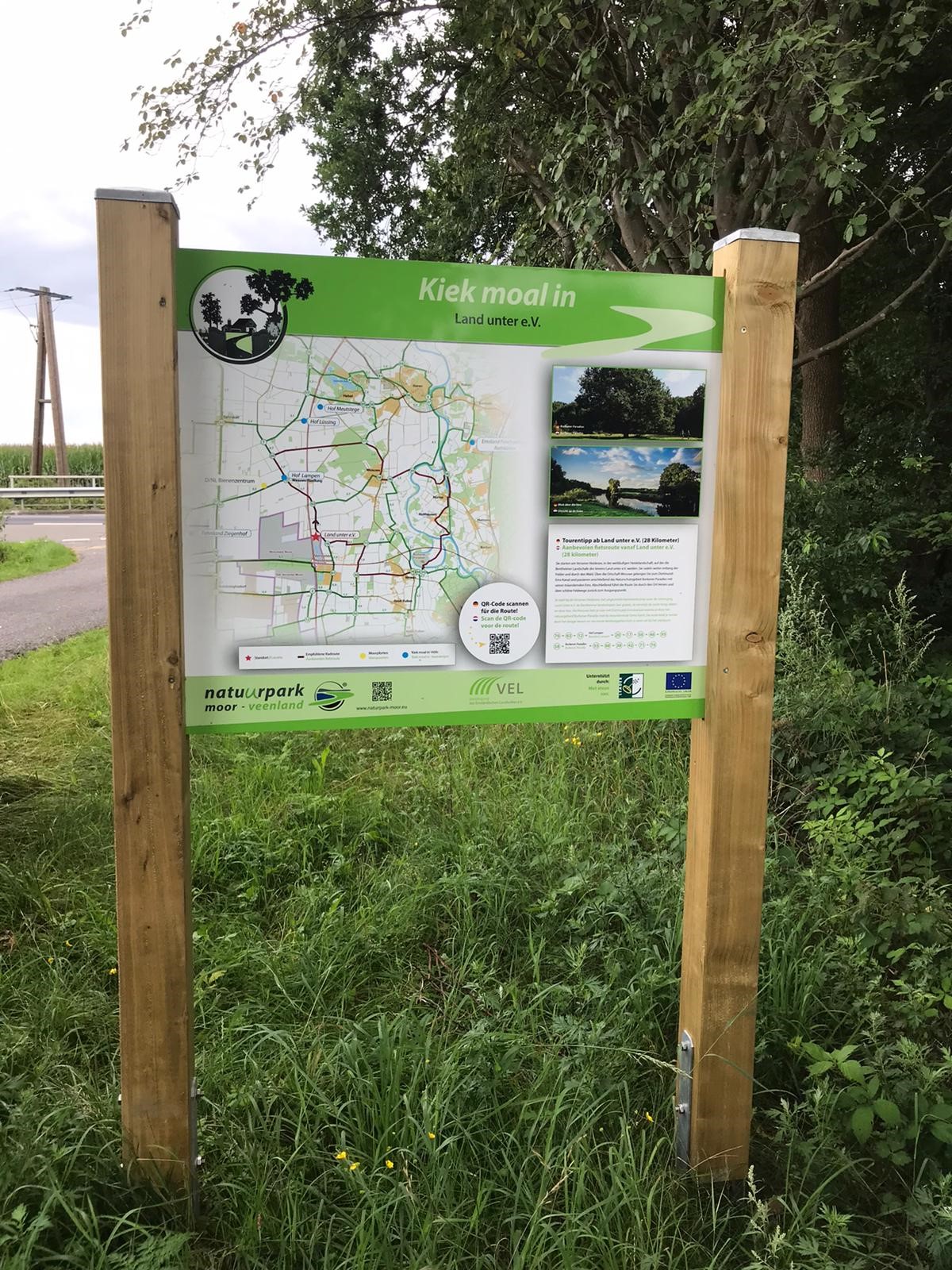
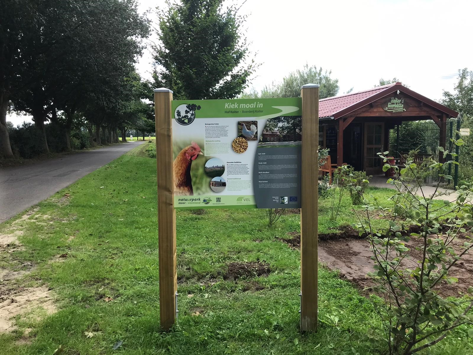
Customer
Naturpark Moor-Veenland, Germany
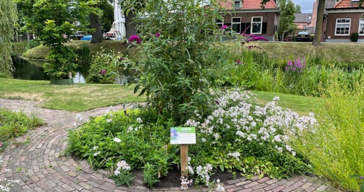
Information panels herb garden De Bleike Lochem
Assignment
Producing and installing an information panel next to the entrance of the herb garden in Lochem and producing smaller information panels giving more info about the herbs in the garden.
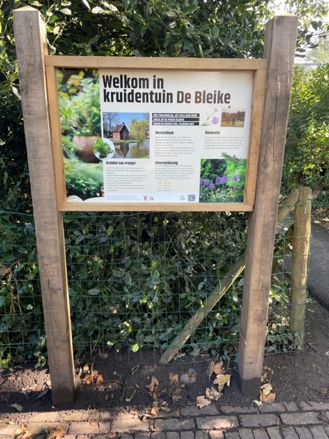
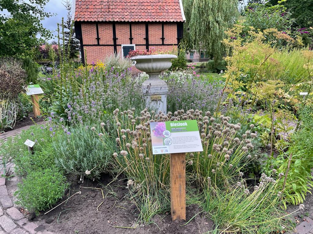
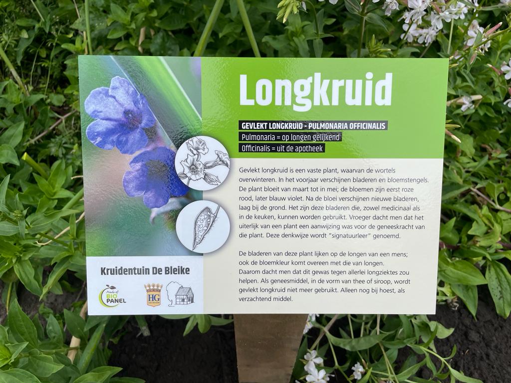
Created
An information panel produced from BioPanel
placed in an oak frame. The panel features information about the herb garden. This panel is located next to the entrance.
In addition, there are four smaller information panels with made that are located at various herbs.
Customer
Historical Genootschap Lochem
Jesse Drabbe
If he can, this student from Lochem likes to help out in the field as well as in the office. For instance, Jesse pedals away many kilometres of cycling routes to see how many superfluous QR code signs can be found in the field. He also checks whether the routes are still correct. When it comes to hobbies, football is at the top of the list. Besides, he can often be found in his little studio making music. His style? Rap and hip-hop.
Waterway routes and info panels – Water board Amstel Gooi and Vecht
Assignment
The Water board Amstel Gooi and Vecht wants both residents and tourists to enjoy the nature and water heritage in their region. Through a flyer, sailing routes and information panels, recreationists will be made aware of the beauty of this area and tempted to take to the water.
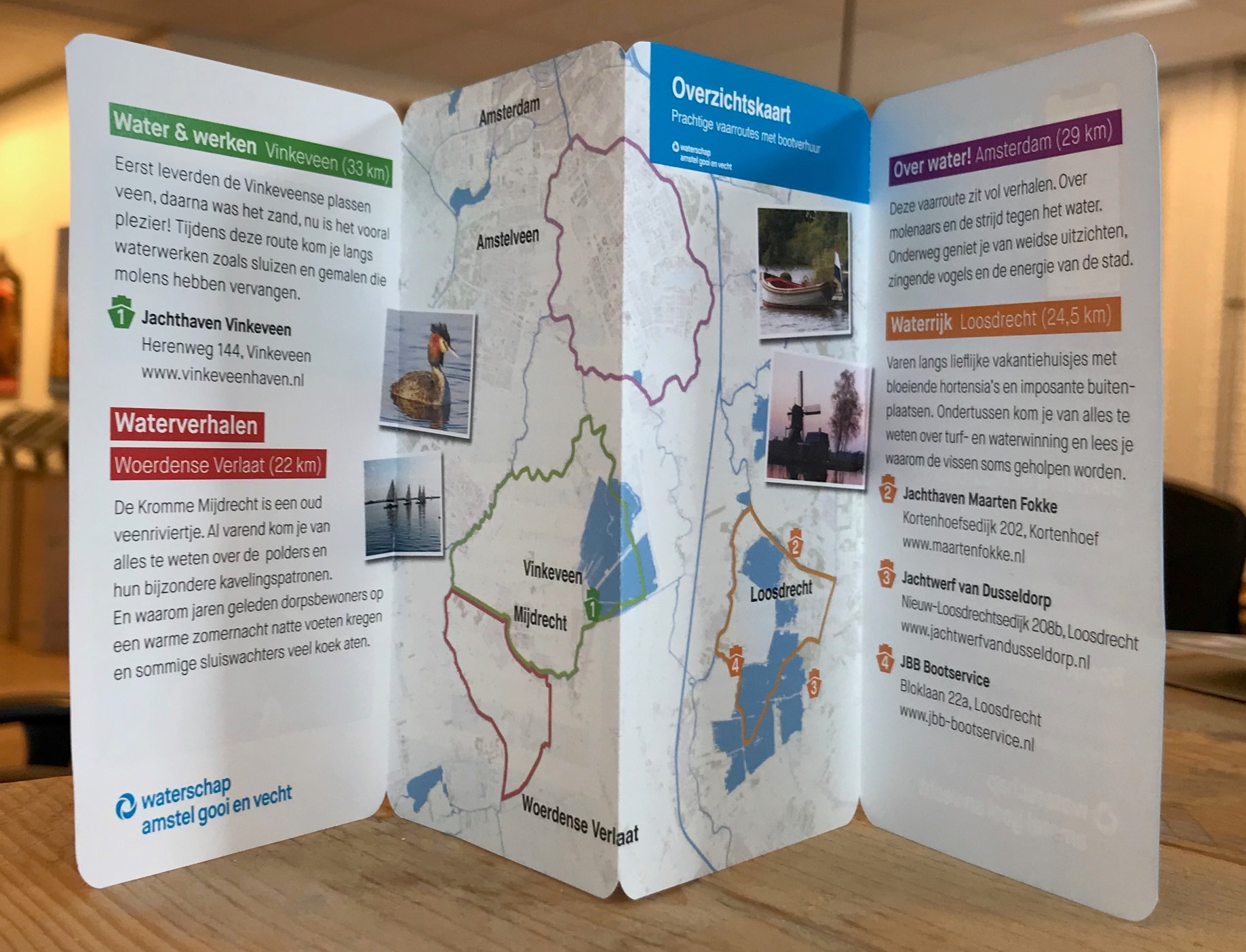
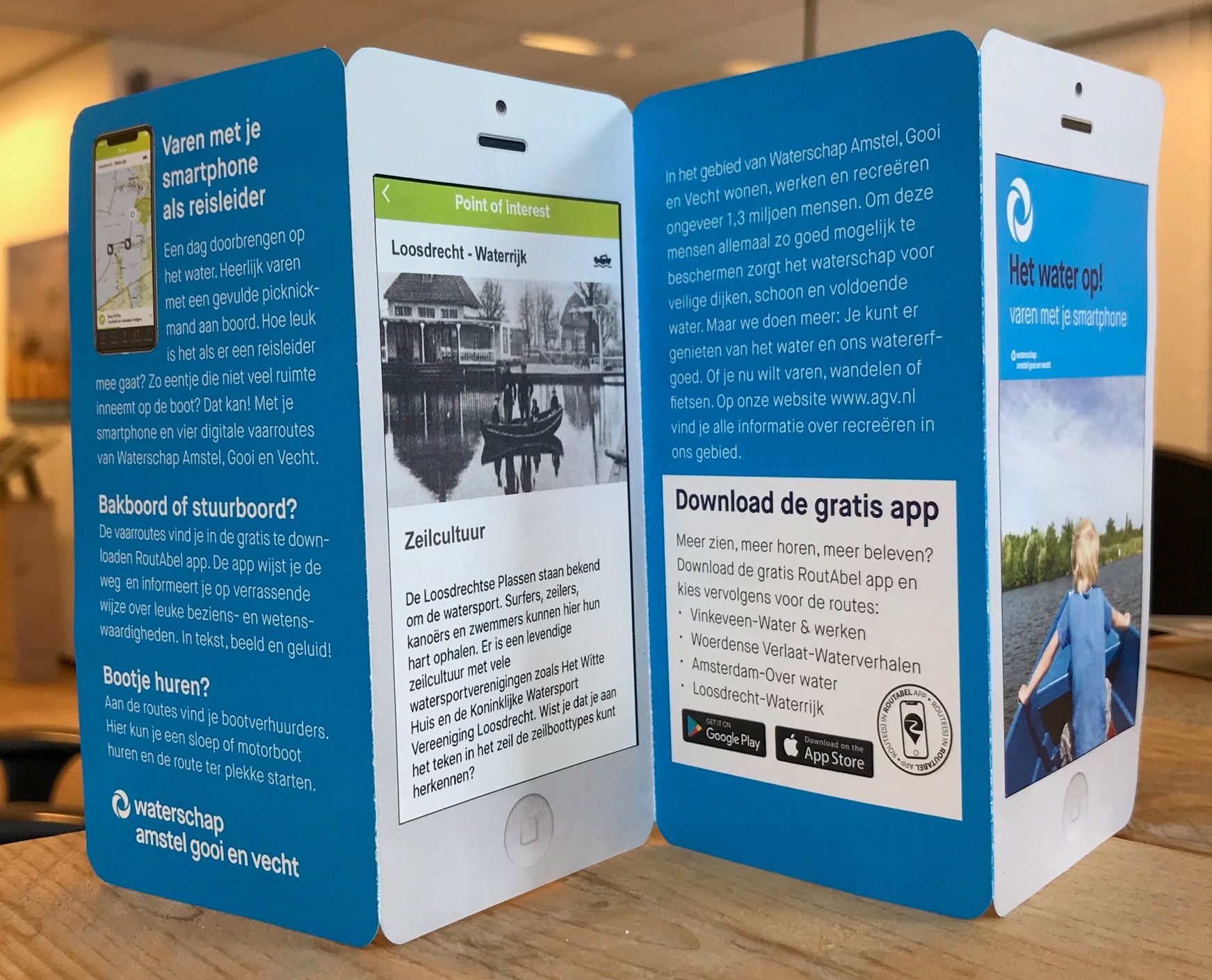
Created
We have developed four digital boating routes that can be found in RoutAbel’s app. These routes are promoted through an informative flyer distributed at various locations along the waterfront. In addition, five information panels have been developed from BioPanel, a bio-based plastic composed of renewable, plant-based raw materials. These panels show the boating routes. They have been placed at various boat rentals.
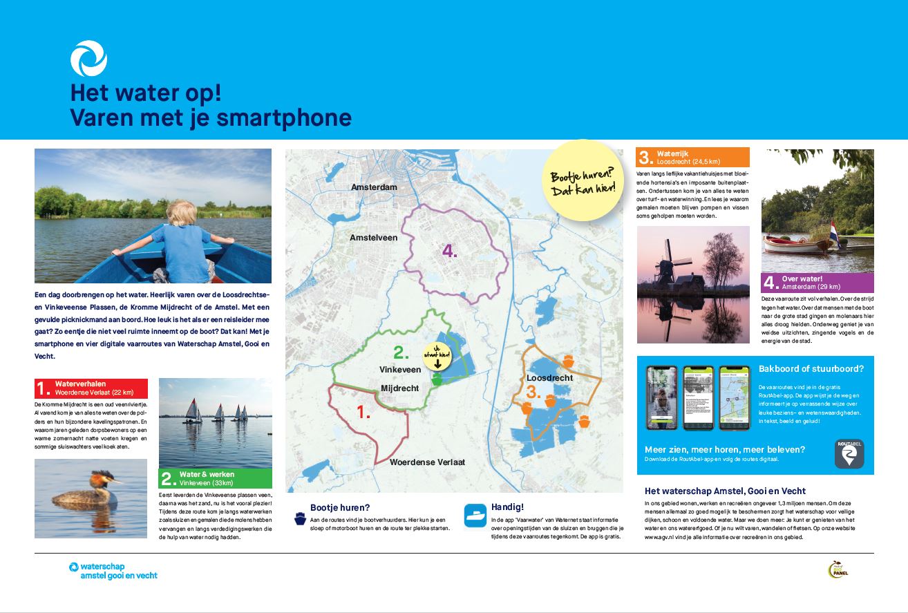
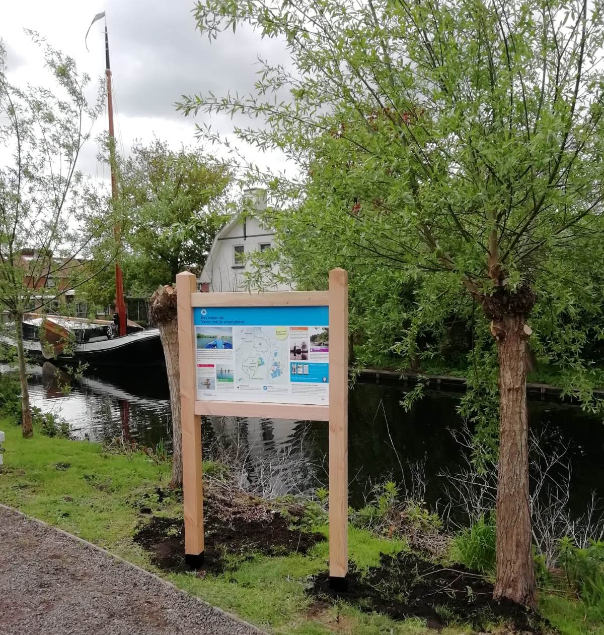
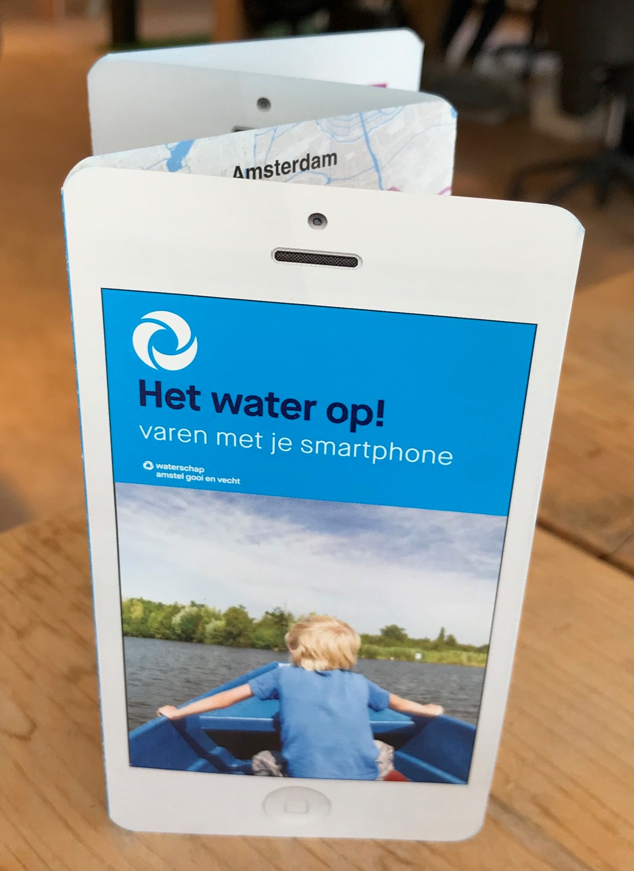
Customer
Water board Amstel Gooi and Vecht
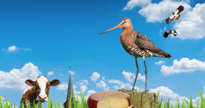
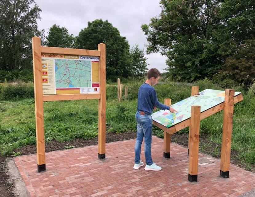
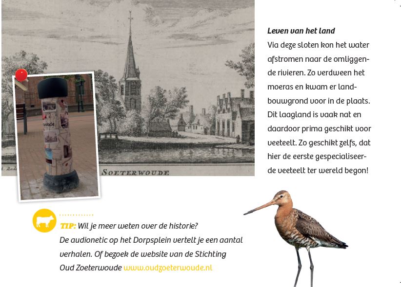
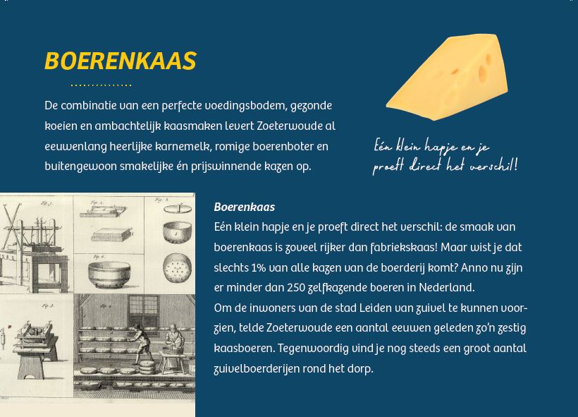
Farmers’ cheese route Zoeterwoude
Assignment
The municipality of Zoeterwoude asked us to develop an experiential cycle route ‘Cheese’. The cycle route starts from one of the Singels in Leiden and is part of eight experiential cycle routes in the municipalities of the Leidse Ommelanden that strengthen city-country connections for recreational cyclists.
Created
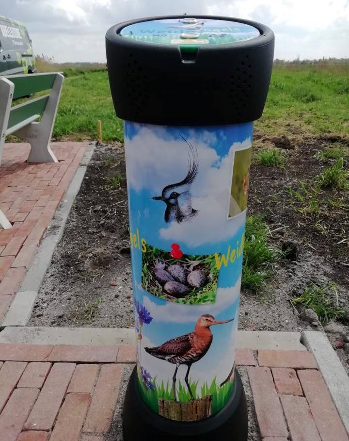
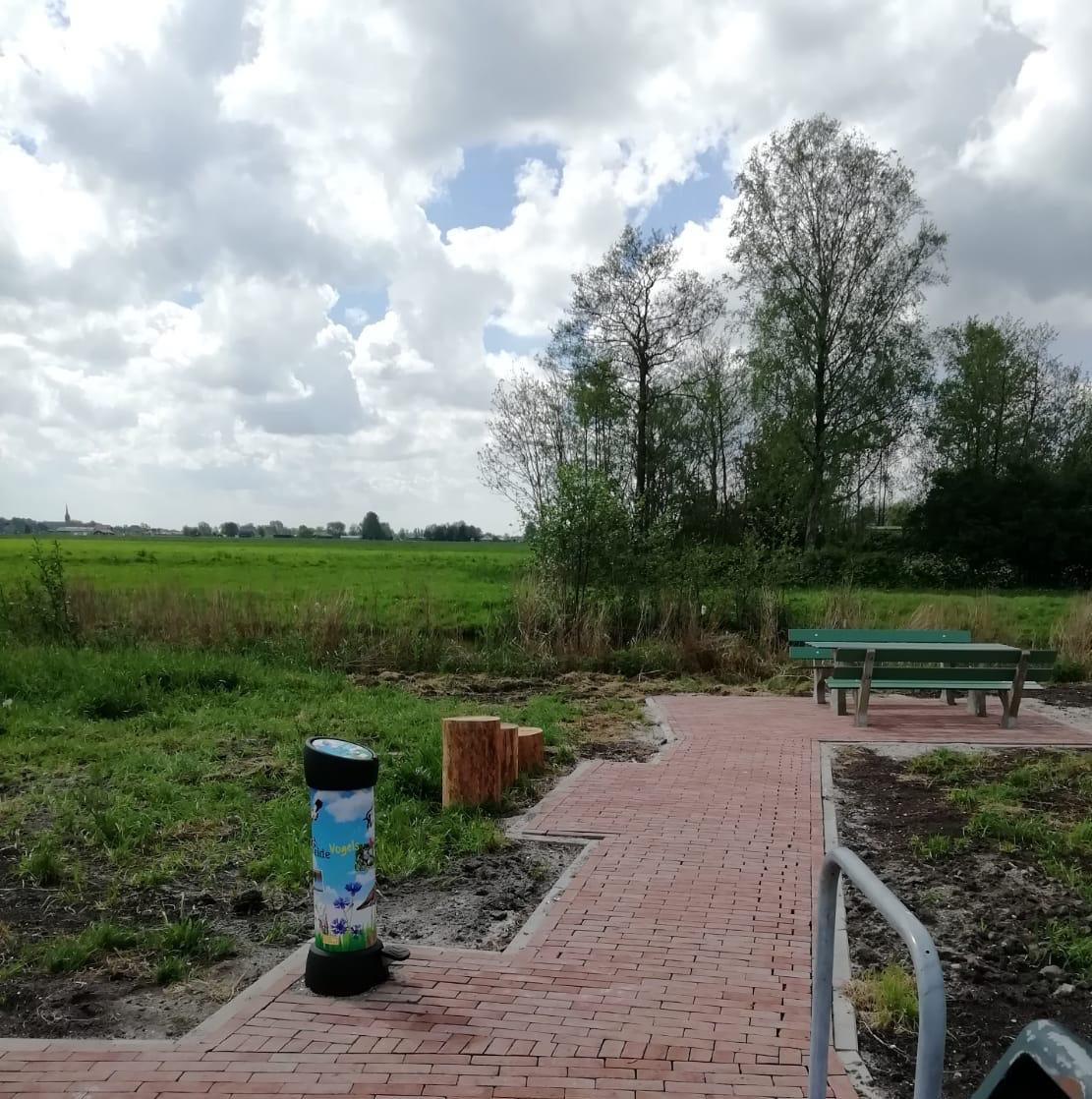
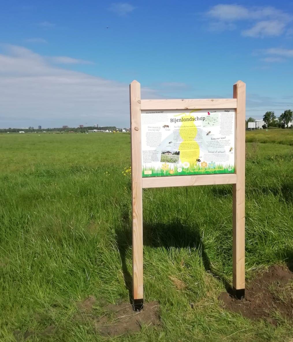
A 20 km Farmers’ Cheese Route that leads recreational travellers through the municipality of Zoeterwoude and past artisan cheese, ice cream and dairy farms. The route has been set up together with the farms/entrepreneurs involved. Along the way, the cyclist will receive information about the agricultural peat meadow area, the meadow bird areas, the historical buildings, the dairy preparation process the flowery roadsides/biodiversity and the bee landscape. The route is marked with yellow, rectangular signs depicting a white cow. The shape of this cow is reflected in the information panels located along the route. A number of audionetics and a bee panel provide further additional information about the area.
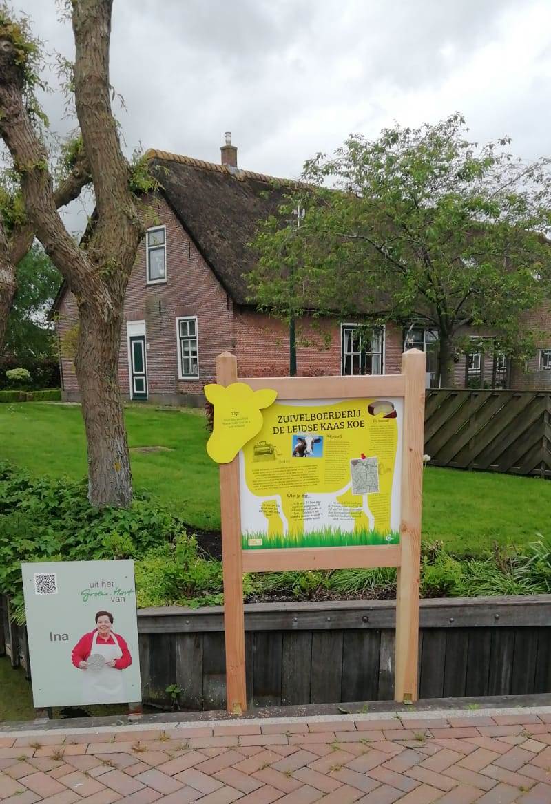
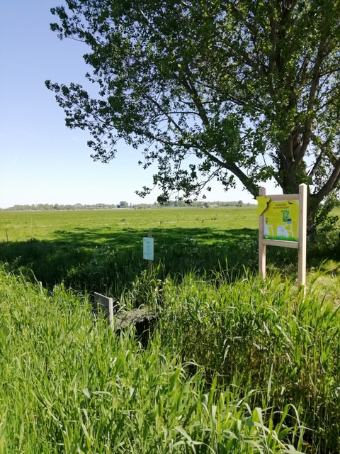
The project Farmers’ cheese route consists of:
- A signposted cycle route of 17,5 km
- A digital version of this cycle route in the app RoutAbel
- 15 information panels scattered along the route (at cheese and dairy farms). The panels are made of our sustainable Biopanel
- 3 audionetics, each with 3 short stories (for instance about meadow birds, old Zoeterwoude, cheese making)
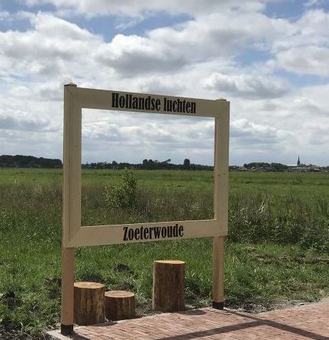
- A ‘masterpiece’, consisting of a life-size painting frame showing the Dutch skies of Zoeterwoude as a work of art. Recreationists can place themselves in the ‘painting’
- A 3D map of the route, designed in the same look & feel as the information panels
- @ information panels about the unique Bee Landscape in and around Zoeterwoude, again designed in the same look & feel. This panel is also made of Biopanel
- A clear website, ontdekzoeterwoude.nl , which bundles all this information about Zoeterwoude and the cheese and dairy farms
- Setting up and maintaining a Facebook page Ontdek Zoeterwoude
- A route booklet with background information, fun tips (also for children) and facts
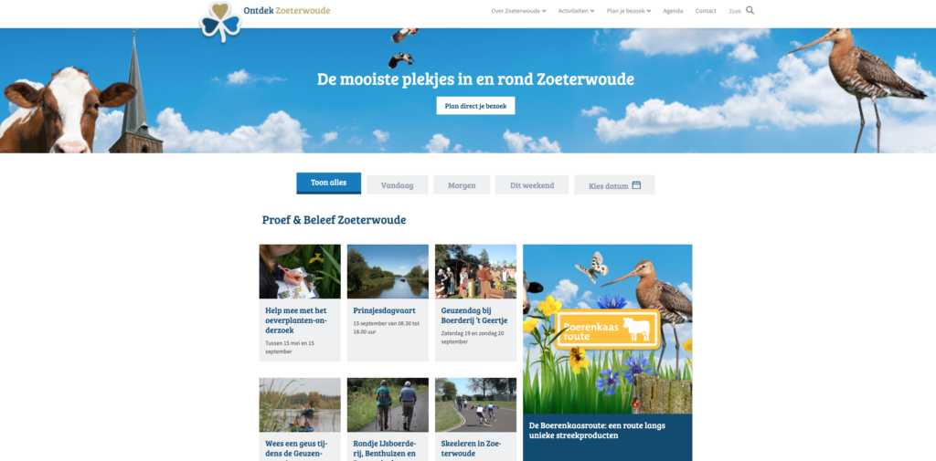
Website www.ontdekzoeterwoude.nl
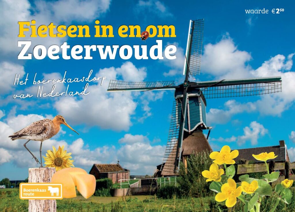
Route booklet:
Customer
Municipality of Zoeterwoude, in collaboration with Province of South Holland and Holland Rijnland region
Jeroen Drabbe
Co-owner of AbelLeisure, the commercial man. Sees opportunities everywhere, even when they are not so visible. Usually enthusiastic. When he is not, Jeroen is really busy. He is an inspired communicator and knows how to market his products. If there is time besides work and family, this Brabander likes to do sports. Putting metres on his racing bike or running to clear his head.
BioPanel
BioPanel – Biobased signposts and information panels
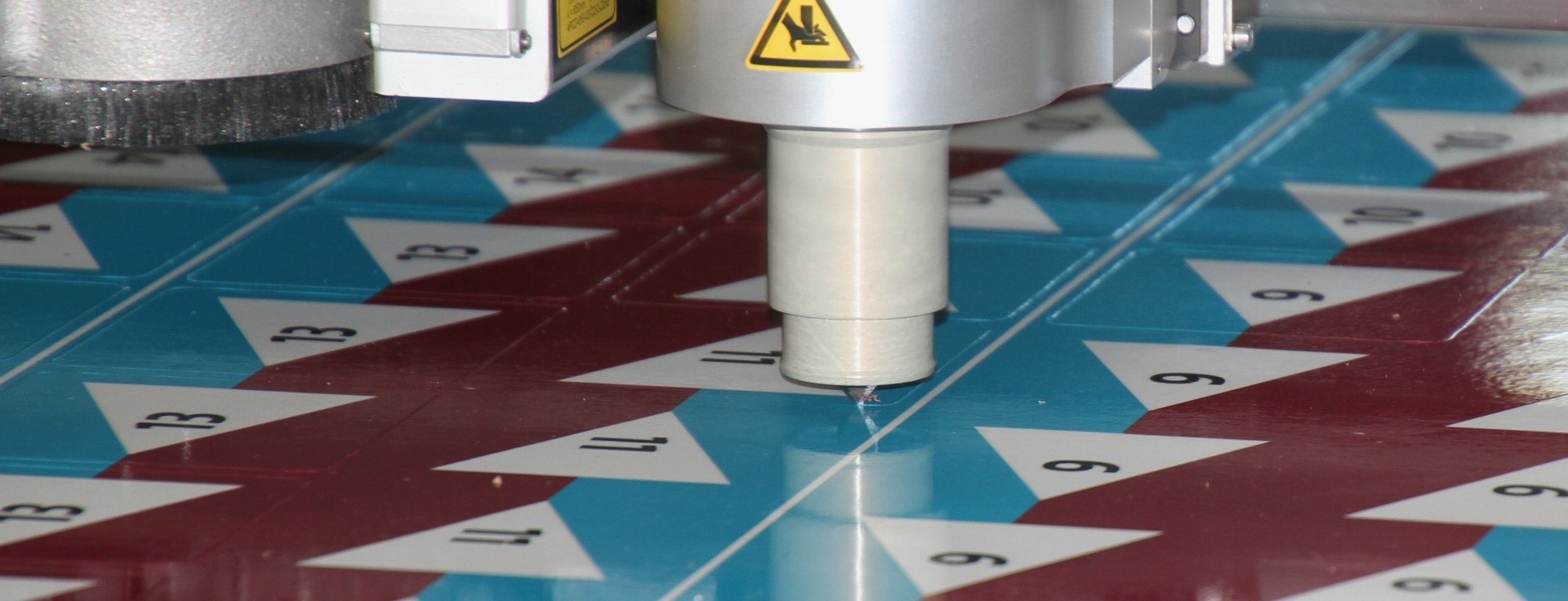
BioPanel is a biobased CO2 neutral composite plastic sheet material consisting of industrial hemp and thermoplastic biopolymer. The sheet material forms the basis for route marking and information panels. The strength of the panels is comparable to usual HPL panels.
At end-of-life, BioPanels undergo upcycling, this is achieved by melting down the sheet material and processing it into new route marking or information panels. Eventually, we can also compost BioPanel. In doing so, we become the owner of our own waste. We guarantee a lifespan of 10 years.
An important vegetable raw material in BioPanel is industrial hemp. This annual plant thrives very well in Dutch moist soil. The plant can be harvested and used as a raw material after only a few months.
Using hemp in bio plastic has many advantages:
- The fibre is much stronger than components used in plastic
- The production of plastic based on fossil resources creates huge CO2 emissions, while flax is grown locally and absorbs CO2
- Hemp is widely available and grows fast
- Almost the entire plant is used
- For sustainable agriculture, hemp is beneficial in controlling parasites and weeds
Due to the raw materials used, BioPanel has a natural brown colour. Information and signing is applied via a signface. In cooperation with 3M, BioPanel is provided with a PVC-free foil. A full-colour print is applied to this foil, after which the print is provided with a PVC-free protective laminate.
Printing on a PVC free foil is much more environmentally friendly than, for example, a screen printing method. At the end of its service life, the foil is removed from the BioPanel and undergoes recycling. The BioPanel is processed into the same panel or similar application again at a relatively low temperature.

Bicycle signposts in the province of Gelderland
Assignment
Developing a sustainable solution for bicycle signposts at various locations in the province of Gelderland (between Apeldoorn and Arnhem).
Created
For this purpose, we have developed 65 bicycle signposts made of BioPanel, a bio-based plastic consisting of renewable, plant-based raw materials. The construction surrounding the signs was designed to make use of existing brackets. The signs are designed in the standard white and red layout as required by law.
The signs are mounted on existing posts.
Customer
Province of Gelderland

Fred van Schoonhoven
Co-owner of AbelLeisure. Commercial with a touch of technology. Develops and leads new projects with preferably a pinch of innovation in them. He knows the limits of a project, is down-to-earth like a Tukker should be and likes to talk at lunch about his strategies as coach of a girls’ football team. As soon as something can be measured, he goes wild about sensors or a smart outdoor space…
Oranjeroute
Opdracht
Signposting the Dutch-German Oranjeroute; a cross-border cycling tour from Apeldoorn to Moers, Germany. 200 wonderful kilometres of cycling along the rich history of the Dutch royal house of Oranje-Nassau.
Created
We signposted this route and provided frames with information panels at four locations. The entire network was digitalised with sign passports for both the German land registry and Dutch route offices.
On bottle piles On intermediate markers Signposting in Germany
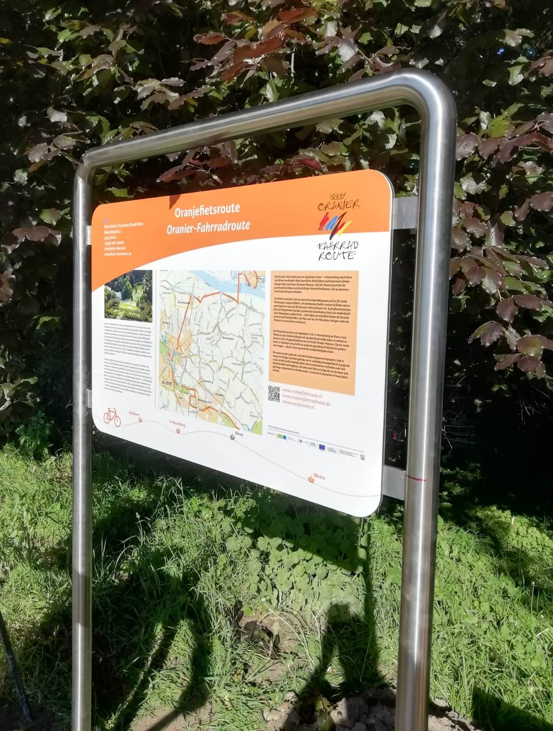
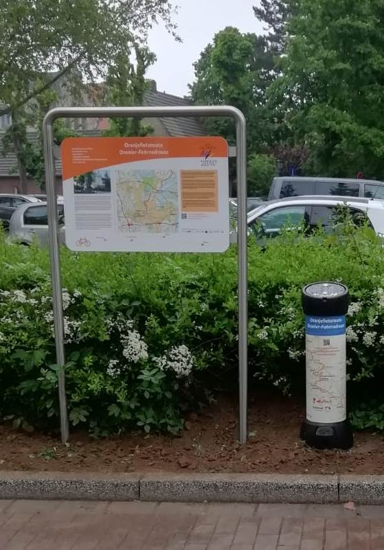
Information panel
Customer
Project group ‘In het spoor van de Oranjes’
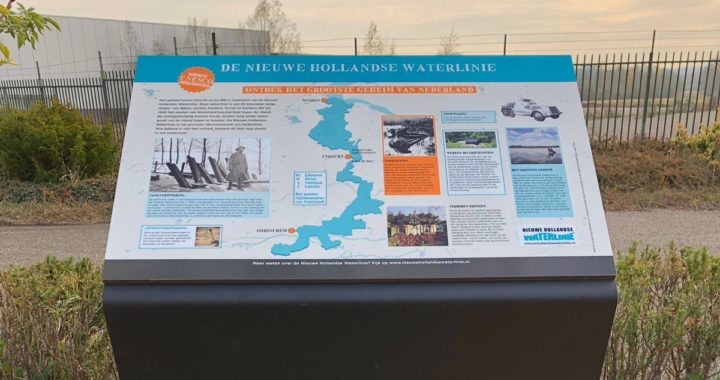
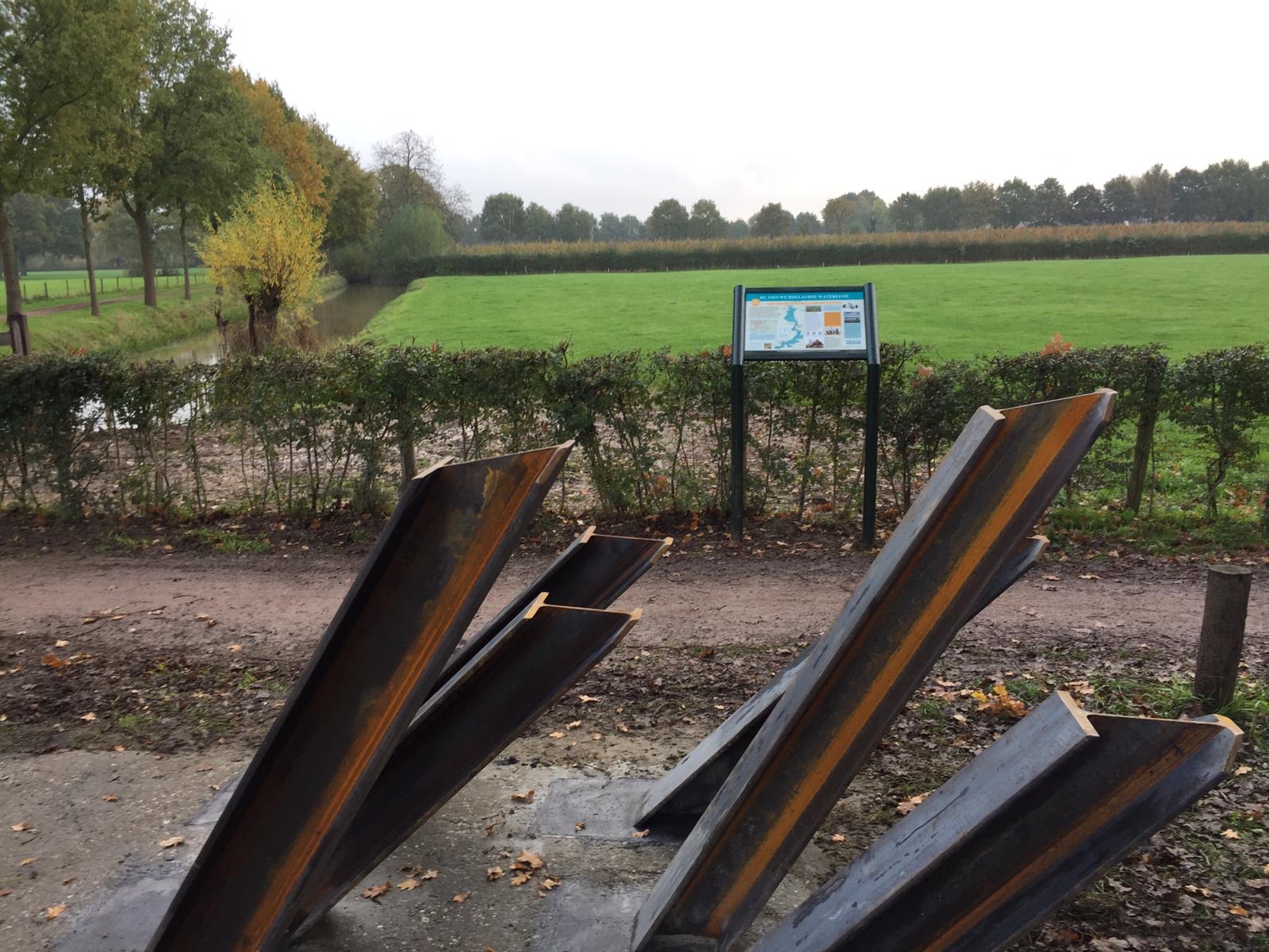
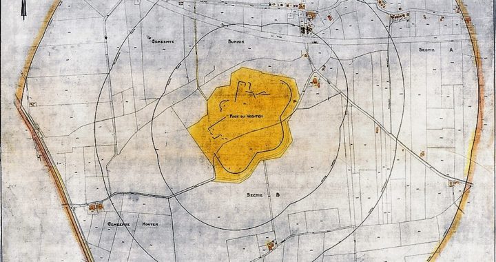
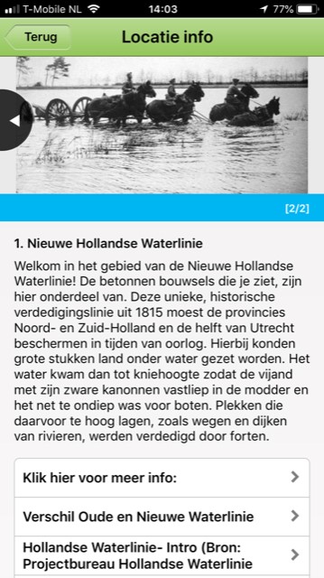
Information panel Nieuwe Hollandse Waterlinie
Assignment
– Designing and realising two (identical) information panels located next to two new artworks in the municipality of De Bilt.
– Designing and realising two (identical) information panels located near the tank barriers in Bunnik.
Created
– Two (identical) information panels, designed in the house style of the Nieuwe Hollandse Waterlinie. The panels are mounted on custom-made, steel frames and stand next to two artworks on both cycle paths along the Utrechtseweg in De Bilt. The artworks visualise a tank barrier built here in World War II.
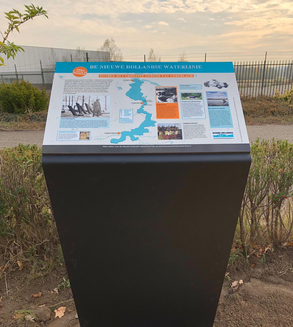
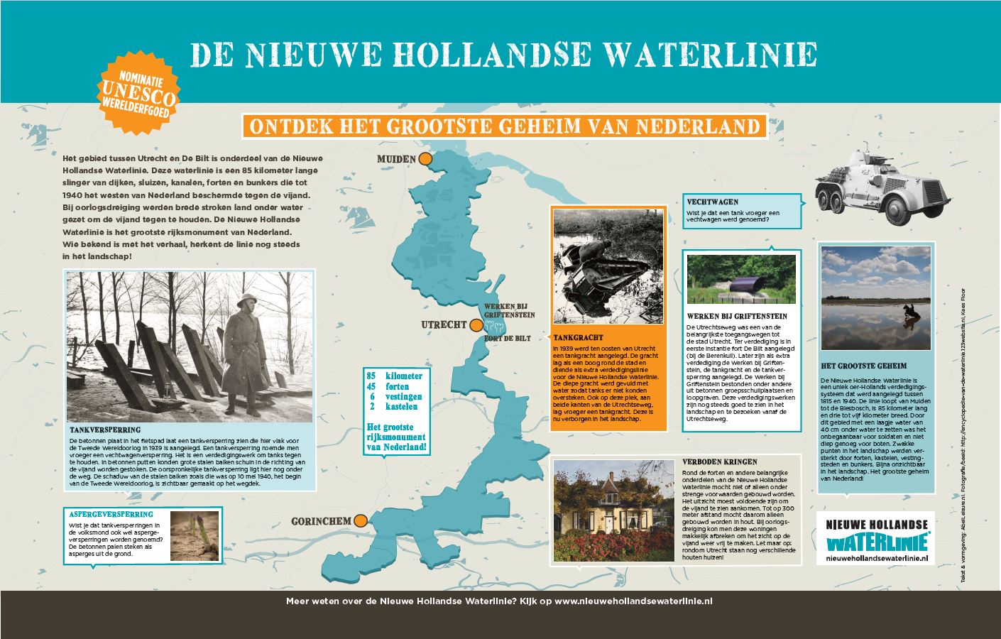
– Two (identical) information panels, designed in the house style of the Nieuwe Hollandse Waterlinie. The panels are mounted in dark green, aluminium frames and stand next to two tank barriers at fort Rijnauwen. The artworks visualise a tank barrier built here in World War II.
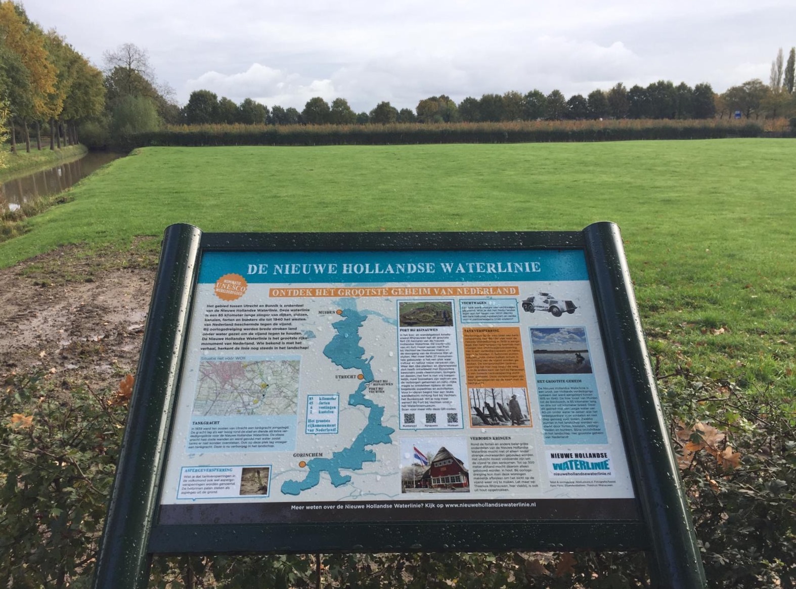
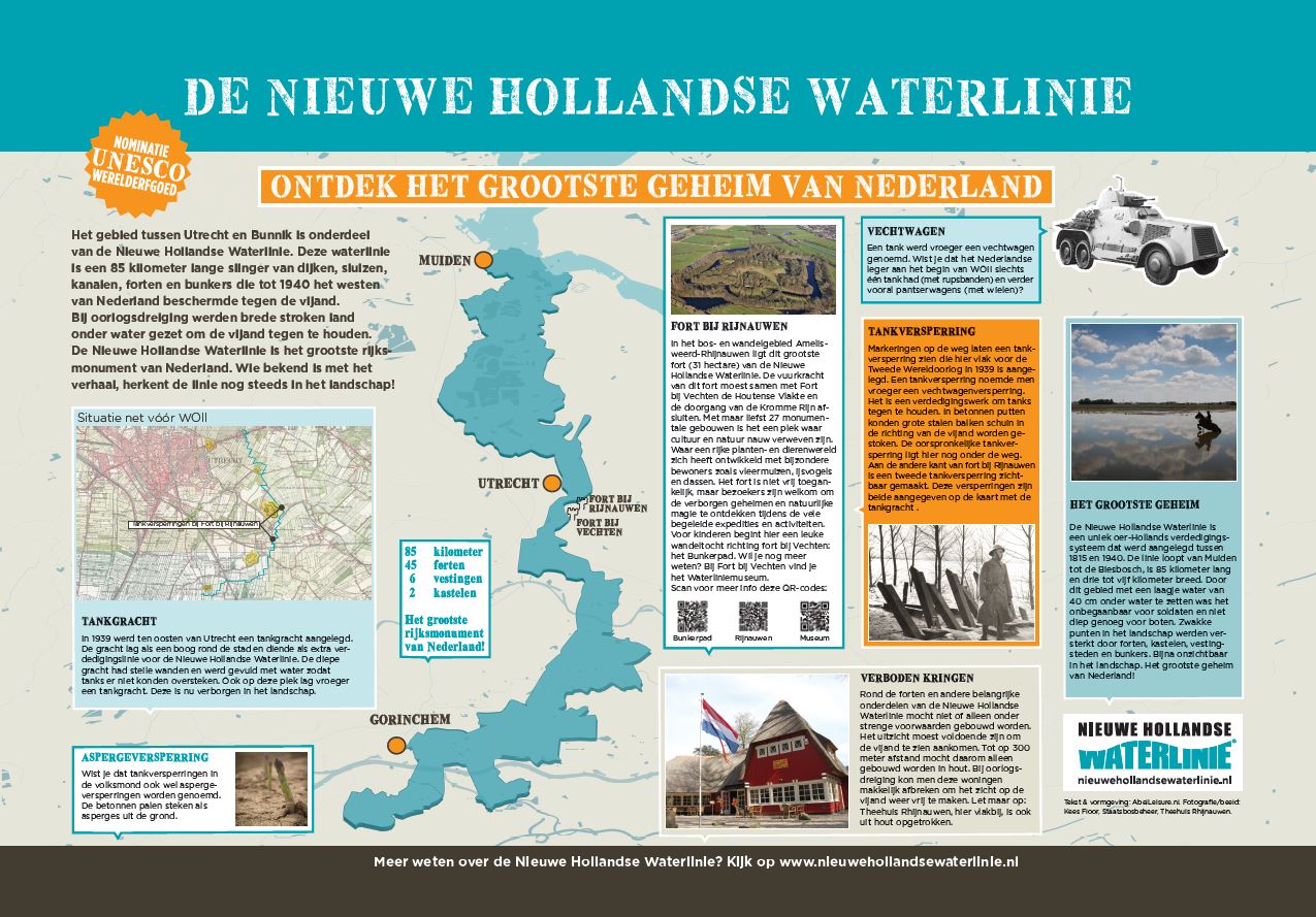
Customer
– Province of Utrecht (panels in De Bilt)
– Municipality of Bunnik (panels as fort Rijnauwen in Bunnik)
Walking network Rijn- and Veenstreek & Zoeterwoude
Assignment
With the construction of the new walking network, the municipalities of Alphen a/d Rijn, Kaag & Braassem, Nieuwkoop and Zoeterwoude want to increase walking opportunities in and around the Rhine and Veen region and Zoeterwoude. Walking is good for your health. Tourists and recreationists need to be motivated to walk here. Get the local entrepreneurs who derive their income from the tourism sector enthusiastic to make creative use of the network and promote this too. With the ultimate goal of attracting tourists who will spend more in the area, e.g. at restaurants along the way or other entrepreneurs.
Created
On 10 February 2017, the new Walking Nodes Network Rijn- en Veenstreek and Zoeterwoude was officially opened. Existing farmland walking routes are part of this, in addition, the network has been substantially expanded.
Walking network Rijn- and Veenstreek & Zoeterwoude consists of:
- Over 450 km of walking network (paved and unpaved)
- Over 300 junction poles
- 35 information panels
- Bridges, decks and footbridges
- Various theme routes
- Promotion includes:
- Business model
- Junction map of the area
- Multi-day arrangements
- Presence and promotion at the annual Walking and Cycling Fair
- Putting together promotional products with entrepreneurs
Customer
Municipalities Alphen a/d Rijn, Kaag & Braassem, Nieuwkoop and Zoeterwoude
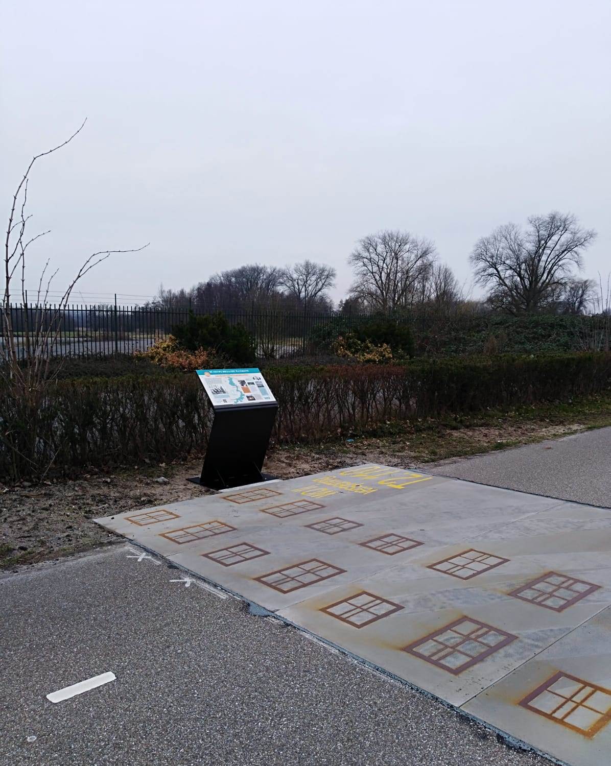
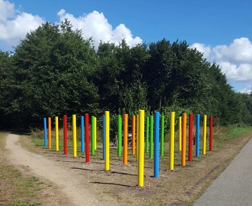
Colourful children’s route to the Gagelbos
Assignment
Designing and realising an information panel and children’s route to tempt children from the residential area of Overvecht (Utrecht) to play outdoors in the nearby Gagelbos.
Created
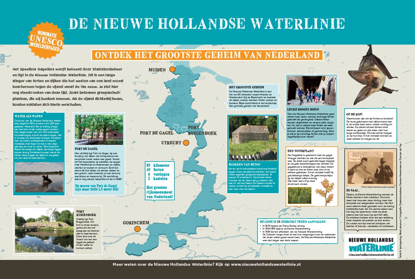
The Gagel route: a children’s route for children aged between 4 and 12. A colourful route that connects city and countryside and challenges them to play and go outside. It also playfully highlights the Nieuwe Hollandse Waterlinie, of which the Gagelbos is a part.
The Gagel route starts at the information panel at Stadsboerderij Gagelsteede in the Overvecht district. Children can take a Challenge Card from the storage box. They can use it to walk from the centre of Overvecht into the Gagelbos. On the way and in the forest, they are challenged to do challenges. This way, they discover the Gagelbos and learn about the history of this special piece of nature.
The children’s route runs through the landscape of the Nieuwe Hollandse Waterlinie, the largest national monument in the Netherlands. This unique primal Dutch defence system was built between 1815 and 1940. The line runs from Muiden to the Biesbosch and has been nominated as a UNESCO World Heritage Site.
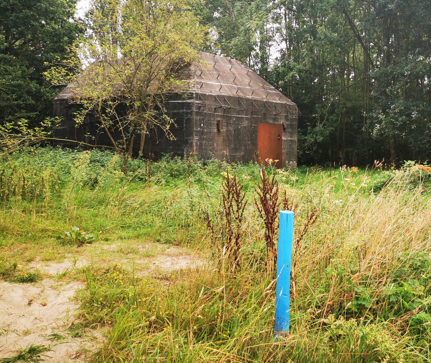
Furthermore, at one of the bunkers in the Gagelbos, there is an information panel for children explaining the forest, nature and the Nieuwe Hollandse Waterlinie. The panel is designed in the house style of the Nieuwe Hollandse Waterlinie.
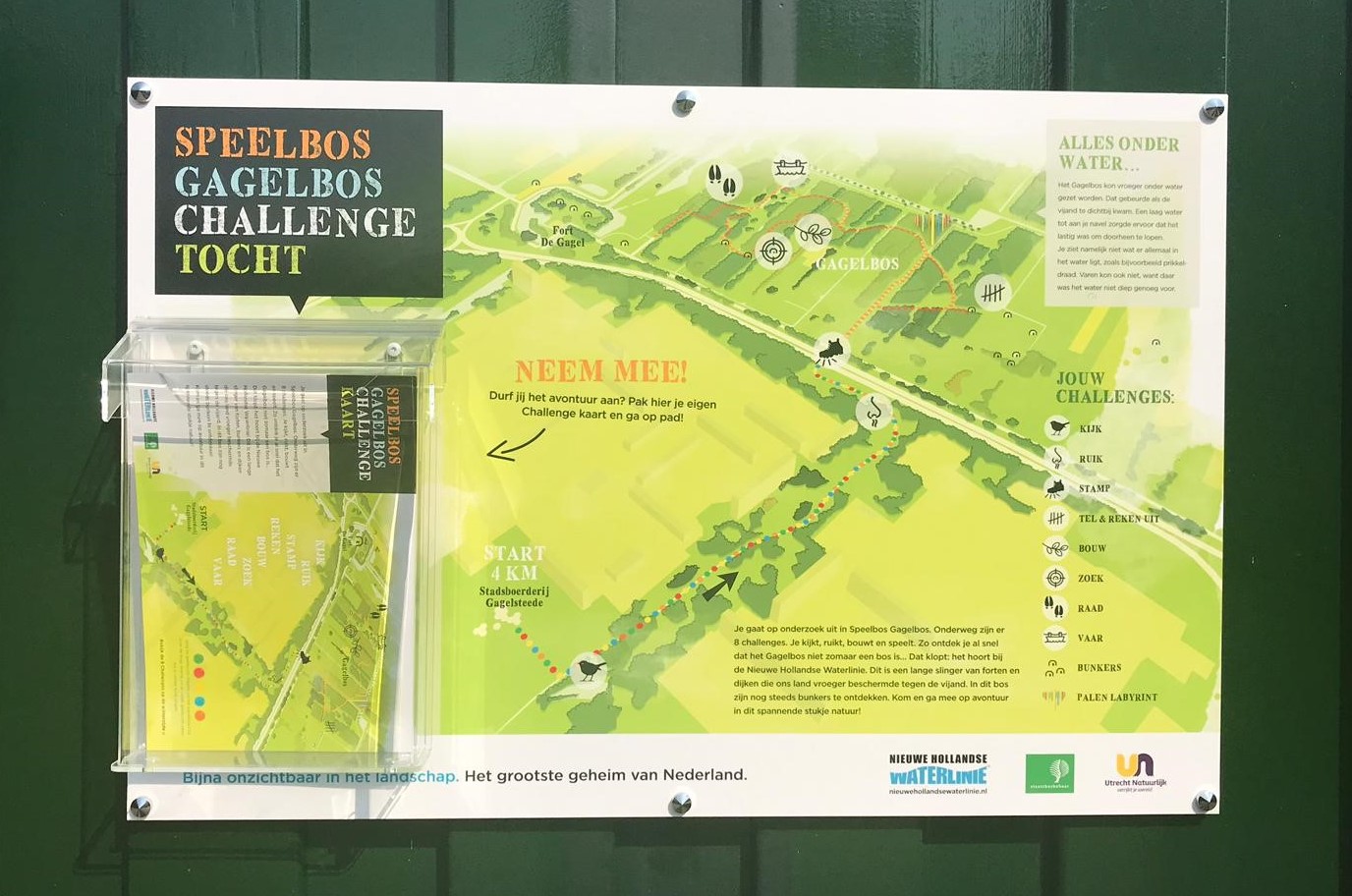
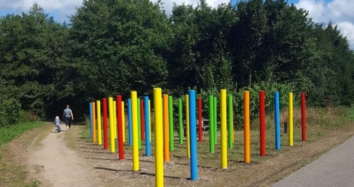
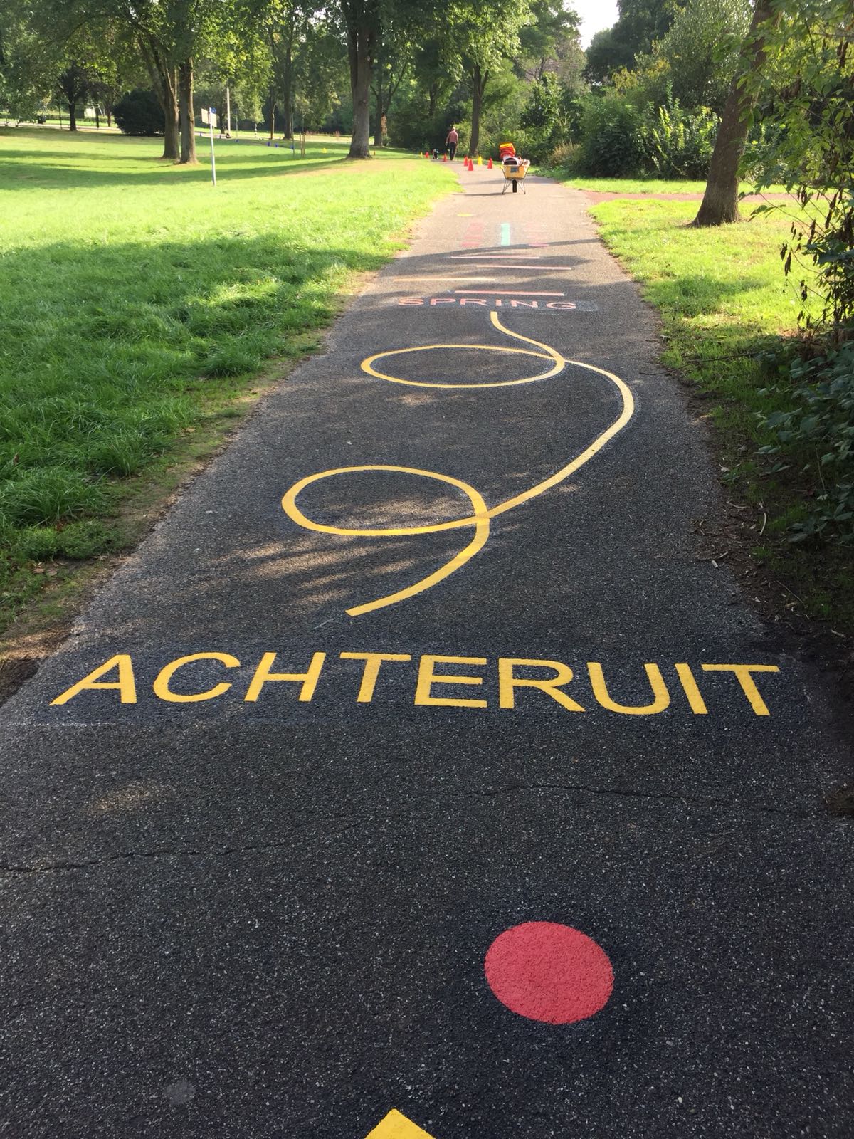
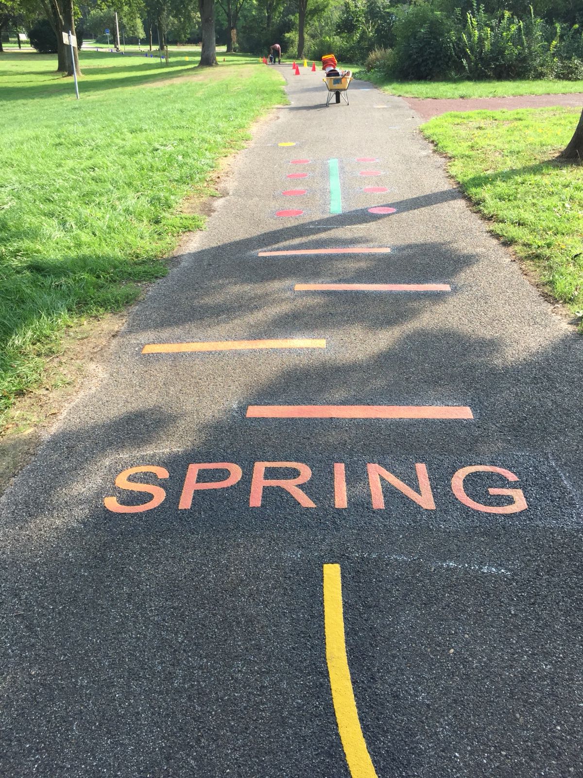
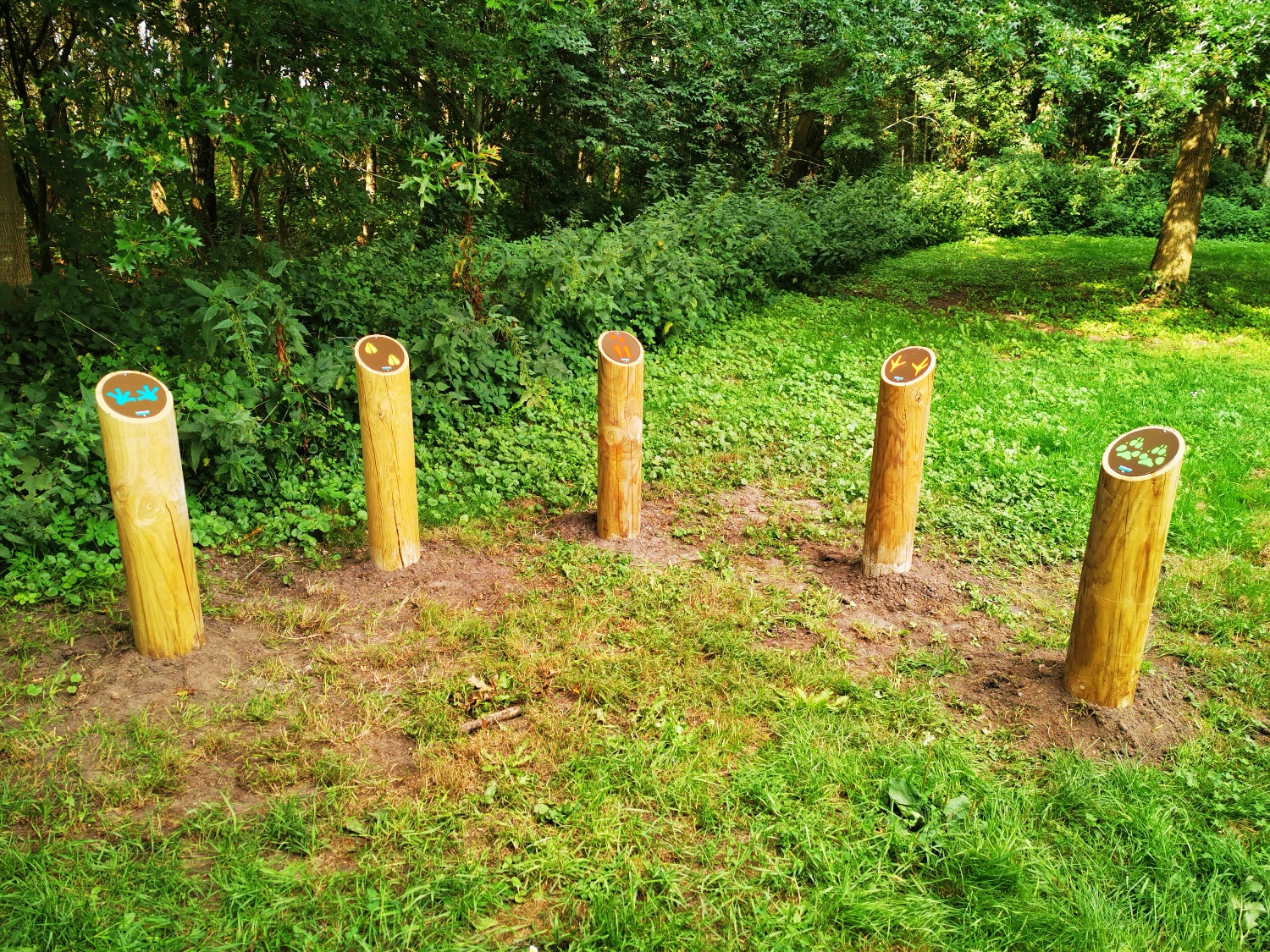
The children’s route consists of:
- route using coloured dots on paving stones and coloured posts in the Gagelbos
- tasks on the route (walk backwards and follow the line, jump, sundial – what time is it? etc.)
- labyrinth consisting of coloured poles
- information panel on Speelbos Gagelbos
- information panel on the Gagel route with storage box for the challenge cards
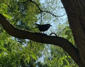
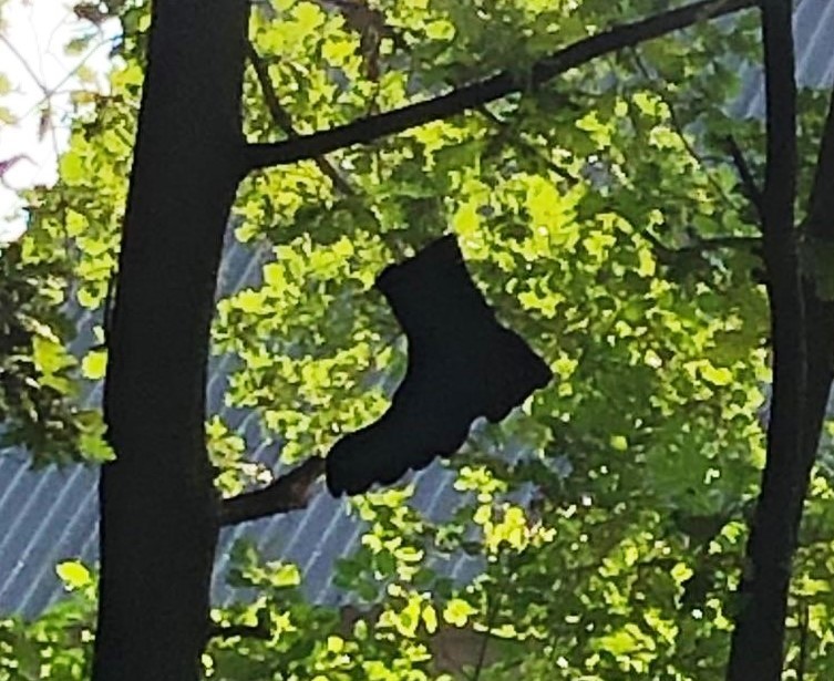
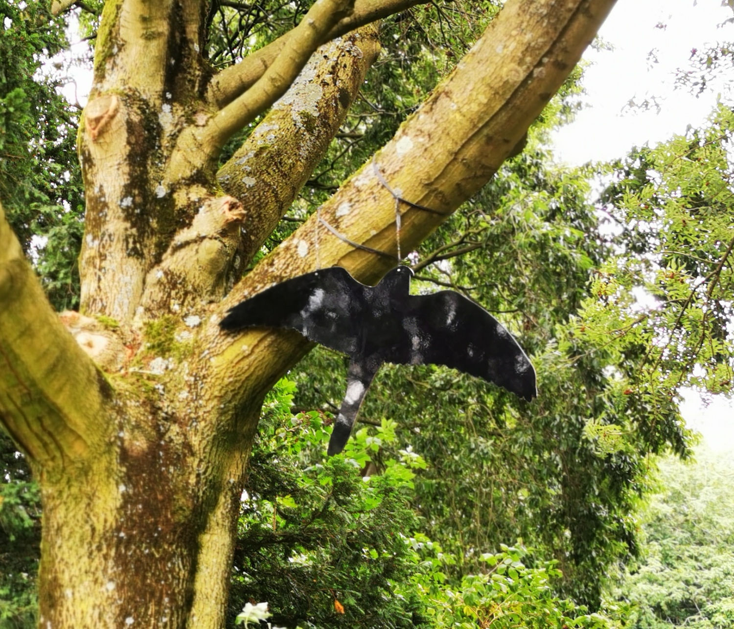
- various ‘specials’ in combination with the Challenge card, such as bird silhouettes and silhouettes of soldier attributes
- wooden poles with pictures of animal tracks
- signs with various directions
Customer
Province of Utrecht and Staatsbosbeheer
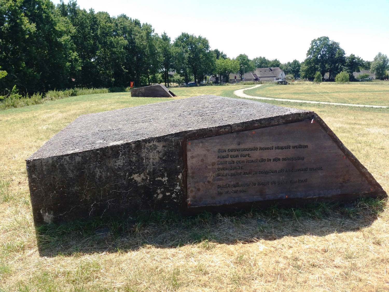
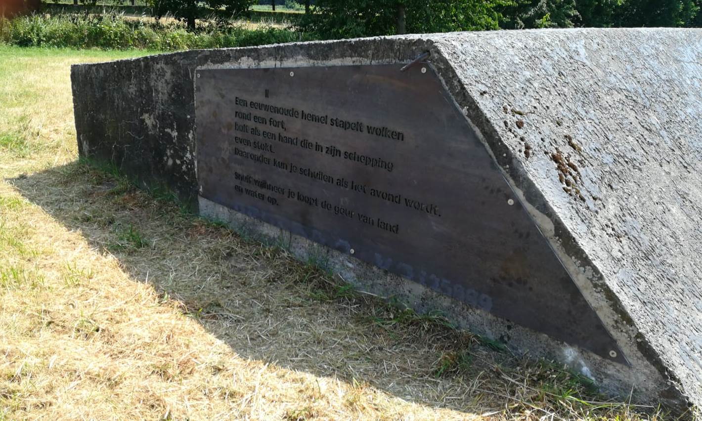
Ode to the landscape of the Bunker Trail
Assignment
Producing and placing 3 corten steel plates with lines of poetry for 3 group shelters on the ‘Bunker Trail’ in Bunnik. These concrete shelters were built during WWI and are part of the Nieuwe Hollandse Waterlinie.
Created
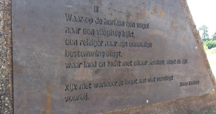
Custom-made corten steel plates into which the letters of the lines of poetry have been cut out. In the open air, the plates take on a characteristic brown-red rust colour, so that the texts become clearly legible against the grey, concrete background.
As an ode to the landscape around the renewed Bunker Trail in Bunnik, Onno Kosters of the Utrecht City Poets’ Guild wrote the poem ‘Behind the scenes’. In the poem, the immediate surroundings of the Bunker Trail are brought to life. Readers are urged to use their senses and thus, as they walk, reflect on what really matters: earth, water, air. Walkers can read the poem on three bunkers along the path. The Bunkerpad allows you to walk from Fort Vechten to Fort Rijnauwen (and visa versa). The area is part of the Nieuwe Hollandse Waterlinie, the Netherlands’ largest national monument and nominated for inclusion on the UNESCO World Heritage List.
Customer
Province of Utrecht
Wooden Houses, Stone Fortresses
Assignment
Bring attention to the special, wooden houses from the period of the New Dutch Waterline (NHW) to tourists/visitors. The aim is to let tourists/visitors around Utrecht cycle through the landscape of the NHW and let these visitors share in the stories surrounding this line. The route has 3 different starting points.
Created
A 20-page brochure whose function is to tempt people to cycle the Wooden Houses, Stone Forts cycle route. This brochure describes the route and provides information (points of interests) about the NHW and the wooden houses the route passes. A fold-out map gives recreational cyclists a good overview of the route and points of interest. In addition, the cycle route has been digitised.
Wooden Houses, Stone Fortresses consists of:
- Detailed route booklet including overview map
- Digital cycling route
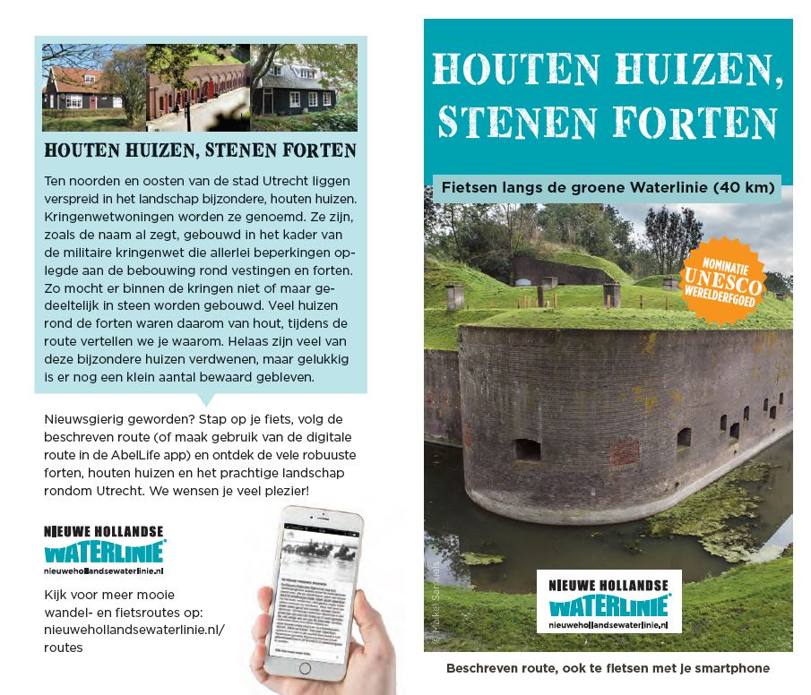
Customer
Province of Utrecht
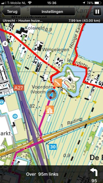

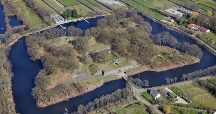
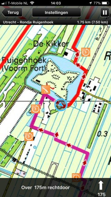
Noorderpark Ruigenhoek
Assignment
To bring a walking route in Noorderpark Ruigenhoek, a special recreational and natural area between De Bilt and Utrecht, to the attention of potential walkers by enriching the route with promotional tools, distribution channels and experiences.
The aim of the route is to tempt residents to walk around the area and let visitors from outside the area share in the stories surrounding the Nieuwe Hollandse Waterlinie.
Created
The walking route has been digitalised and enriched with information such as audio, texts, photos and videos.
The route is offered as a free route in the RoutAbel App. The routes can be used on iPhone and Android devices.
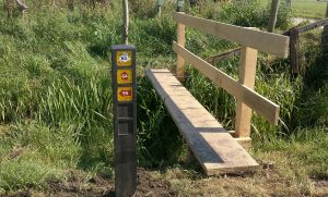
At the car park of Ruigenhoek (Gageldijk), at junction 21, a clickboard has been added on a lectern of the walking route network. This sign aims to tempt visitors to take the walking route. It has an appealing design in the NHW house style and also directly communicates the junction numbers, so hikers can photograph them and have immediate access to the route directions.
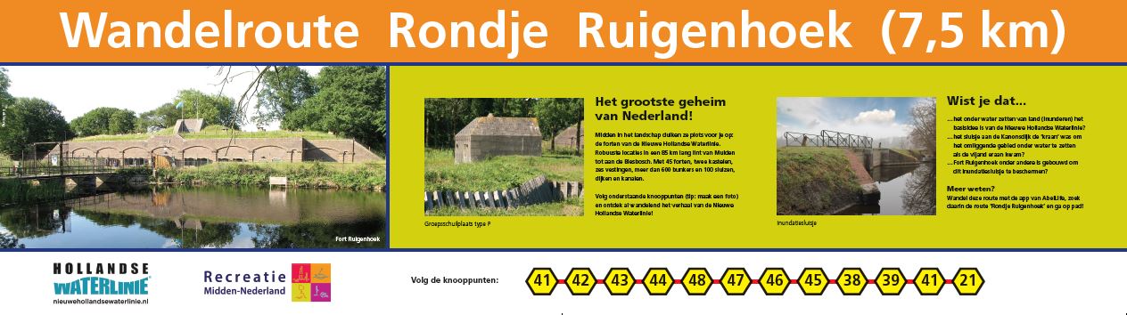
Noorderpark Ruigenhoek consists of:
- Digital walking route
- Clickboard
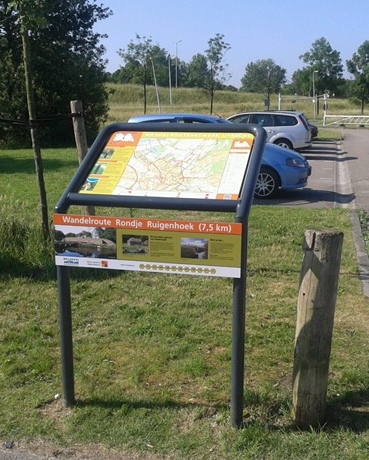
Customer
Province of Utrecht
Jan Blanken route
Assignment
Among the authorities in the Vianen – Culemborg – Leerdam – Gorinchem area, there was an ambition to develop a tourism and recreational product around Jan Blanken. Jan Blanken was a hydraulic engineer who played an important role in important hydraulic engineering projects in the area and the Netherlands. In 1987, a 75-kilometre cycle route was developed as a result of an exhibition at the Rijksmuseum on Jan Blanken. This cycle route was updated and turned into a tourist product which should be an economic engine as well as a link between entrepreneurs and municipalities in the region. The route should become the basis for cooperation in the region.
Created
A weatherproof flyer to follow the Jan Blankenroute (75 km), which runs along the junction network. These junctions are indicated on a tear-off strip that can be attached to bicycle handlebars with the help of an included ribbon. The flyer also includes a map of the route with the starting points and some points of interests are briefly described. It also suggests experiencing a related route. This is the existing AbelLiferoute ‘Waterworks’, a digital cycling route of 29 km from Vianen. The brochure’s function is to tempt people to cycle the route.
The Jan Blanken route consists of:
- Weatherproof flyer with tear-off strip (junctions)
- Ribbons with the Nieuwe Hollandse Waterlinie logo to attach to the handlebars
![]()
![]()
![]()
Customer
Region Alblasserwaard-Vijfheerenlanden
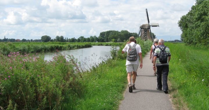
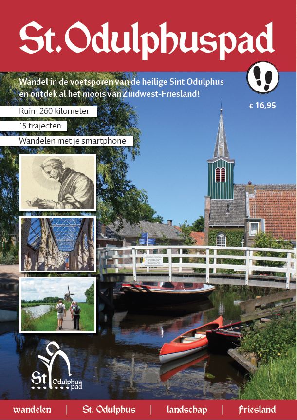
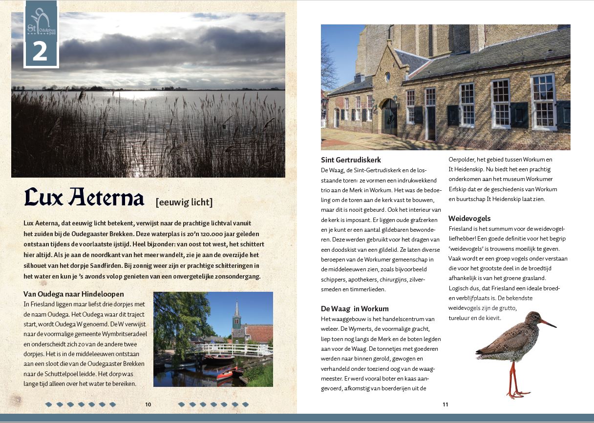
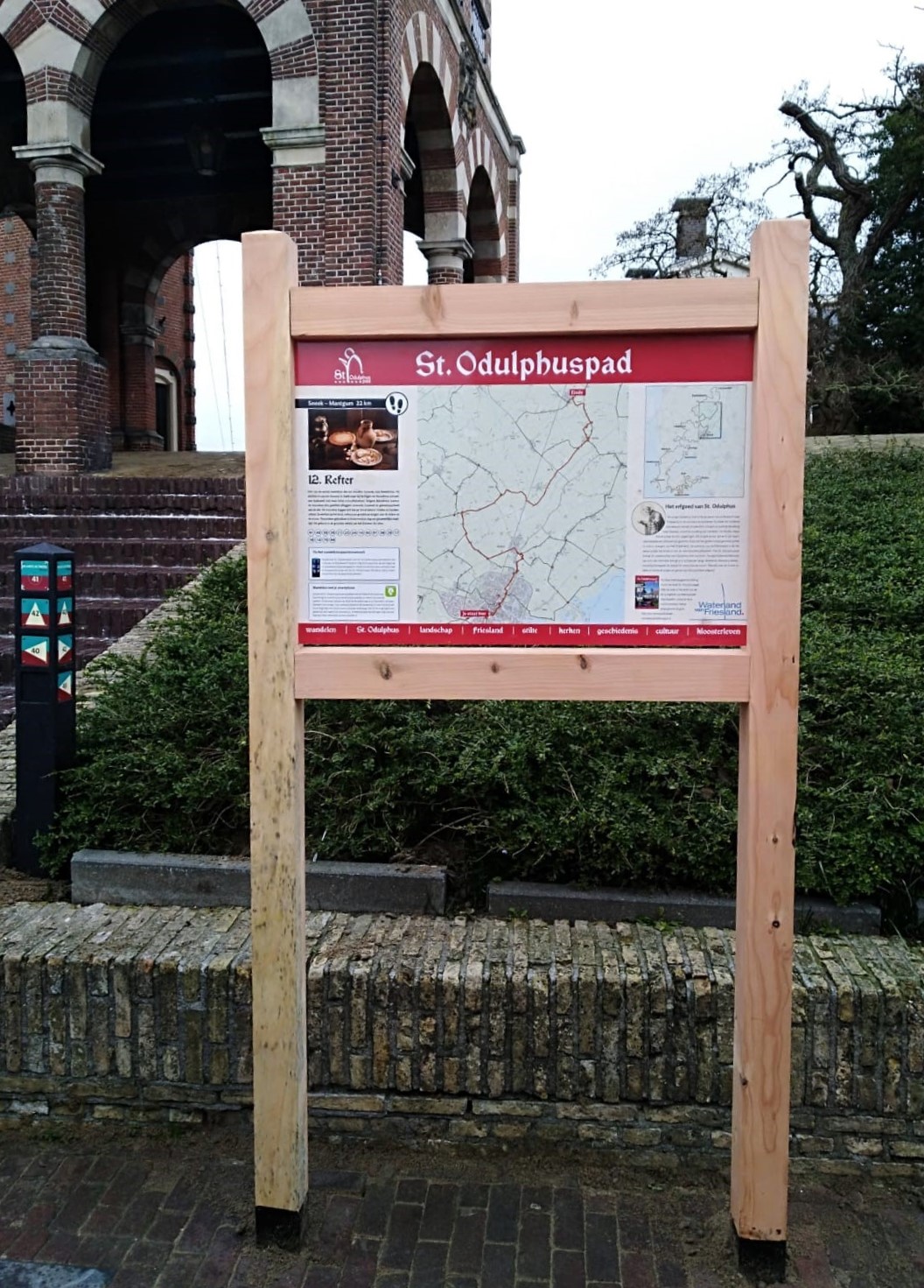
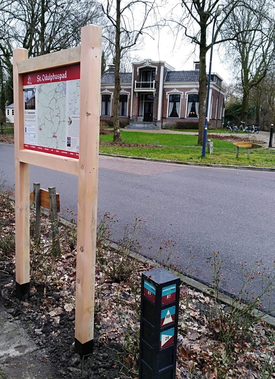
St. Odulphuspad
Assignment
With this project, we want to contribute to the growth of awareness of cultural history and experience of nature and landscape among ‘de Mienskip’ (the local population) and its guests. We also want to stimulate cultural tourism and the experience of nature in South-West Friesland by renewing and improving the range of tourism products. The aim is also to establish Friesland as a region for pilgrimage. More tourists, more spending, longer stays and thus a stronger tourist economy.
Created
The St. Odulphuspad is a multi-day walking route along the most beautiful things South-West Friesland has to offer. The hiker passes by vanished monasteries, medieval churches, beautiful lakes, surprising hills and forests. The trail also passes through seven of the Frisian eleven towns. In total, the hiking trail is over 260 kilometres long and consists of 15 sections.
This hiking trail was developed from the region’s DNA. Religion once shaped this area. Missionaries like Boniface, Willibrord and Odulphus travelled to the north to convert the inhabitants to Christianity. Odulphus’ followers founded monasteries and courts. The monks built dikes to reclaim new land. This is how today’s landscape was formed. The St Odulphus trail tells the stories of the past and connects all the beauty of its legacy. Besides the pearls of the area, this walking route also connects the entrepreneurs in this region. They support this initiative and aim to increase tourist spending in South-West Friesland by more than 300,000 euros per year.
An integral approach was chosen: a beautiful book with a stamp card and 15 routes that can be travelled using both the walking network and the RoutAbel app as a guide. The app takes walkers on the nicest paths and treats them to special stories. A total of 29 information panels have been installed along the route. Together with various marketing and promotional campaigns, the St. Odulphus path is firmly placed on the map: for the best experience of all the beauty of South-West Friesland, choose the St. Odulphus path.
In the meantime, the third, fully updated edition of the book has been published. This edition includes a QR code for RoutAbel: with this, you can very easily download all routes on your smartphone.
The project St. Odulphuspad consists of:
- A book with the 15 routes and a stamp card
- QR code for 15 digital routes in the RoutAbel app, including 4 additional St Odulphuspad circular hikes
- 29 information panels spread throughout the route
- 4 day walks in the RoutAbel app
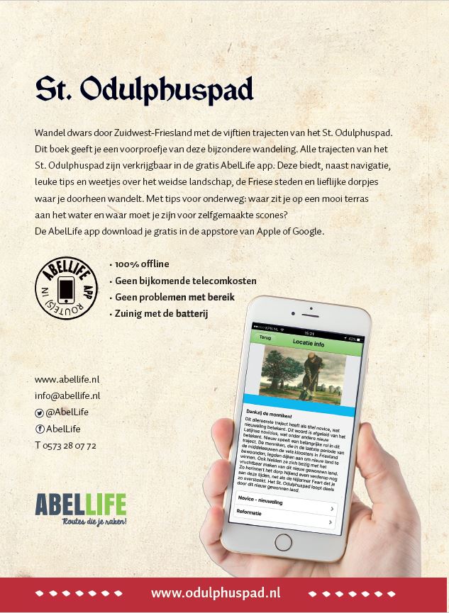
When one has walked all the routes and stamped all 15, one can order a special souvenir: the St Odulphus artefact, made of wood excavated from the site of the so-called ‘third Odulphus monastery’ in Hemelum.

Customer
Foundation Lytse Marren
Fitpad Lochem
Assignment
Designing and producing seven stands for the Fitpad, located at sports park the Elze in Lochem.
Created
7 panels in wooden frames scattered along the Fitpad Lochem.
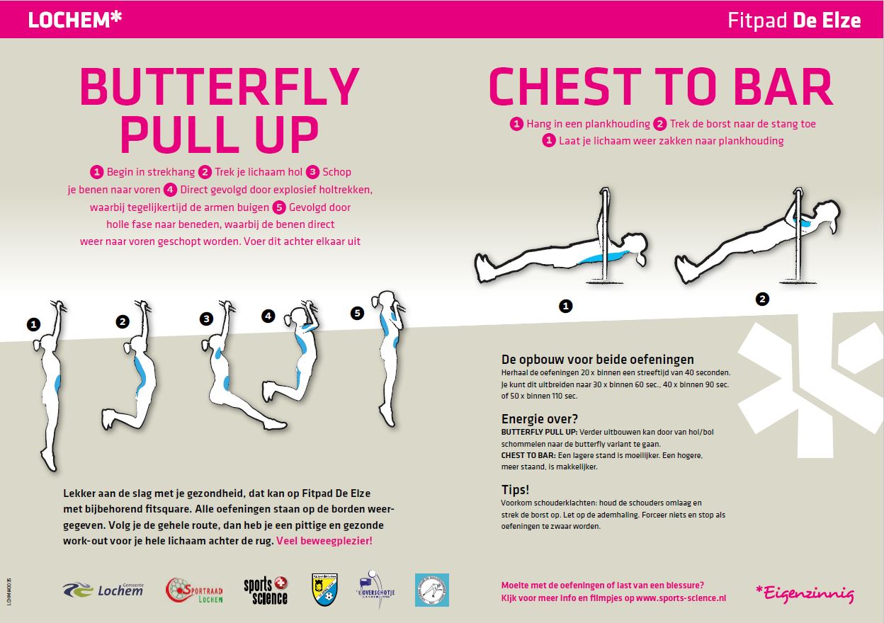
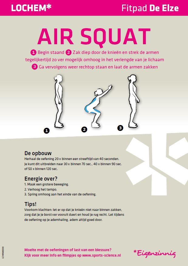
Fitpad Lochem consists of:
- 7 panels with fitness exercises
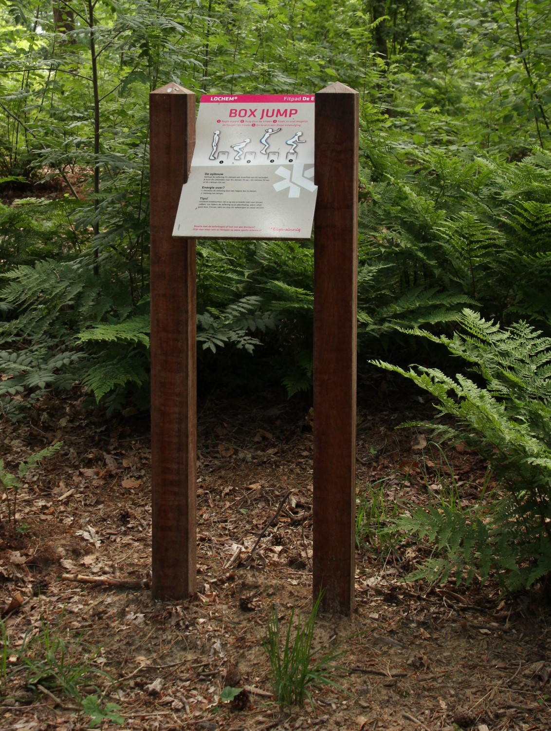
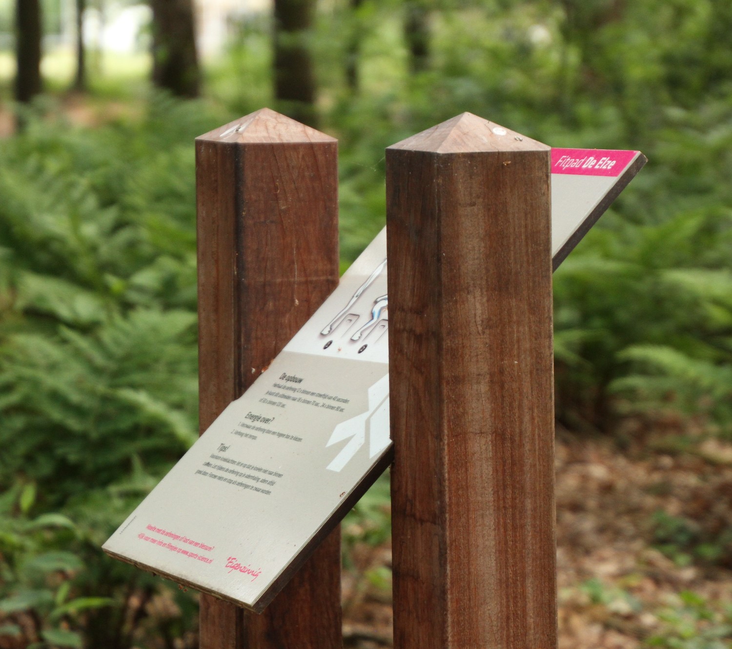
Customer
Municipality of Lochem
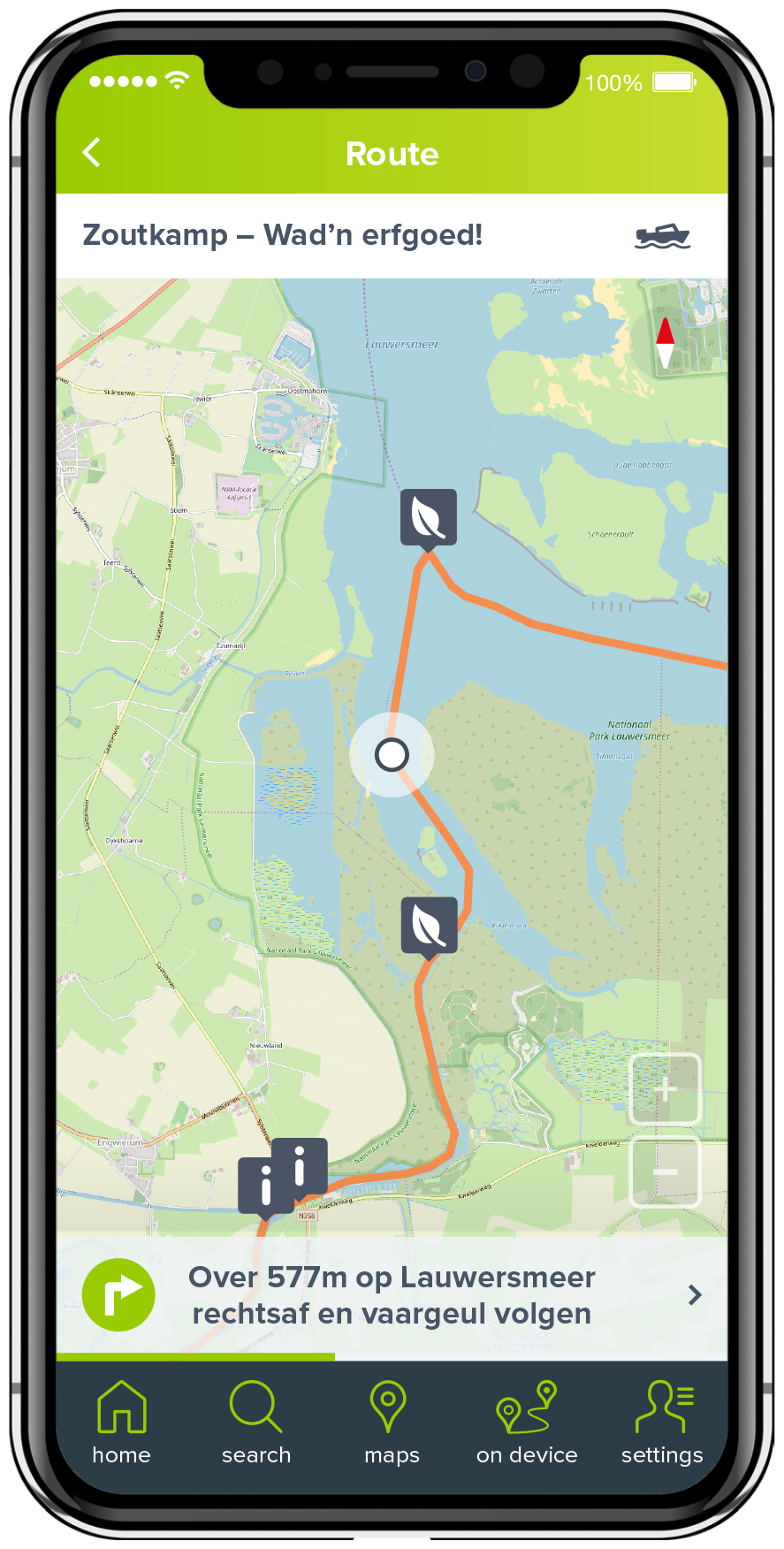
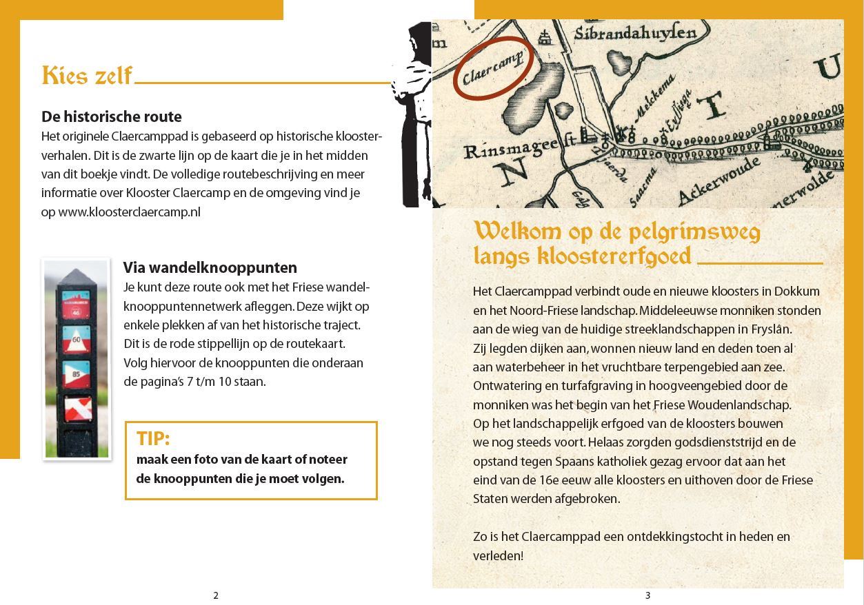
Claercamppad
Assignment
To bring the Claercamp trail, a walk from the St Jacobiparochie (North Friesland) to Zoutkamp (Groningen), to the attention of potential walkers by means of a brochure and an information panel. The aim of this route is to tempt residents/tourists to walk the route.
Created
A walking booklet in which the multi-day walk (75 km) can be followed via junctions. In addition to these nodes, a short impression of the route, some places of interest, an overview map of the route and three day routes from Dokkum are listed.
The Claercamp path links the pilgrims’ route St Jabikspaad in Het Bildt with the Lauwerszee and the province of Groningen. The footpath is named after the Claercamp Monastery: from the 12th to the 16th century, the largest mother monastery in the north of the country.
An information panel has been placed near the former monastery Claercamp with the aim of inviting the hiker to further explore the area on foot.
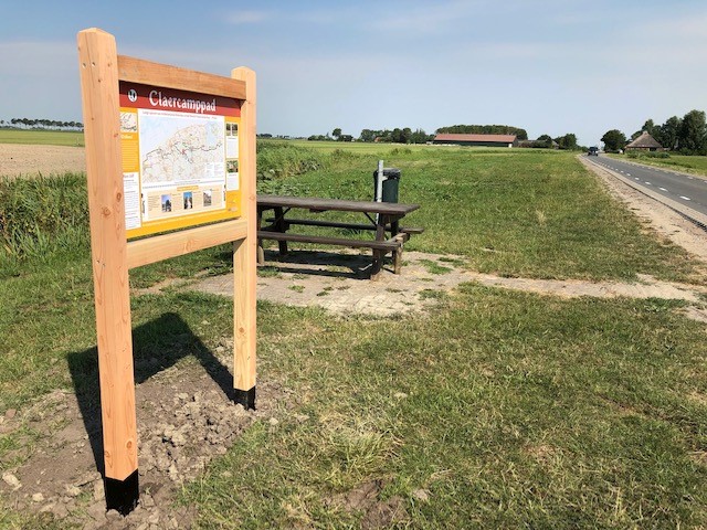
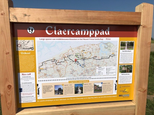
The Claercamppad consists of:
- Hiking booklet
- An information panel with appealing content
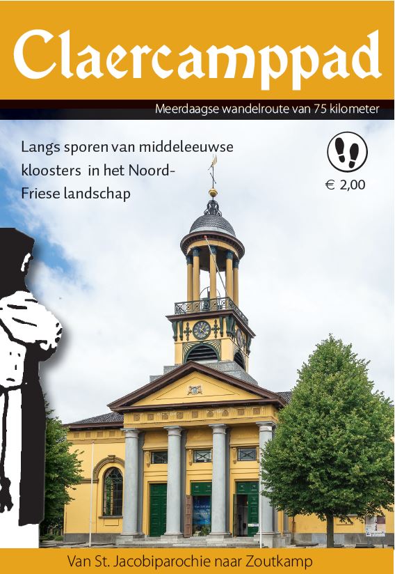
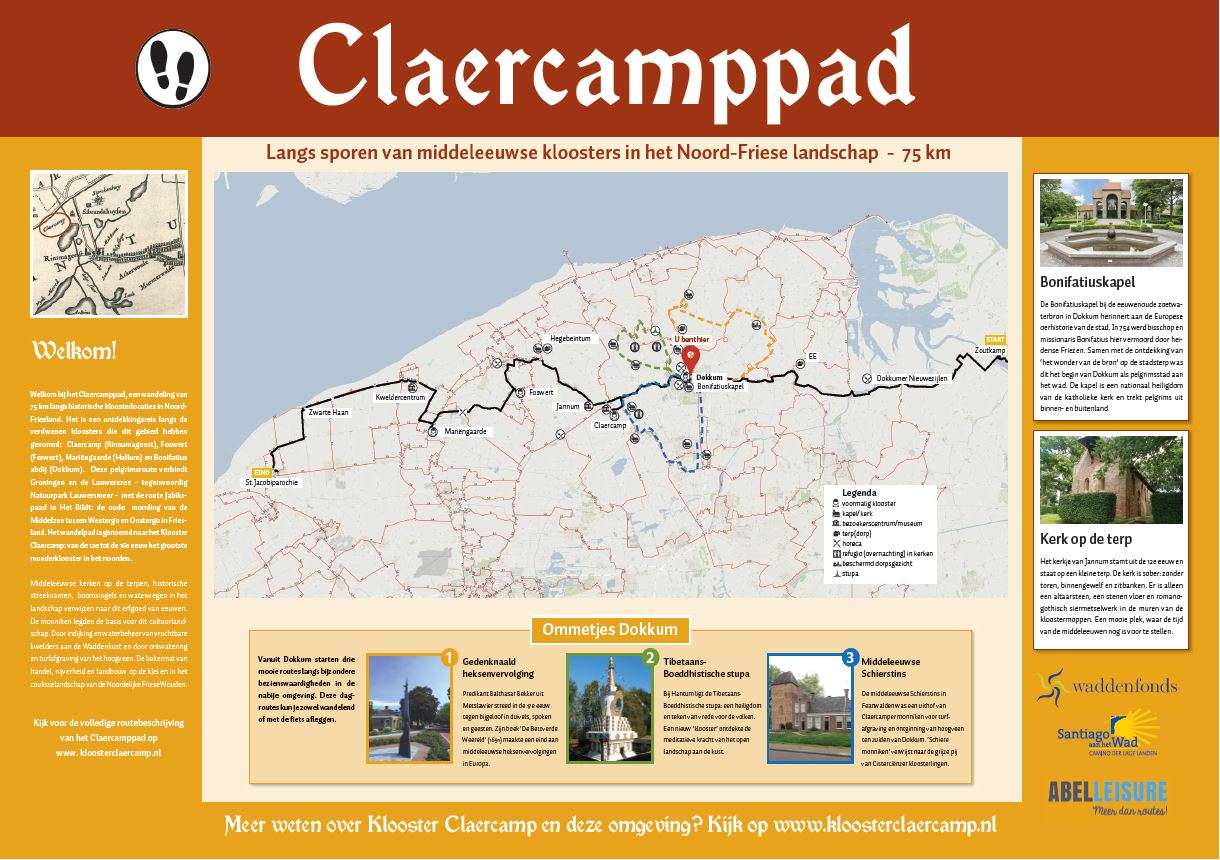
Customer
Foundation Santiago aan het Wad
De Ploeg Hotspots
Assignment
In 1918, a group of young Groninger artists founded Kunstkring De Ploeg. The Groninger Museum selected 25 Ploeg paintings that can be linked to the place where they were (possibly) painted or where De Ploeg members found inspiration for the works on display. In cooperation with Groningen architecture centre Platform GRAS, replicas of the selected works have been placed in the city and surrounding areas. With the free bicycle route ”De Ploeg Hotspots”, you will cross the Groningen of De Ploeg.
Created
Specifically for the Ploeg Year (1918-2018), a beautiful cycle route along 19 of the 25 hotspots has been created. The Groninger Museum is the starting and finishing point of this 40-kilometre route. The route is a combination of cycling junctions and described directions.
AbelLeisure developed the cycle route, provided the route description and digitised the route to GPX format.
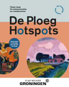
Customer
Groninger Museum and Platform Gras
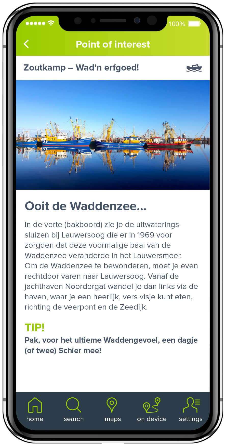
RoutAbel
RoutAbel is an App with more than 500 fun and exciting cycling, walking and boating routes. There is a lot of useful information on the App.
- Proper navigation with directions
- Detailed maps
- Tips for trendy restaurants or tasty local products
- Built-in sounds to recognise birds or other animals
- Interesting facts about nature;
- Film fragments in which, for example, Philip Bloemendaal shows via an old Polygoon newsreel how the first inhabitants came to Almere
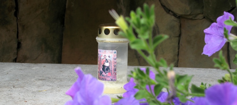
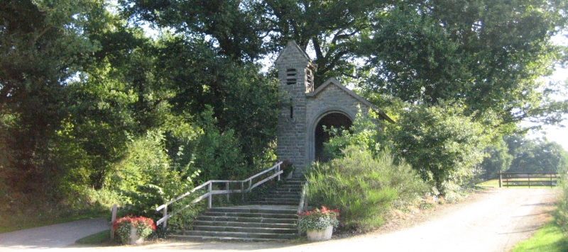
- Sound extracts (Celine Dion’s Ave Maria) which make you experience the atmosphere of a maria chapel intensely.
- Unexpected anecdotes and interesting facts at the sights along the way.
- Fun and exciting activities for children at the special children’s routes
The app is suitable for iPhone and Android devices.
The routes work 100 % Offline so:
- No additional telecom costs;
- No problems with signal coverage;
- And low battery consumption.
![]()
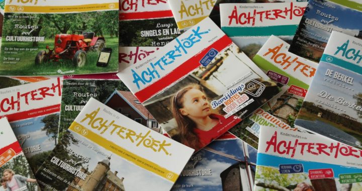
Digital walking and cycling through the Achterhoek
Assignment
Spread out through the Achterhoek to create a network of digital experience routes. Linked to the routes is a brochure so that people can offer the digital routes at various sales points.
Created
A large number of RoutAbel routes with various themes. Including children’s routes with game elements and themed routes around industrial and cultural heritage and nature.
The digital experience routes in the Achterhoek consists of:
- 18 children’s routes, 30 cultural-historical routes and 13 routes about industrial heritage
- 7 booklets with children’s routes, 10 booklets with cultural-historical routes and 2 booklets with routes about cultural heritage
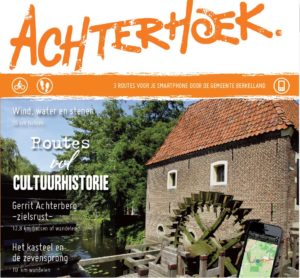
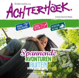
Customer
Achterhoek Toerism
Cyclomedia
30 years leading in images. CycloMedia visualises public space with high-quality 360° street photos and aerial photos with GIS accuracy. More »

Innovation
We apply the latest innovations in our concepts and in the products we make. For instance, innovations in the field of sustainability.
Of course, we also use the latest technological developments and apply the latest business models to our concepts. Examples include applications of 100% bio-based materials, such as BioPanel and the latest app technologies, revenue models behind tourist products and the sensor technology that allows us to measure the use of various objects and paths in the landscape in real time.
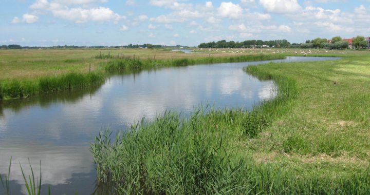
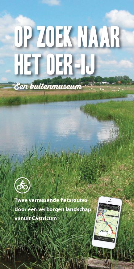
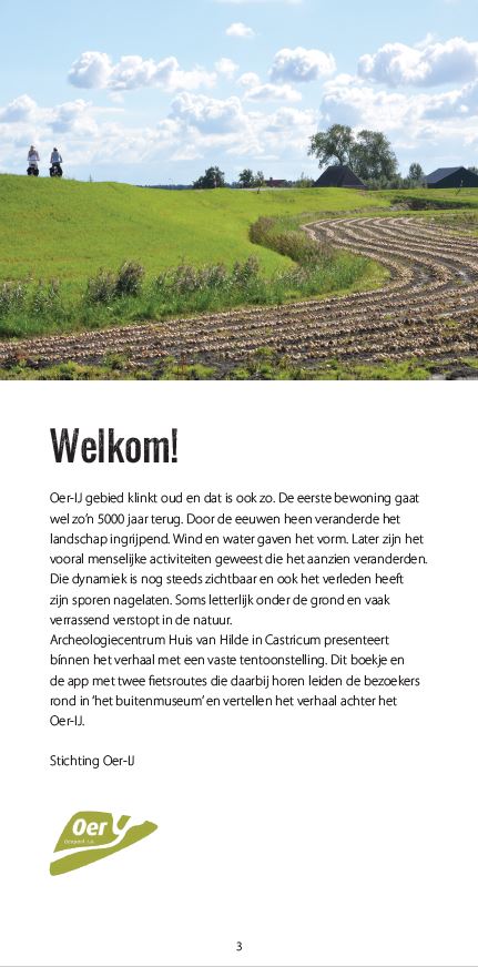
In search of the Oer-IJ
Assignment
Between Haarlem, Alkmaar and Zaanstad lies an extraordinary piece of North Holland. This is where the Oer-IJ flowed thousands of years ago. An erratic branch of the Rhine, which flowed into the sea at Castricum. A unique landscape. A residents’ initiative was launched to put this beautiful area on the map as an earth monument.
A connection must be made for a wide audience between the information from the exhibition in the Huis van Hilde (archaeological centre of the province of North Holland) and the opportunities to learn about the landscape where that history is still tangibly present.
The aim of the project is to raise the profile of the Oer-IJ and make consumers aware of the special values this area represents. This also works towards increasing the number of visitors and tourist and recreational spending.
Created
Experience the Oer-IJ is divided into two parts that are conceptually linked. These are the components:
1. Virtual Outdoor Museum Oer-IJ
The virtual “Outdoor Museum” is a museum by bike which is partly digital and partly physical. It is a virtual museum on your smartphone that starts at the Huis van Hilde. You are then navigated by your smartphone along a route in the Oer-IJ, experiencing the museum along the way. Experience-filled information is provided in the form of videos, audio, photos and texts interspersed with physically present elements in the landscape.
As a visitor, you choose your preferred museum route in advance and receive imaginative stories and information linked to the theme.
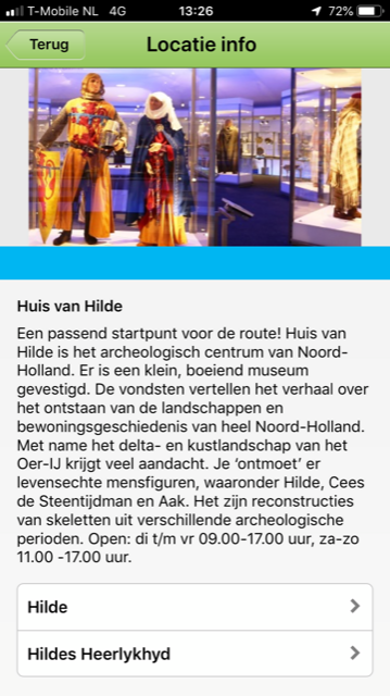
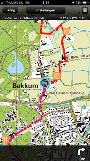
2. In search of the Oer-IJ
To support the cycle routes, a book has been written. The aim of the book is to tempt people to experience the museum, provide additional information or afterwards as a reference book. The book contains valuable stories told in an appealing way. The virtual “Outdoor Museum” brings the book to life and gives an extra experience along the way.
The book includes a voucher code that allows consumers to download the museum tours directly onto their smartphones.
The Oer-IJ consists of:
A book with the story of the Oer-IJ
Login code for two digital routes in the RoutAbel app
Customer
Foundation Oer-IJ
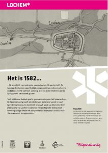
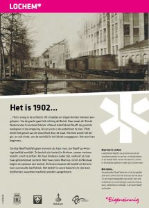
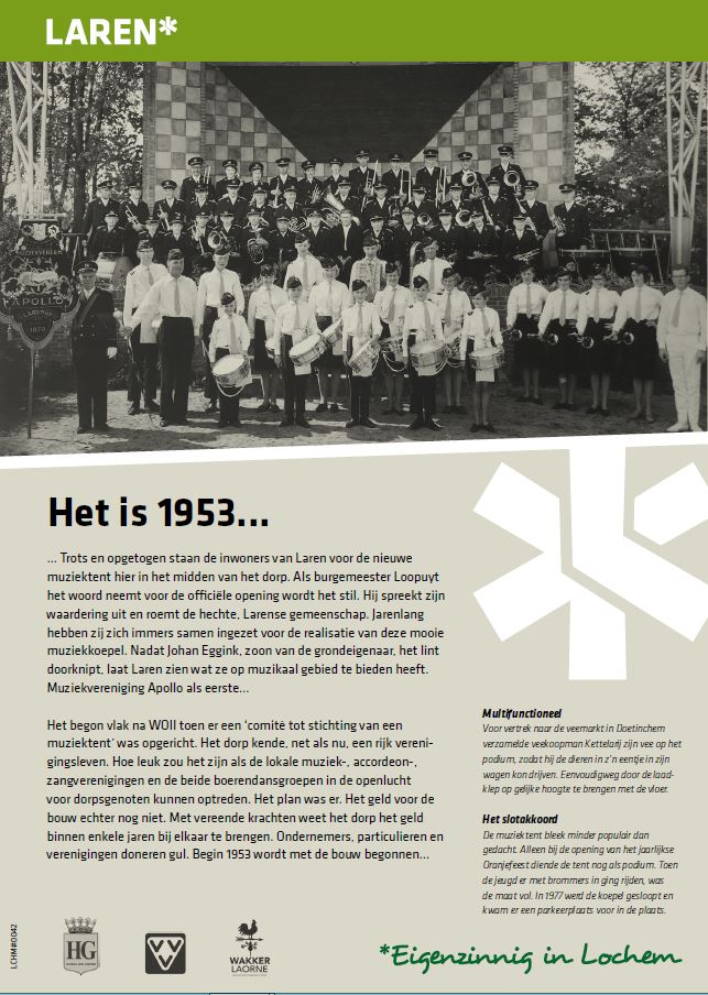
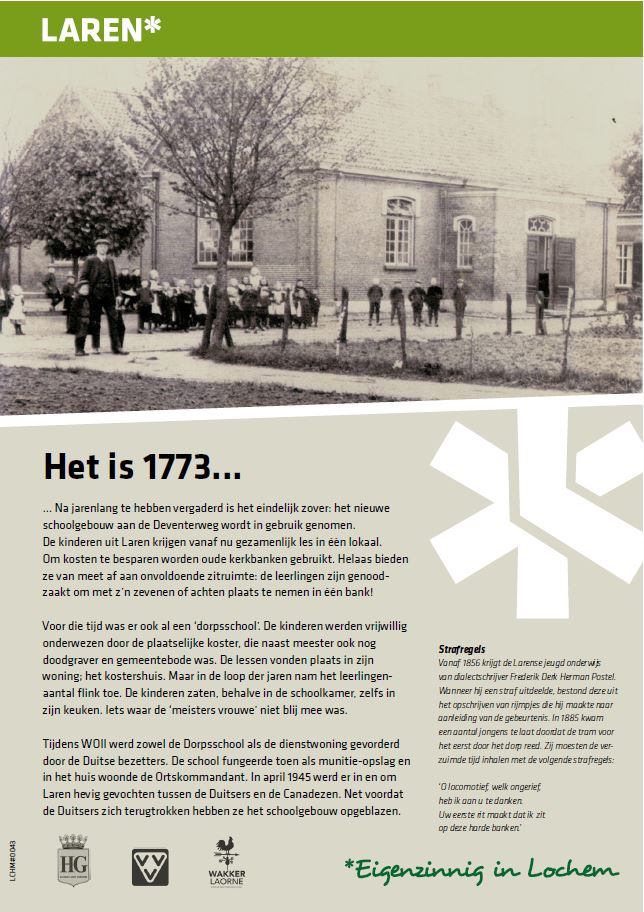
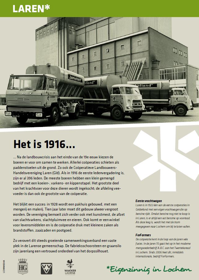
Outdoor museum Lochem
Assignment
Research shows that neither the Lochem municipality nor the town of Lochem has enough observable historical objects to justify a visit to Lochem by Dutch or foreigners. However, there are the necessary fascinating stories to encourage that visit. These stories need to be told in an engaging way.
There are several goals:
- The Historical Circle wants to tell about the history of Lochem
- Eigenzinnig Lochem, an organisation that works to boost tourism, culture and entrepreneurship, wants to develop and implement activities that will enable entrepreneurs in the municipality to achieve greater sales from more visitors and increased spending
- VVV Lochem wants to attract more tourists to the municipality with greater brand awareness and by promoting high-profile products from Lochem.
- The municipality of Lochem wants to offer more space for civic initiatives, and also cooperate in implementing those initiatives on e.g. municipal land
Created
We have made an inventory of locations in the municipality of Lochem that have a historical story to tell. We wrote the historical stories concisely and in accessible language. We also looked for matching images, such as photos from the past, an old map or print. This together makes it a harmonious whole.
This project will soon be supplemented by a digital walking route along these information panels located in Lochem. This route takes you back into the fascinating history and gives you even more information about Lochem and its beautiful surroundings. In text, image and sound.
Outdoor museum Lochem consists of:
- 32 historical panels in the municipality of Lochem (writing texts, finding suitable images)
- Design, production and installation of the information panels
- Follow-up: develop a digital walking route in the RoutAbel app along the historical panels
Customer
Municipality of Lochem in cooperation with Historical Society Lochem-Laren-Barchem and Eigenzinnig Lochem
Dike secrets
Assignment
To stimulate a broad public to discover the Land of Maas and Waal by bicycle. In which the public preferably also use catering facilities, visit attractions and shops.
Created
With the cycle routes through the area, we provide the public with information, eye-openers and anecdotes.
This is done in a light-hearted way that makes them look at the river landscape in a new way. What seems ordinary becomes extraordinary, what seems true gets unmasked, what is hidden becomes visible.
On each cycling tour, about 10 ‘dike secrets’ are revealed. What are those mysterious houses along the dike doing, where no life seems to be? Why do dike roads meander so often? Cyclists dive extra deep into the dike secrets via videos on the app. While cycling past pumping stations, farms, brickworks and castles, Dijkgeheimen offers a world of water stories.
The information is also in-depth – including via videos in the RoutAbel app – and via the link to Facebook for behind-the-scenes views and more information.
Dike secrets consists of:
- 2 digital cycling routes, downloadable in the RoutAbel app
- 2 cycling routes in a printed route bundle
- A Facebook account to provide more information and insights, a Twitter account to activate the tourist
- Weather presenter Margot Ribberink, known from RTL4 and Omroep Max, is the face of the routes
Customer
Regional Office for Toerism Arnhem Nijmegen